
| Distance: 6.6 miles (out and back) |
Elevation Gain: 2,369 feet |
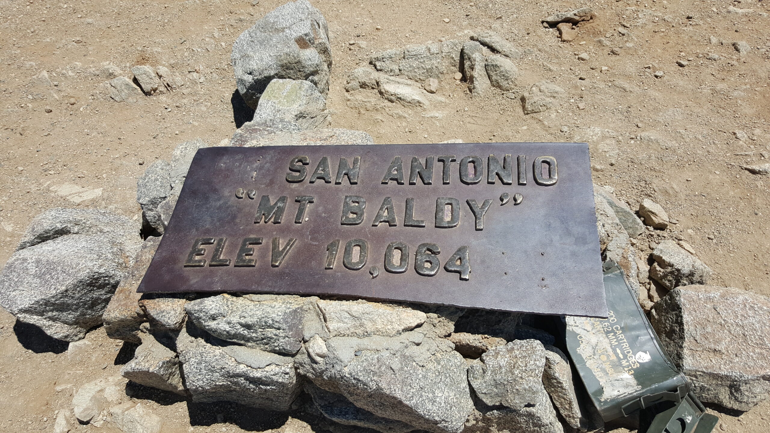
Peak Elevation: 10,064 feet |
| Objective: Hike Mt. Baldy via Devil’s Backbone from Baldy Notch, San Gabriel Mountains, California | Difficulty: Strenuous |
|
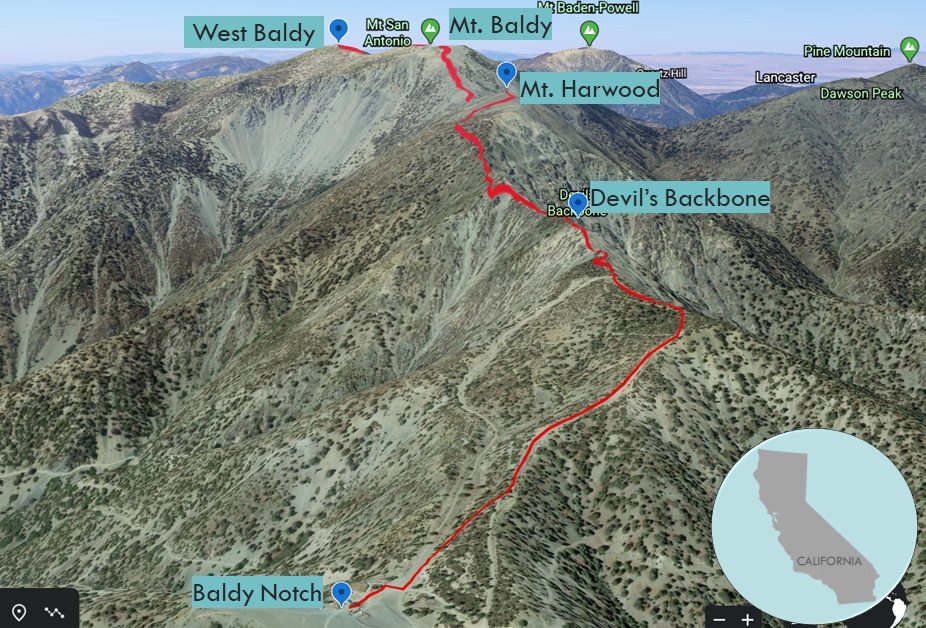
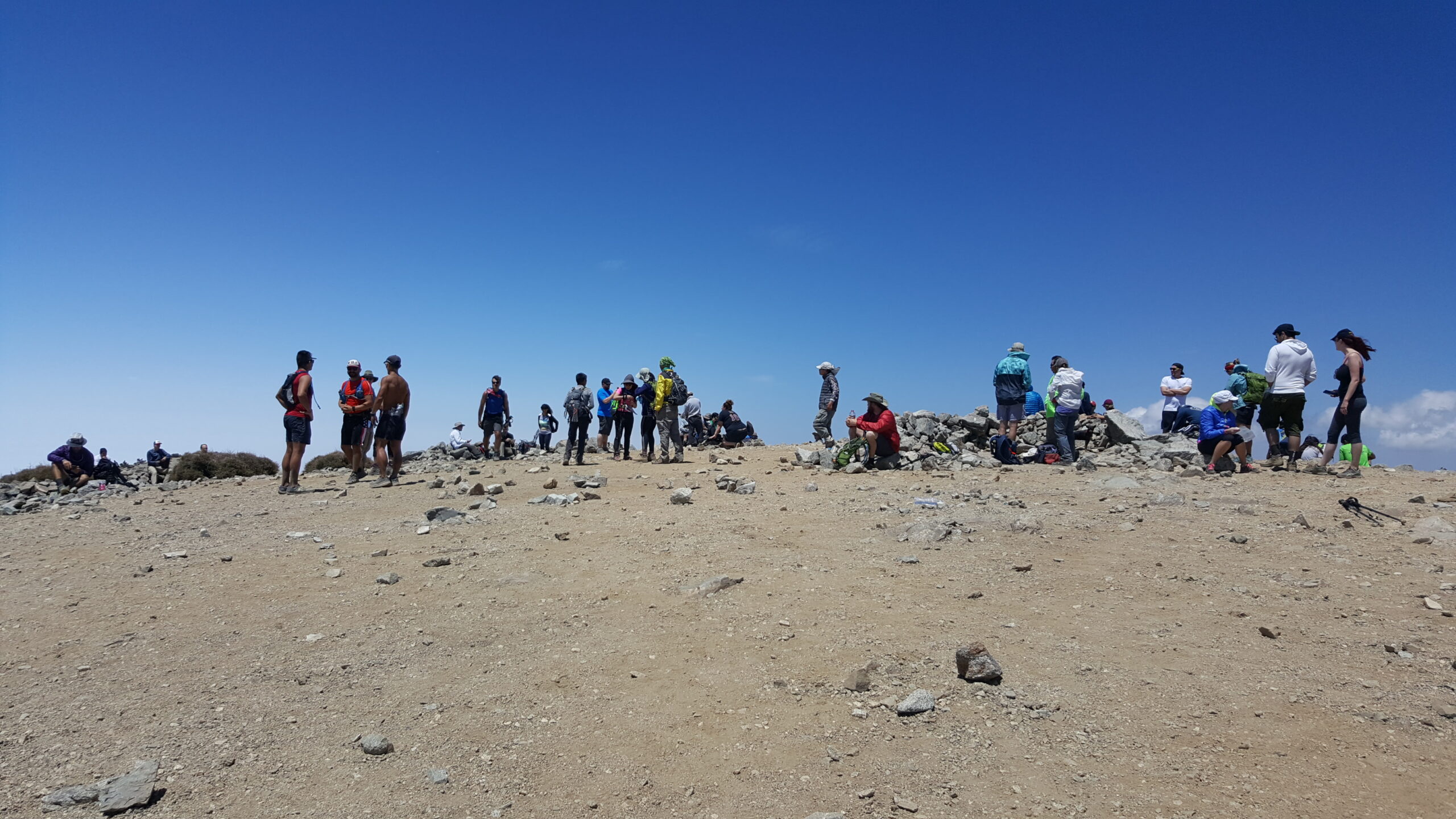
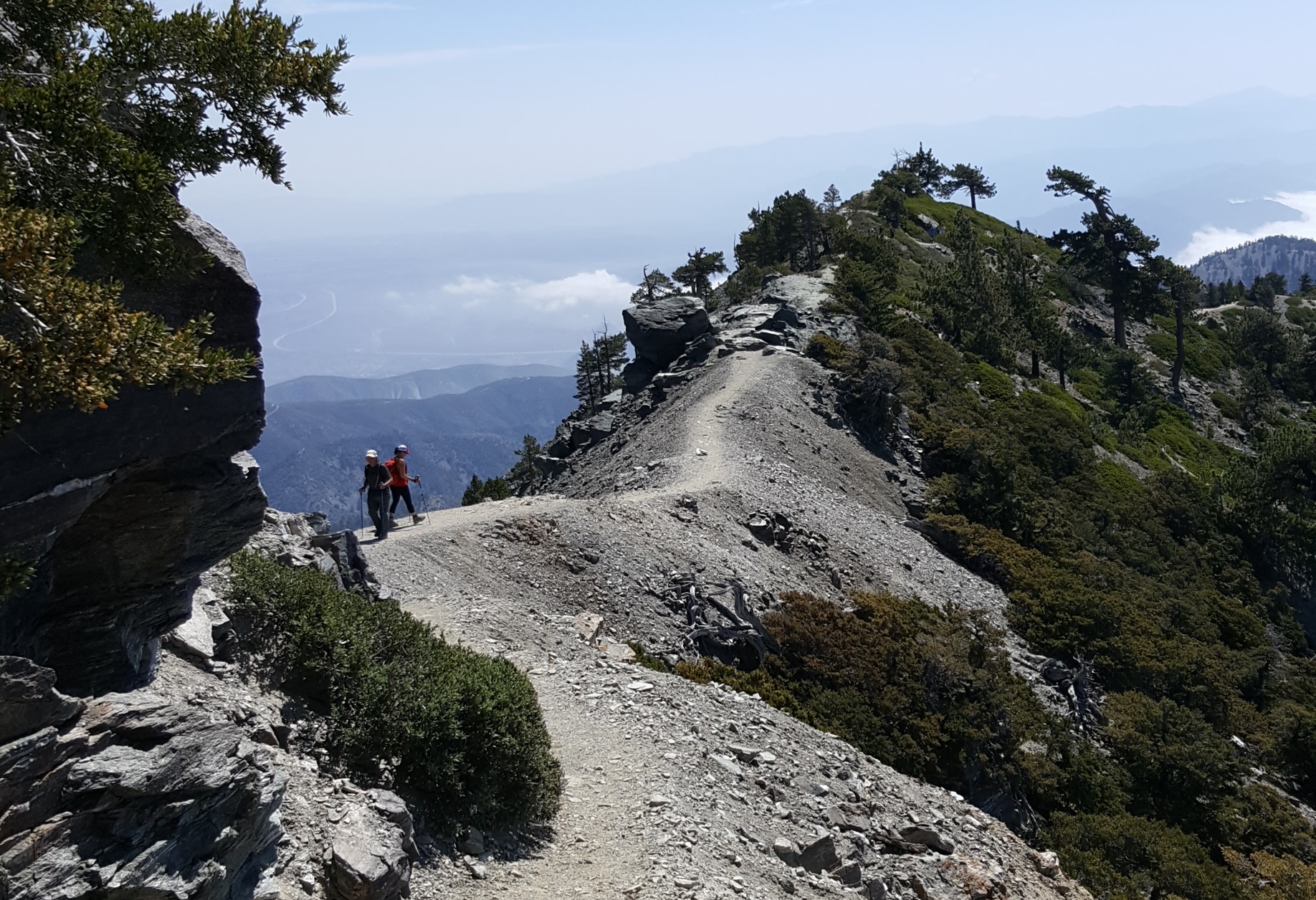
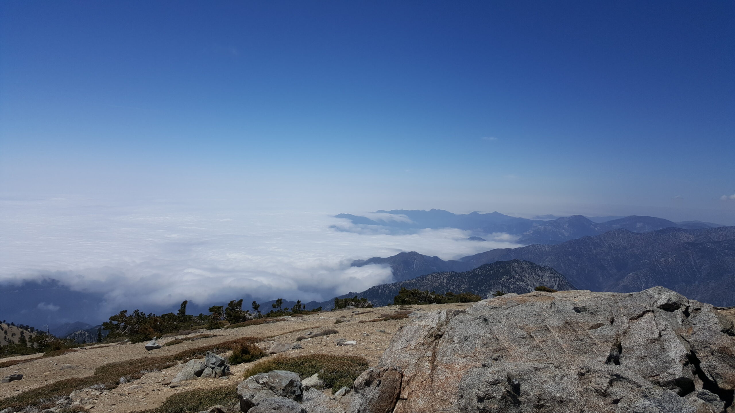
Standing on a knife-edge ridge with 2,000-foot drop-offs on both sides, you realize why locals call it the Devil’s Backbone. This is the most dramatic route to the summit of Mt. San Antonio. Baldy is the highest point in Los Angeles County at 10,064 feet and one of 57 ultras in the US. (An ultra peak has at least 1,500 meters of topographic prominence.) On a clear day, you can see the ocean. The Devil’s Backbone also connects Mt. Harwood, Mt. Baldy, and West Baldy along the same razor sharp ridge. Taking the ski lift to Baldy Notch, gets you into the thick of the action on the Backbone.
By Edward So, who has summited most of the peaks in the San Gabriel Mountains
Directions to Trailhead
| Head east on the 210, and exit Baseline Road in Claremont. Turn left on Baseline Road. Turn right on Padua Avenue. In 1.8 miles, turn right onto Mt. Baldy Road. In 7.2 miles, go past Mt. Baldy Village. Continue 2.8 miles on Mt. Baldy Road. Turn right to stay on Mt. Baldy Road. Drive 2.3 miles to the Mt. Baldy Ski Lifts parking lot. |
Directions to Summit
Start: Devil’s Backbone Trail connects Baldy Notch with the peak, and is 2.8 miles long with 2,269′ of elevation gain. You can reach Baldy Notch by:
Baldy Notch: Follow the fire road up to the beginning of the Devil’s Backbone Trail. |
Ski Lift to Baldy Notch
Riding the Mt. Baldy Ski Lifts to Baldy Notch saves a 2.3 mile climb (1,500′ gain) from the parking lot.
Calm Your Nerves on the Backbone
From Baldy Notch, the fireroad climbs steeply to the second ski lift, marking the start of the Devil’s Backbone Trail. This is a remarkably narrow rising ridgeline spine with significant drop-offs on each side, connecting Baldy Notch to the summit. (When this trail has ice and snow, you need crampons and an ice axe.)
Extra Peaks on the Backbone
The Devil’s Backbone keeps ascending until it levels off next to Mt. Harwood. After spotting Mt. Harwood’s ridgeline trail, follow it to the Harwood’s peak while it parallels the Backbone below. Or you can always scramble up the scree. The path dips before rejoining the Backbone for one last climb up the switchbacks to the top of Baldy. Make sure you stick to the ridgeline trail via the saddle to West Baldy. The Bear Canyon Trail to Baldy Village loses too much elevation.
For a more challenging hike to the top, check out the guide for hiking to Mt. Baldy via the Ski Hut route.
Diversions
The Top of the Notch restaurant and bar is a great spot for refueling. Occasionally, there is live music at the Notch, such as Elevated Solstice’s reggae and roots rock lineup. The Notch also has 600′ zip lines that are 70′ above the ground.
Factoids
Gold-seekers originally established the trail to the summit in San Gabriel Canyon. The Devil’s Backbone trail can be dangerous in winter months. Aurelia Squire Harwood was a conservationist, educator, and first female President of the Sierra Club.
Red Tape
If you park at the Ski Lift parking lot, you must purchase a $5 parking pass. To park on the roadside, you need an Adventure Pass for each vehicle.
Video Tour of Mt. Baldy (via the Devil’s Backbone)
Other Routes to Baldy
You have many options for getting to the top of Baldy. You can take the Ski Hut route, the Devil’s Backbone, or you can combine them both into a loop.
Hike Mt. Baldy via Ski Hut Route | San Gabriel Mountains Trail Guide
Hike Mt. Baldy via Ski Hut and Devil’s Backbone | San Gabriel Mountains Trail Guide