| Objective: Antarctic Kayaking in the Southern Ocean Distance: 26.7 miles (round-trip) Trip Length: 11 days Best time to visit: November to March Caution: Extreme cold, sea sickness, rough seas |
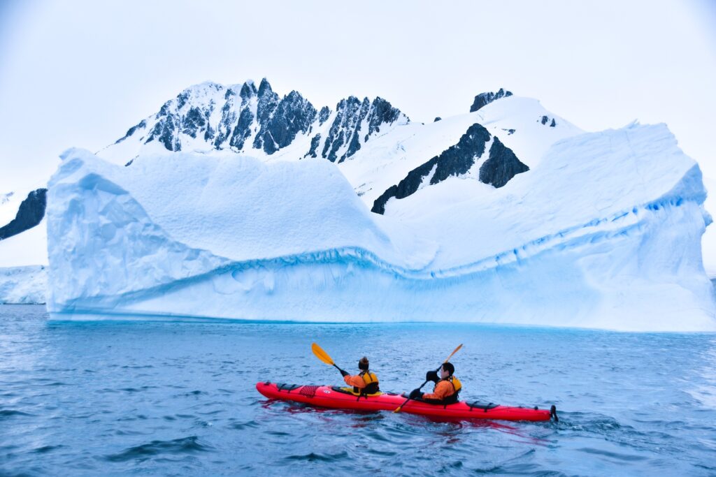
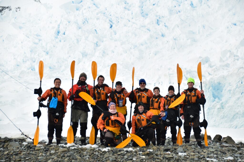
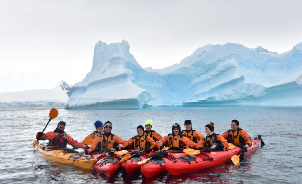
Antarctic Kayaking is a thrilling and exhilarating adventure. Paddle near tall blue icebergs. See the glorious glaciers. Experience amazing wildlife and enjoy group camaraderie. Float through an unspoiled wilderness.
During ship excursions, you will have a magical experience in nature’s sculpture garden. Experienced sea kayakers will push their limits in extreme environments under close supervision from qualified kayak guides. The number of Antarctic kayaking opportunities will depend on the itinerary and weather conditions.
By Edward So, an adventure travel writer and polar expedition kayaker who has been to all seven continents
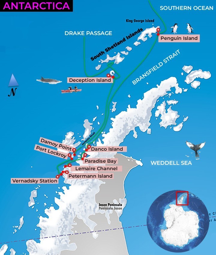
| Crossing Drake Passage | Antarctic Excursions | Penguin Island | Paradise Bay | Petermann Island | Port Lockroy | Damoy Point | Deception Island | Plan Your Visit | Equipment | Video Tour |
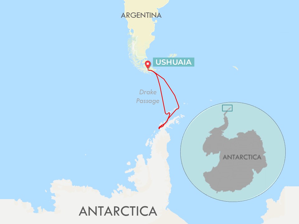
First, you must cross the dreaded Drake Passage!
Ushuaia is in Tierra del Fuego at the southeastern end of Argentina. As the world’s southernmost city, Ushuaia is the starting point for the expedition ship as it navigates the Beagle Channel. Endure the crossing of the treacherous Drake Passage, as 17-foot waves smack the vessel over two days. During the first night, the crew bolts down the portholes in the cabin, as the water level rises. At the Antarctic Convergence, cold Southern Ocean waters mix with warm northern waters, causing turbulent conditions.
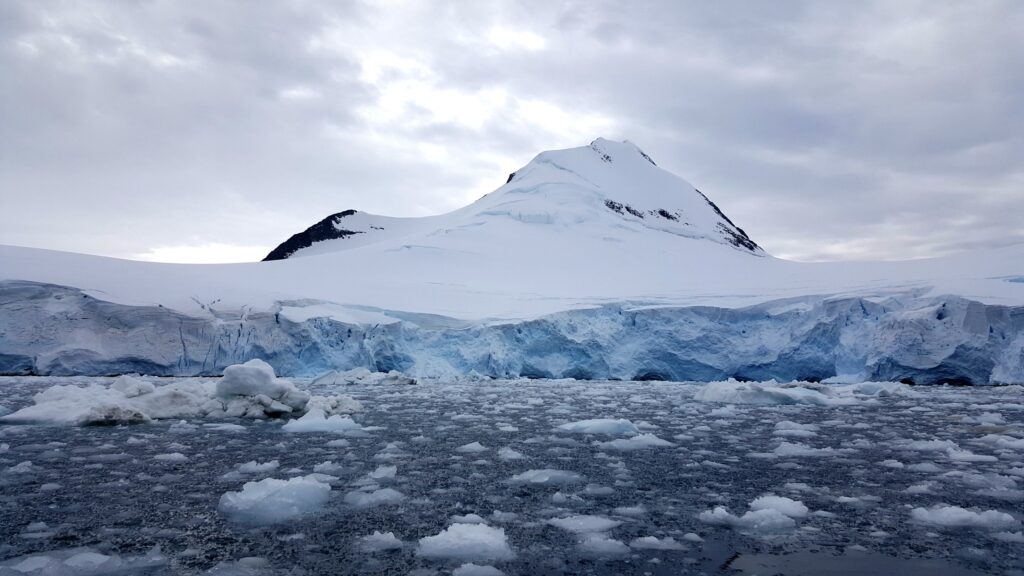
Land ho! At last, we have spotted land along the South Shetland Islands. The Antarctic Peninsula includes the continental mainland and islands off the western coast.
Antarctic Excursions
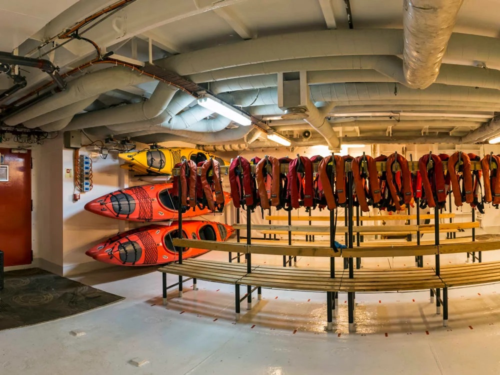
To explore Antarctica, there are excursions in the morning and afternoon, either by motorized Zodiac boat or by kayak. Before we disembark, we head to the mudroom, the staging area for leaving the ship. At my changing spot, I put on my dry suit, booties, spray skirt, and PFD.
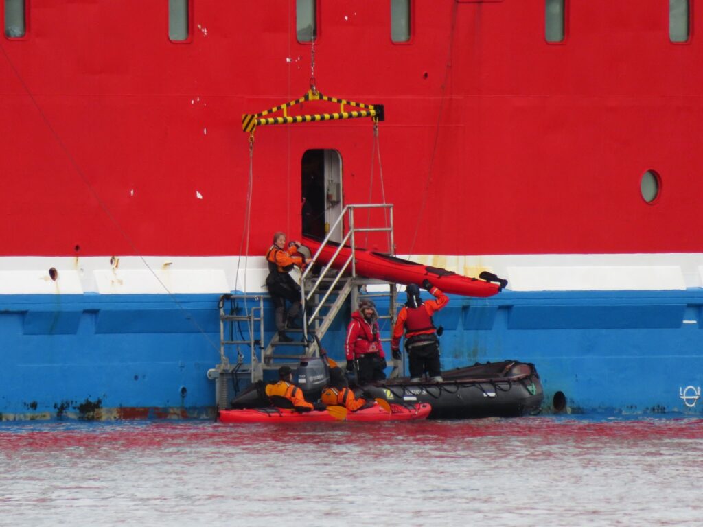
There is a door on the side of the ship where we lower kayaks down a staircase to the water. There are also sturdy Zodiacs ready to ferry us to the polar continent. Sea kayaking is the ultimate way to see Antarctica’s treasures. At water level, the craft is non-threatening to colossal whales and curious seals alike. We see penguin colonies, lounging seals, and the remains of whaling ships and explorers from bygone eras. The gentle pace gives you time to appreciate the kaleidoscopic terrain and listen to the ice below.
Penguin Island: Welcome to Antarctica
| Coordinates: 62.05.54’S, 057.54.84’W Distance: 5.26 miles |
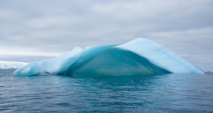
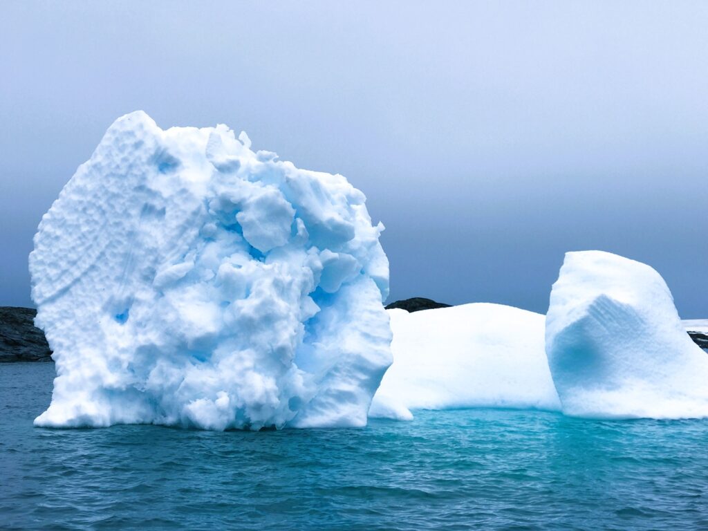
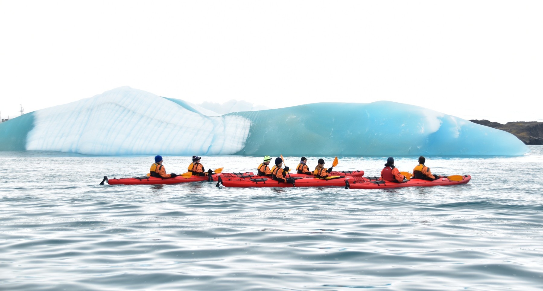
From north of Penguin Island, the team circumnavigates the perimeter of the island in a clockwise manner. Our five kayaks pass a mega-iceberg and stare at its deep blue stripes. The low-slung kayak offers a unique perspective of the giant elephant seals resting on the rocky promontories.
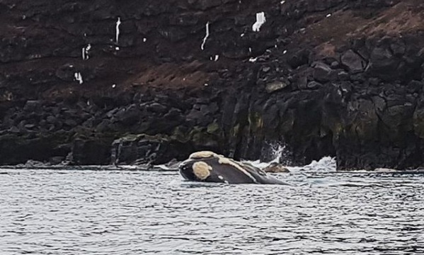
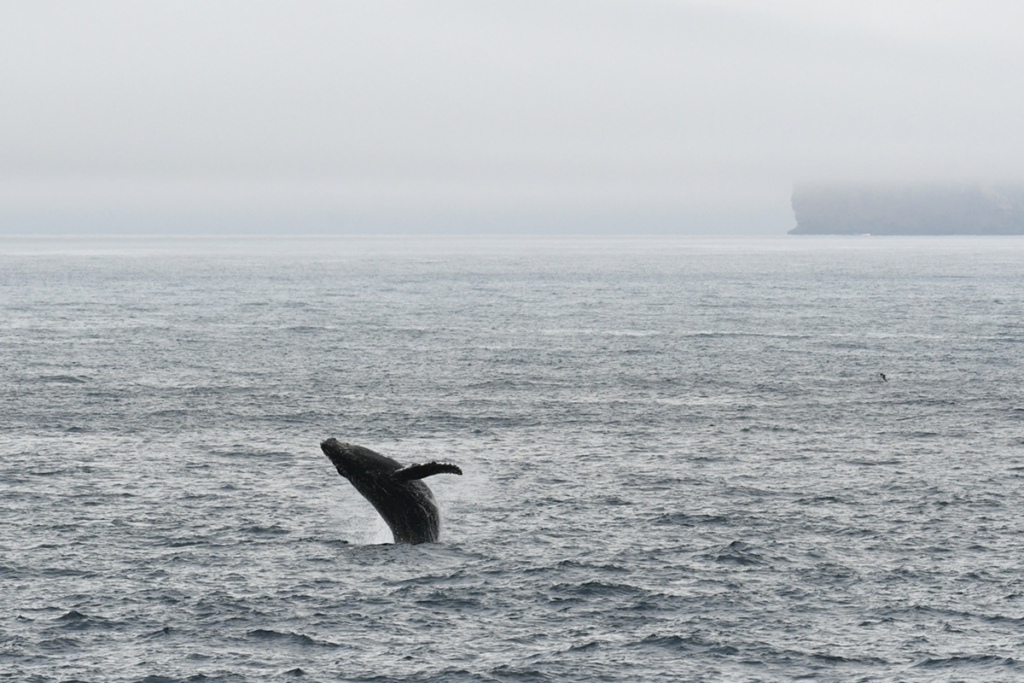
Off in the distance, we hear a strong gushing sound. The heavy breathing becomes louder and more distinct. Then, only 20 feet from our bow, an endangered Southern Right Whale sends a V-shaped spray from its blowhole.
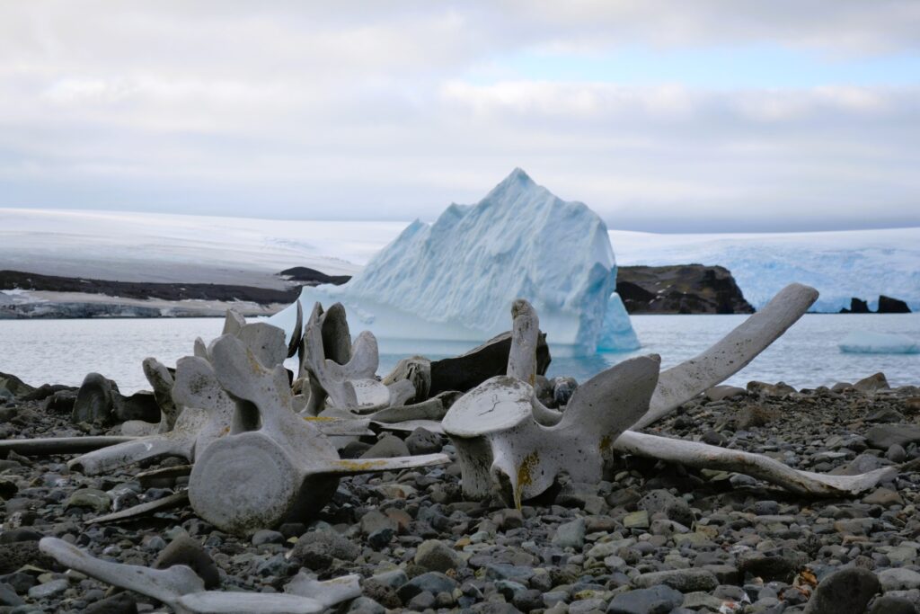
Penguin Island is the first chance to set foot on the continent of Antarctica. On shore, you notice giant whale skeletons left by whalers from long ago.
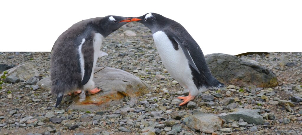
There are large colonies of chinstrap and gentoo penguins. Many of them are marching up the penguin highway. The landscape bursts with colors like reds, greens, grays, and blues; features textures such as rocks, water, and mountains; and exudes the distinct smell of penguin guano. It is much more than the vanilla visions of flat white expanses. At the top is the large red cinder cone of Deacon Peak that takes half an hour to walk up.
Paradise Bay: Mainland of Antarctica
| Coordinates: 64.53.42.’S, 062.51.85’W Distance: 4.56 miles |
Paradise Bay is a large harbor by the west coast of Graham Land. We paddle past the gray stone coast of Argentina’s research base, Almirante Brown. The shore is full of Gentoo penguins, Antarctic shags, and Antarctic fur seals. Near Skontorp Cove, a glacier has deposited a moraine with sediments flowing into the water. We steer toward the rocky beach and land our kayak. And then, like kids rushing to unwrap gifts, we step on the mainland of Antarctica! We wildly wave our paddles and leap above the rocks.
Petermann Island: Monumental Brutal Ice
| Coordinates: 65.11.7’S, 064.08.23’W Distance: 4.44 miles |
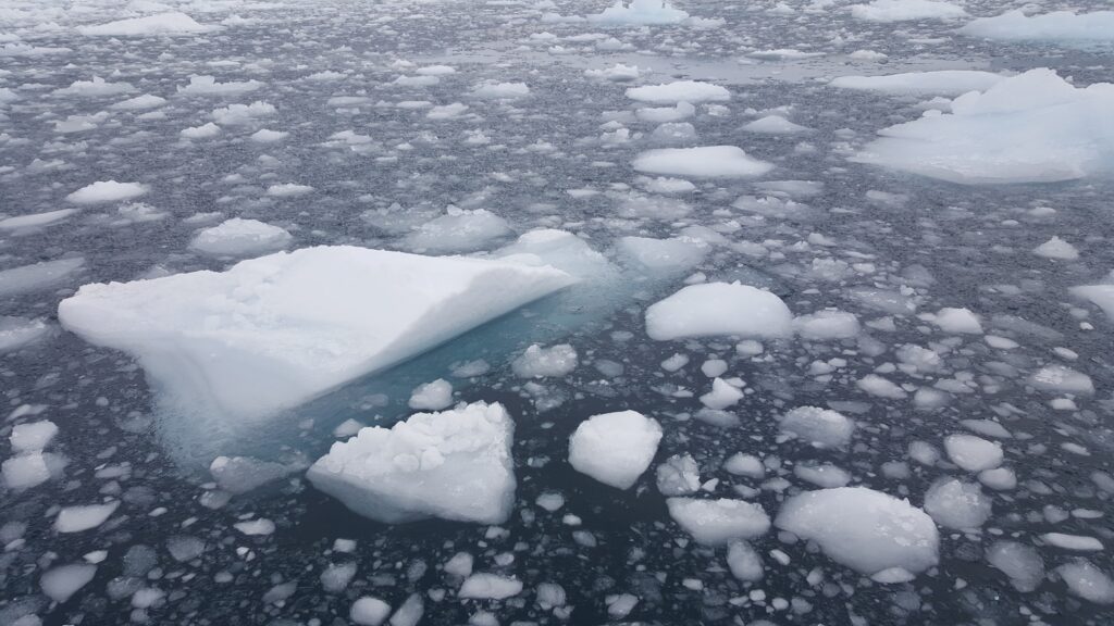
Petermann Island is in the Wilhelm Archipelago by Graham Land. From Port Circumcision, we attempt to circle around Petermann Island and meet at the southern end. Yet, the sea is dark and choppy. Brash ice scrapes loudly as it pushes the sides of the boat and rudder. Harsh waves roll at us from all directions. As we face an incoming swell, the bow turns up to the sky. We catch some air, then the hull makes a dull hollow sound. The surreal silhouettes of the ice sculptures wobble and shake on the rippling water. A mountain-sized iceberg seesaws violently. We take a swirling path around a frosty obstacle course of tabular icebergs, bergy bits, and growler ice. My mind drifts off to visions of sugarplums, molars, frozen waves, and giant bluish-white Cheetos dancing in my head.
Port Lockroy
| Coordinates: 64.49.58’S, 63.30.09’W Distance: 3.25 miles |
This harbor is by the northwest shore of Wiencke Island and across Neumayer Channel from Anvers Island. We paddle into Port Lockroy by the shallow water near Jougla Point and Goudier Island. Then, we head south into Peltier Channel and float at the base of Mt. Luigi and the Fief Range. The tranquil water here is magnificently calm and gentle. Port Lockroy is also home to the Penguin Post Office, where you can send a postcard home from Antarctica.
Antarctic kayaking is demanding. You wake up early, move gear around, lift kayaks off the ship, paddle for hours, and tend to blisters. Enjoying the otherworldly scenery makes it all worth it.
Damoy Point: Savage Wildlife Encounter
| Coordinates: 64.48.81’S, 63.31.22’W Distance: 5.33 miles |
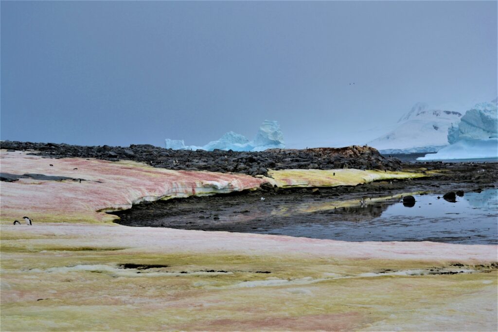
Damoy Point is the northern entrance to Port Lockroy. We follow the penguin colony spread across the bands of rock and snow banks along Damoy Point’s coast. The red and green ground is not penguin guano. The Christmas-colored algae coats the shore.
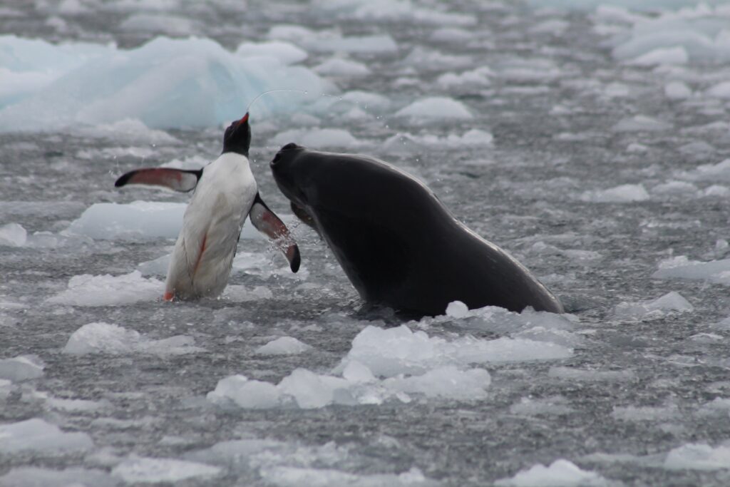
After turning to Dorian Bay, we spot a leopard seal with a freshly caught penguin. The penguin is still alive and flopping around. But the seal viciously slams its prey against the water and tosses it up in the air. At some point, the guts spill out. This late in the season, the seals have already fattened up and are at maximum body mass. They are not really hungry and are merely playing with their food.
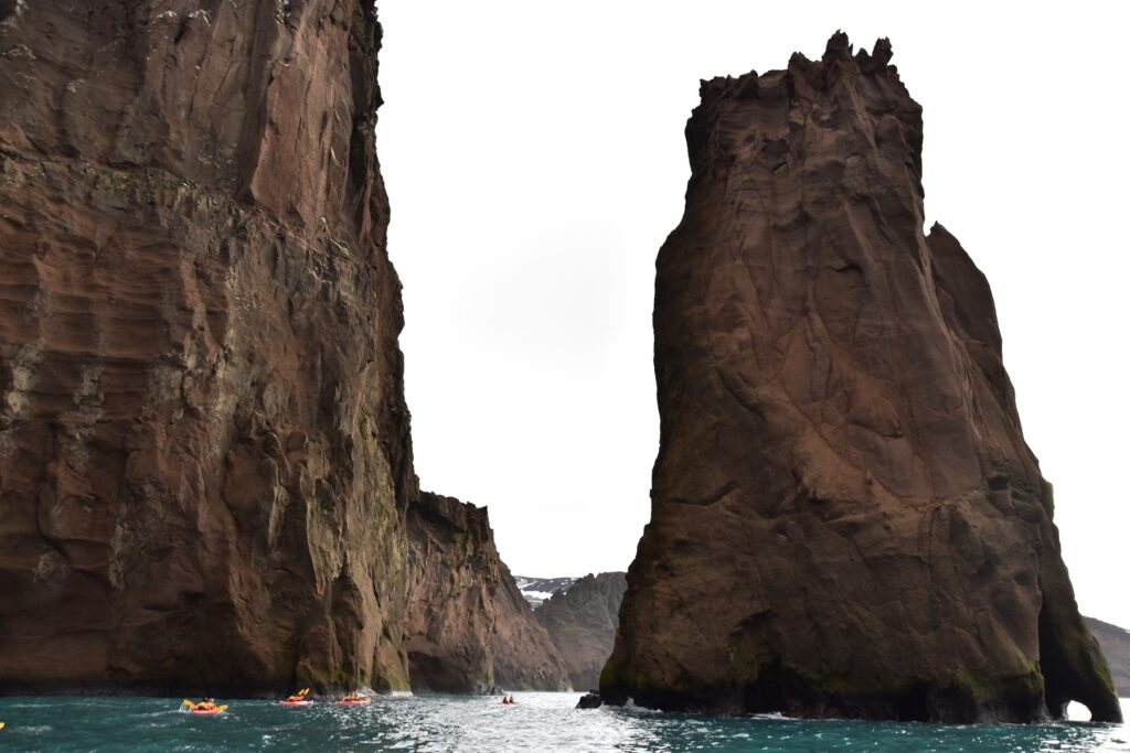
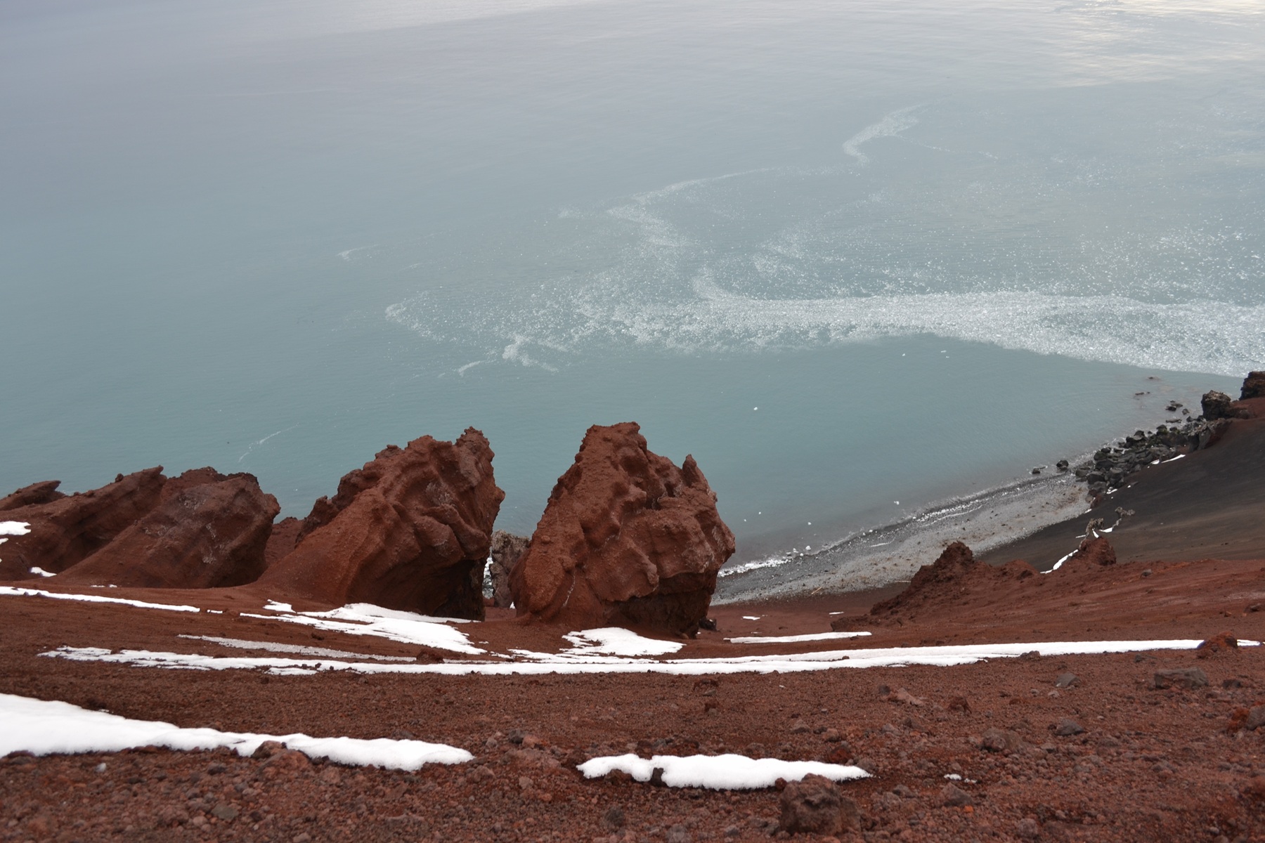
Deception Island: A Hidden Atoll Playground
| Coordinates: 62.58.88’S, 60.93.79’W Distance: 3.87 miles |
Starting from Whaler’s Bay, we paddle through calm and glassy water below the shelter of the inner wall. As we are in the middle of a large volcanic caldera, the area smells like sulfur. We shoot a patch of white water under an arch named the Needle by Deception Island’s hidden entrance, Neptune’s Bellows. Then, we hug the coast along the high jagged outer wall of the atoll until Neptune’s Window and turn around. On the way back to Whaler’s Bay, a couple seals follow our boats during our last round of kayaking.
We line up for some pictures then we dash across the black volcanic rock beach. The toes feel the chill first, a few more steps, and then I dive headfirst into the frosty Antarctic water. After the polar plunge, in the mudroom, we warm up with shots of aquavit.
Plan Your Antarctic Kayaking Adventure
| Transportation: Catch a flight to Buenos Aires, Argentina. Fly to Ushuaia. Embark for Antarctica on an expedition ship. At Antarctica, there are zodiac boats and kayaks. Excursions: There are two per day, one in the morning and one in the afternoon. You can select Antarctic kayaking or hiking for either of the excursions. Lodging: The expedition ship has cabins for two to three people. Food: The dining room offers delicious meals. Vendor: Book an Antarctic expedition with G Adventures Cost: $5,000 – $7,000 for a triple/quad cabin (not including flights) |
Equipment
| Provided Gear: * Prijon Excursion HTP double sea kayak with rudder steering * Adjustable paddles * Personal Floatation Device * Kokatat SuperNova dry suit * Spray skirt * Pogies (mittens) * Wetshoes * Dedicated Zodiac with safety gear What to Bring: * Moisture-wicking medium-weight thermal shirt (base layer) * Lightweight thermal underwear bottoms (base layer) * Medium-weight long-sleeve fleece top (insulating layer) * Non-cotton pants (insulating layer) * Wool cap * Buff * Wool socks * UV protection (sunglasses, sunscreen, lip balm) * Camera * Waterproof bag |
Antarctic Kayaking Statistics
| Location | Coordinates | Distance Paddled | Time on Water | |
| miles | km | |||
| Penguin Island | 62.05.54’S 57.54.84’W |
5.26 | 8.47 | 2:05 |
| Paradise Bay | 64.53.42.’S 62.51.85’W |
4.56 | 7.34 | 2:40 |
| Petermann Island | 65.11.7’S 64.08.23’W |
4.44 | 7.15 | 1:30 |
| Port Lockroy | 64.49.58’S 63.30.09’W |
3.25 | 5.23 | 2:00 |
| Damoy Point | 64.48.81’S 63.31.22’W |
5.33 | 8.57 | 2:15 |
| Deception Island | 62.58.88’S 60.93.79’W |
3.87 | 6.23 | 1:30 |
|
Total |
26.71 miles | 42.99 km | 12:00 | |
If you would like to kayak in a warmer climate, how about the South of France?
Video Tour of Antarctic Kayaking
Frequently Asked Questions About Antarctic Kayaking
| How much does kayaking in Antarctica cost? An Antarctic expedition with kayaking add-on typically costs $5,000-$7,000 for a triple/quad cabin, not including international flights to Ushuaia, Argentina. Flights from the US to Buenos Aires and onward to Ushuaia typically add $1,000-$2,000. Do you need kayaking experience to kayak in Antarctica? Best time to kayak in Antarctica? What should I wear for Antarctic kayaking? Which operator offers kayaking in Antarctica? Is Antarctic kayaking dangerous? How far do you kayak in Antarctica? |
More Antarctic Adventures
Keep Kayaking!
If you are looking for other epic kayaking adventures, check out the following.