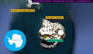
| Objective: Summit Deacon Peak Location: Penguin Island, South Shetland Islands, Antarctica Distance: 0.5 miles (out and back) Peak Elevation: 560 feet Elevation Gain: 600 feet Difficulty: Easy |
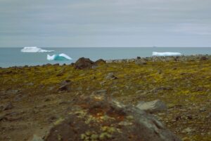
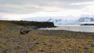
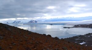
For most people, stepping onto Penguin Island is a huge milestone. It marks your passage to Antarctica. What better to celebrate than climbing a mountain in Antarctica? Deacon Peak may be more like a hill, but it is definitely the summit of Penguin Island. While it’s just a leg stretcher at half a mile round-trip, you’ll see spectacular views of King George Bay.
The South Shetland Islands are 65 nautical miles north of the Antarctic Peninsula. In King George Bay, Penguin Island is south of the largest of the archipelago, South Georgia Island.
| Directions to Trailhead | Directions to Summit | Trek Highlights | Red Tape | Factoids | Photos | Video Tour |
Directions to Trailhead
| 😉 Fly to Buenos Aires. Fly to Ushuaia. Take a ship across the Drake Passage. Sail southwest from the northeast corner of King George Island (the largest of the South Shetland Islands). Go along the Bransfield Strait until reaching Penguin Island. Take a Zodiac boat to cross the Katsui Strait, and land on Penguin Island. |
Directions to Summit
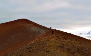
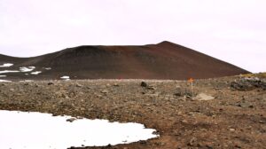
| Trailhead: After wading through the rocks in the shore, climb up the boulders on the coastline. From there, follow the flags marking the trail. 0.4 miles: Hike to the rim of the cinder cone. 0.5 miles: The trail curves along the rim of the caldera until it reaches the top of Deacon Peak. |
Trek Highlights
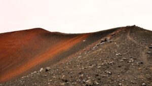
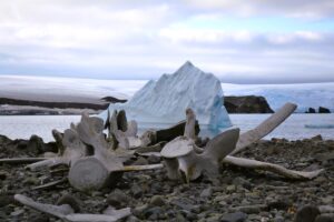
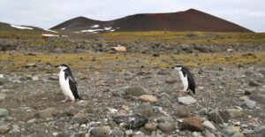
Once you have reached Penguin Island, pass the whale skeleton, and make a beeline for the rim of the caldera. Along the way, there is a penguin highway with chinstrap penguins descending the slope on the way to a fishing trip.
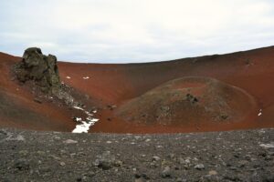
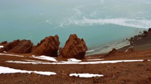
At the ridge, you can peer down into the reddish cinder cone. Follow the curving trail along the rim of the caldera until it reaches the summit. Atop Deacon Peak, you realize how colorful and pungent Antarctica can be.
Red Tape
Follow all the guidelines of the International Association of Antarctica Tour Operators (IAATO) for keeping Antarctica pristine.
Factoids
Back in 1820, Edward Bransfield first sighted Penguin Island during a British expedition. He named it as such because penguins occupied the shores of the island.
In 1937, personnel on the Discovery II charted Deacon Peak, naming it for Sir George Edward Raven Deacon. Deacon was an oceanographer who studied Antarctic waters from the Discovery II.
As a fellow Edward, I approve of both names.
Photos