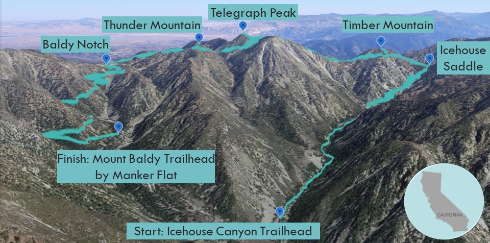
| Objective: Summit the Three T’s, San Gabriel Mountains, California Distance: 14 miles (counter-clockwise loop, shuttle) Peak Elevation: Timber: 8,307’ | Telegraph: 8,989’ | Thunder: 8,587’ Elevation Gain: 4,750′ Difficulty: Strenuous |
The Three T’s Trail takes you on a tour of three summits that start with the letter T. Timber Mountain, Telegraph Peak, and Thunder Mountain are all on the same ridgeline connected to Mount Baldy. You can do a big counter-clockwise loop starting from Icehouse Canyon to Baldy Notch down to Manker Flat. You will need to organize a car shuttle, but that is better than walking on the side of the road for an extra three miles.
Directions to Trailhead
| The start and finish are a few miles apart, so you need to arrange a car shuttle. Leave one car by Manker Flat at the finish and another at Icehouse Canyon at the start.
Manker Flat: Head east on the 210, and exit Baseline Road in Claremont. Turn left on Baseline Road. Make a right on Padua Avenue and continue for 1.8 miles. Turn right onto Mount Baldy Road and drive for 11.5 miles past Mt. Baldy Village. Make a left at Falls Road. Turn left again at Mt. Baldy Road and find parking on the side of the street above Manker Flat campground. |
Directions to Summit
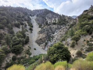
| Trailhead: The hike begins on Icehouse Canyon Trail. 1 mile: At the Chapman Trail junction, continue straight ahead on Icehouse Canyon Trail. 3 miles: At the second Chapman Trail junction, continue on Icehouse Canyon Trail. 3.6 miles: At Icehouse Saddle, turn left to head north on Three T’s Trail. 4.3 miles: Follow the spur trail to Timber Mountain. 4.6 miles: From the peak of Timber Mountain, head back down to Three T’s Trail. 4.8 miles: Turn right onto Three T’s Trail. 6.8 miles: Follow the spur trail to Telegraph Peak. 7.1 miles: From the summit of Telegraph Peak, head back down to Three T’s Trail. 7.5 miles: Turn right onto Three T’s Trail. 8.6 miles: Follow the spur trail to Thunder Mountain. 8.8 miles: From the peak of Thunder Mountain, return to Three T’s Trail. 10.2 miles: Baldy Notch is at the top of the ski lift. Follow the fireroad down to the Manker Flat Trailhead. 13.5 miles: From the San Antonio Waterfall lookout, it is a straight shot to the gate. 14 miles: You have returned to the Manker Flat Trailhead. Shuttle back to your other car at Icehouse Canyon Trailhead. |
To Icehouse Saddle
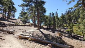
Icehouse Canyon Trail follows a stream next to cabins and cabin ruins. The rocky trail steadily climbs the side of the canyon all the way up to Icehouse Saddle. From here, you can hike to peaks in almost every direction.
Timber
Three T’s Trail begins on the left-hand side heading north. It looks intimidating as it seems to rise straight up right away. After a few switchbacks and 0.7 miles along the ridgeline, you will reach a spur trail to Timber Mountain. The climb to the first T is a nice warm-up for the next one. At the summit of Timber, there are a lot trees and not much of a view. Don’t linger too long because there are giant ants on the logs.
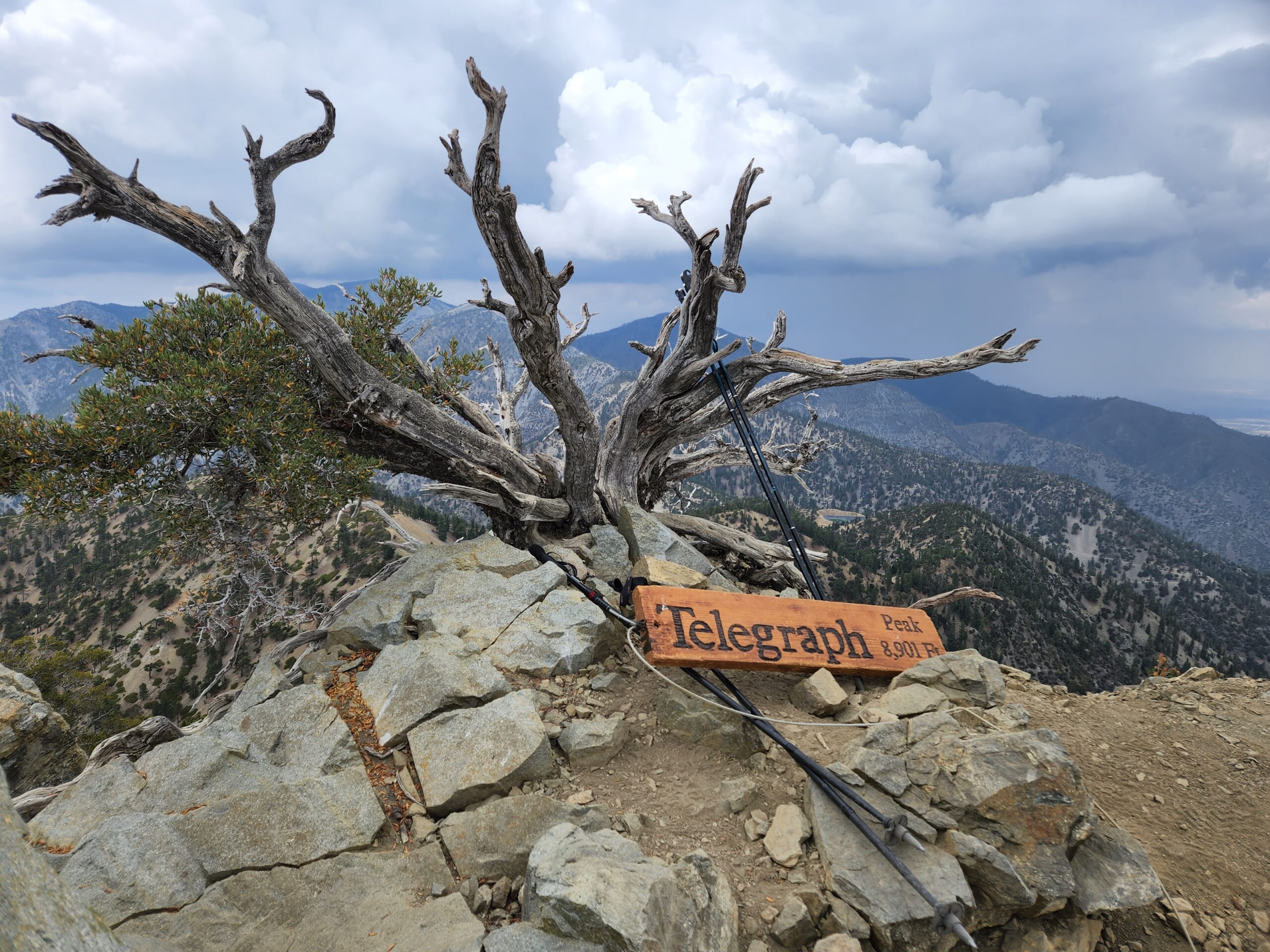
Telegraph
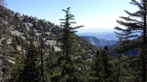
The trail then drops about 500’ into the saddle between Timber and Telegraph. This is followed by twenty switchbacks that climb 1,000’ in just under a mile and a half. The spur trail to Telegraph Peak is about half a mile to the top. Once you have reached Telegraph, the heavy lifting of the hike is over and it is time to cruise. From this second T, you have a spectacular view of Mount Baldy.
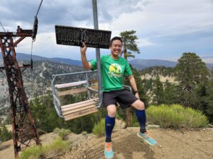
Thunder
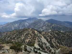
In just under a mile, the trail descends 700’ into the saddle between Telegraph and Thunder. The grade isn’t too steep so you can move rather swiftly. Once you spot the ski lift, it’s just 300’ to the top of the Thunder Mountain. The top of the ski lift is on the summit of this third T. You can imagine all the slopes during the winter covered with snow, snowboarders, and skiers.
To the Notch
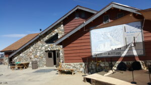
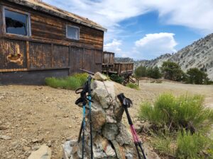
The Three T’s Trail keeps to the right of all the ski runs until it reaches Baldy Notch. There is a reservoir holding water that is used to make snow during ski season. The Top of the Notch restaurant and bar is in a perfect place to rest and refuel with amazing views of the canyon below.
From the Notch, follow the wide fire road down to Mount Baldy Trailhead by Manker Flat campground.
Red Tape
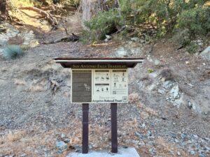
Display your adventure pass.
Photos