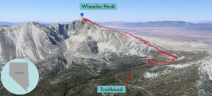
| Objective: Summit Wheeler Peak, Snake Range, Nevada Distance: 8.6 miles (out and back) Peak Elevation: 13,605′ Elevation Gain: 2,835′ Difficulty: Strenuous Caution: Gusts of wind, sudden storms, altitude |
From the eastern stretch of US 50 (the Loneliest Road in America), Wheeler Peak beckons from far away. Wheeler is a stunner with a jagged glacial cirque, glacier, and moraines (glacial lakes). This thirteener is the focal point of Great Basin National Park.
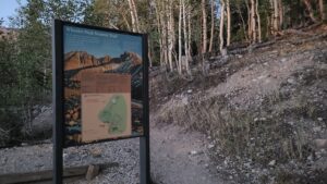
Directions to Trailhead
| From Ely, Nevada, go east on US-50 about 56.6 miles. Turn right onto NV-487. Drive 4.9 miles to the town of Baker. Turn right onto NV-488 and drive 4.9 miles to the west. Turn right onto Wheeler Peak Scenic Drive and drive for 11 miles. The parking lot for the trailhead is on the left (not the end of the road). |
Directions to Summit
| Trailhead: The Wheeler Peak Trail begins through an aspen forest. 1.2 miles: At the first junction, head straight as the path overlaps with the Alpine Lakes Loop Trail. 1.3 miles: At this junction, turn right to continue along the Wheeler Peak Trail through a meadow. 4.3 miles: You have reached Wheeler Peak. Turn around and head back. |
Trek Highlights
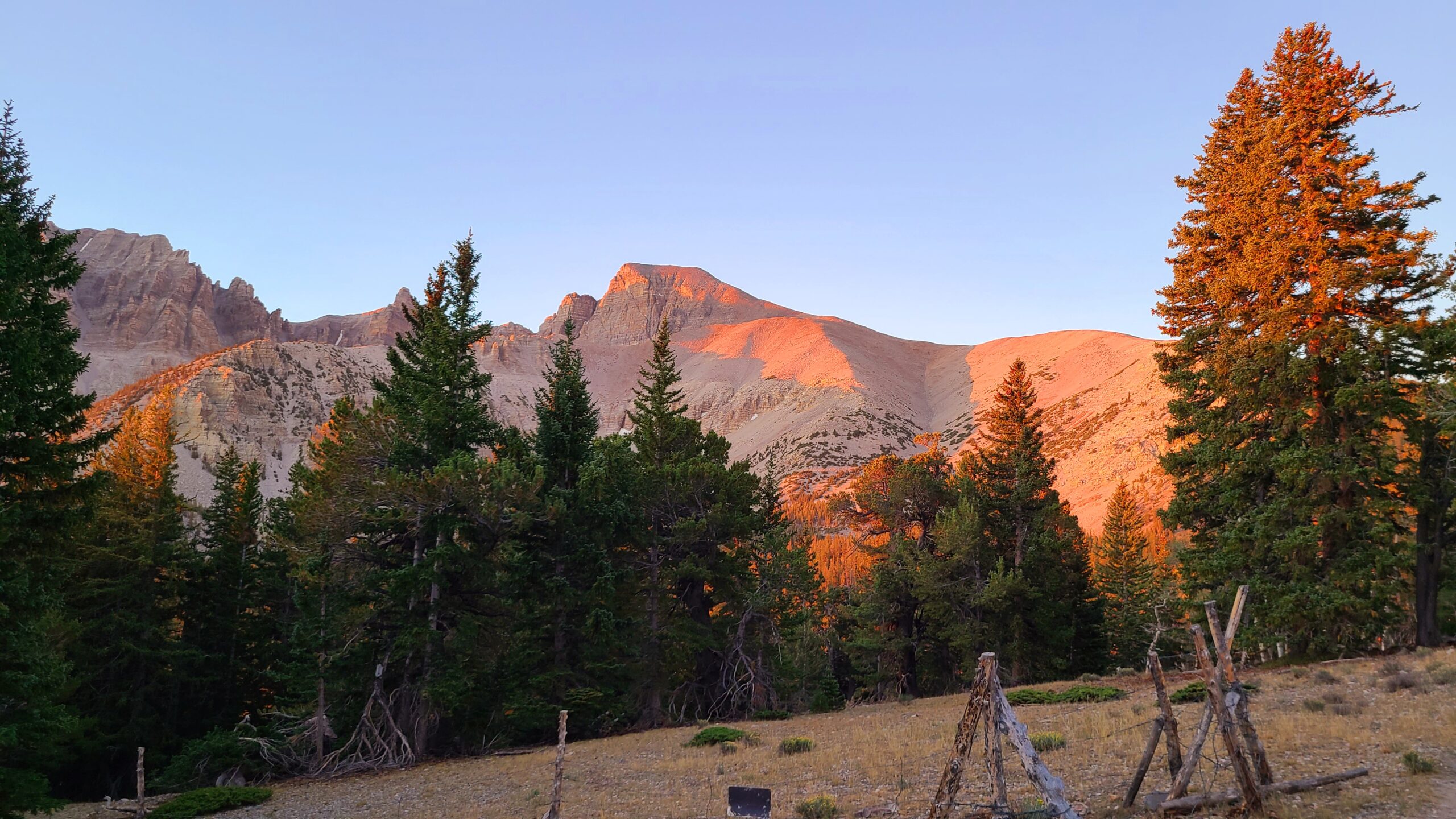
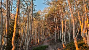
Start early to avoid the direct sunshine and the gusts below the summit. While driving to the trailhead, dodge the large rabbits darting across the road. If you begin before sunrise you will be rewarded. The Sun casts a pink glow on the summit’s eastern face. Orange and golden rays shimmer like a kaleidoscope across the white trunks of the aspen grove. After 0.5 miles, the aspens become shorter and thinner.
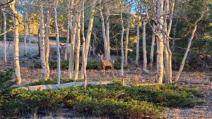
About 1.2 miles from the trailhead, the Wheeler Peak Trail has two big curves as it heads to the ridge. There are many deer at the top of the forest.
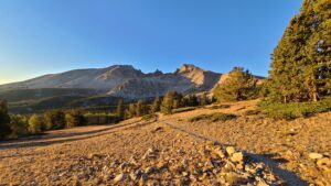
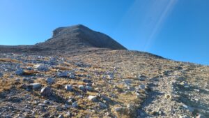
The ridgeline and treeline converge at about 11,000′. The trail becomes a bit rocky at the same time there is no more shade. As you climb higher, the rocks change from red to gray, and it sounds like walking on porcelain.
The summit stands tall above the ridge. There are several wind shelters. On some days, the wind is so strong, it can knock you down and foil a summit attempt. The trail is really steep during the last half mile. You start taking giant steps to get over the big boulders. Sometimes you need to use your hands for balance.
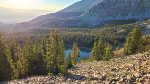
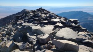
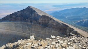
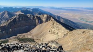
The summit ledge has steep drops on each side. The views are spectacular and you can see hundreds of miles in every direction. This is a green mountain oasis in the vast flat desert. Immediately below are green valleys, lakes, and snow below other peaks.
Red Tape
Great Basin National Park has no entrance fees. Stay at one of the park’s campgrounds, in Baker, or in Ely, 80 miles away.
Factoids
George Wheeler was an explorer and cartographer. He led the Wheeler Survey, which mapped a portion of the US to the west of the 100th Meridian.
Photos