| Objective: Summit Twin Peaks East, San Gabriel Mountains, California Distance: 9.6 miles (out and back) Peak Elevation: 7,761′ Elevation Gain: 3,300′ Difficulty: Strenuous |
The trail from Buckhorn descends into Devils Canyon. Then, it climbs up an extremely steep grade to Twin Peaks East. That final stretch before the summit is a doozy, so remember to bring trekking poles. This is a grueling hike that provides you with three ascents and three descents.
Directions to Trailhead
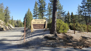
| From the 210 East in La Cañada, drive 33.8 miles on Angeles Crest Highway (CA-2). Continue until you pass the Mt. Waterman ski lift on the right. Park at the Buckhorn Day Use Area parking lot on the left. |
Directions to Summit
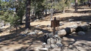
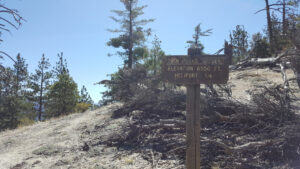
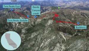
| Trailhead: From the parking area, cross the road and walk southeast about 200′ to a gated dirt road. 0.1 miles: At the first junction, take the left fork and head south on the Waterman Mountain Loop trail. 0.9 miles: The trail takes a big turn and heads west. 1.6 miles: The trail reaches the first of a few switchbacks. 2 miles: At the second junction, take the left fork to Twin Peaks Trail descending into Devils Canyon. 2.91 miles: At the trail to Three Points, turn left to stay on Twin Peaks Trail. 3.53 miles: Cross Devils Canyon’s creek. 3.68 miles: This is the base of Twin Peaks. 3.93 miles: Keep straight and bypass the spur trail to the helipad. The trail climbs up to the summit. 4.8 miles: You have reached Twin Peaks East. Turn around and head back. |
Trek Highlights
Up: The crisp mountain air is peppered with the fragrance of pine needles and smoke. The trail climbs gently and steadily at first until it reaches the Waterman Mountain shelf.
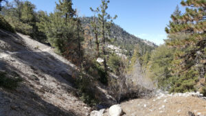
Down: You catch a break as you descend into Devils Canyon, nicely shaded by ponderosa and Jeffrey pines, and pass a knee-high grassy waterfall. Near the bottom, the trail has many little switchbacks. After crossing the gulf between the mountains, you pass bushes with little pink flowers that are buzzing with wasps. At the base of the mountain just below Twin Peaks Saddle, you are lower than the trailhead.
Up: From here, it is over eleven hundred feet of elevation gain up a use trail. The steep slope is sandy and the ball bearing-like stones seem to pull your foot down with every step. The trail is faint and dissolves into the slope. If you go off trail, there are occasional cairns, but try and keep to the left to regain the trail. Otherwise, you will end up performing more 45-degree planks than you would like.
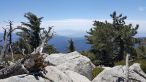
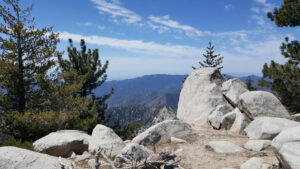
At the top, you really are at the center of the San Gabriel Mountains with a tremendous 360-degree view. You can even see the other twin peaks of Saddleback all the way in Orange County: Santiago & Modjeska. If you like, follow the ridge to Twin Peaks West.
Down, Up, Down: The way back is pretty much a repeat of the way here. You need careful footwork on the initial descent. Then, at the saddle, you are treated to the third ascent of the trip up a dozen switchbacks. Once you have peaked a third time, it is literally all downhill from here. And that concludes today’s rollercoaster hike.
Red Tape
Display your adventure pass.
Photos