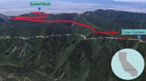
| Objective: Summit Sunset Peak, San Gabriel Mountains, California Distance: 8 miles (out and back) Peak Elevation: 5,796′ Elevation Gain: 1,401′ Difficulty: Moderate |
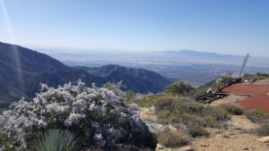
The fire road spirals to the top of Sunset Peak where you can explore the ruins of a fire lookout.
Directions to Trailhead
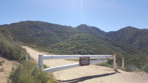
| From the 210 East in Claremont, exit Baseline Road. Turn left on Baseline Road. Turn right on Padua Avenue. Continue 1.8 miles. Turn right onto Mt. Baldy Road. In 7.2 miles, turn left onto Glendora Ridge Road in Mt. Baldy Village. Drive 0.9 miles to Cow Canyon Saddle. Continue west 4.2 miles to Forest Service Road 2N07 on the left. Park in the large dirt clearing. |
Directions to Summit
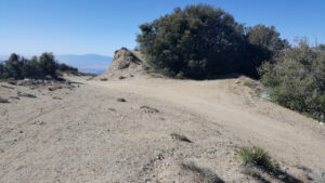
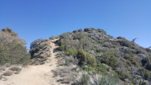
| Trailhead: Walk around the locked gate and head east on the Sunset Ridge Fire Road (2N07). 2.2 miles: At the junction on the western flank of Sunset Peak, turn right onto the Sunset Peak Mountainway. 3.5 miles: Once you get to the ridge, make a U- turn. 3.54 miles: Keep left and follow the road north as it wraps around the peak to make the final ascent. If you go right, the steep spur trail is a shortcut to the summit. 4 miles: You have reached the summit. Turn around and head back. |
Trek Highlights
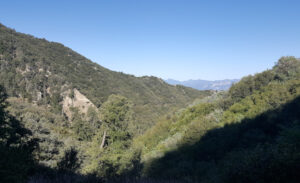
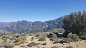
The route to the top is straightforward as it follows the Sunset Ridge Fire Road the entire way. The road gently climbs and hugs the contours of the canyons below the bending ridgelines. The ridge trail is steep and slippery due to the sand and gravel so lean into every step. The peak is covered with metal shingles and the concrete foundations of a former fire lookout tower.
Red Tape
Display your adventure pass.
Factoids
The peak once had a fire lookout tower, which was part of a chain of fire lookouts.
Photos