| Distance: 10.3 miles (out and back) |
Elevation Gain: 2,506 feet |
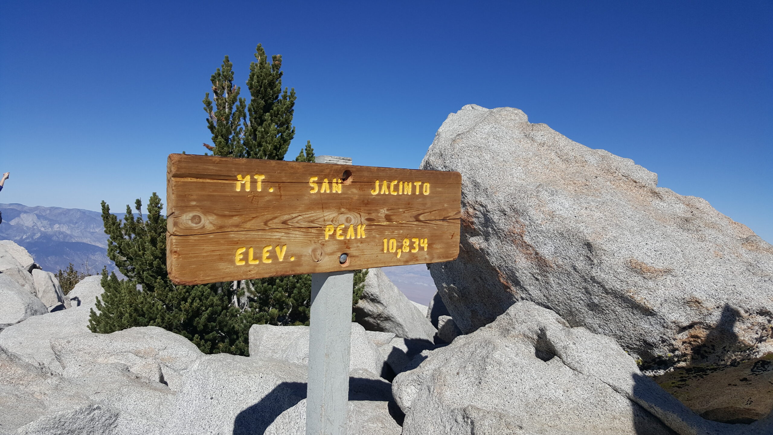
Peak Elevation: 10,834 feet |
| Objective: Summit San Jacinto Peak via Palm Springs Aerial Tramway, San Jacinto Mountains, California | Difficulty: Strenuous |
|
| Cautions: Heat, altitude sickness |
Best Months: June to October |
Permits: Wilderness permit |
San Jacinto, one of SoCal’s “Three Saints”, rises above 10,000 feet with San Gorgonio and San Antonio (Baldy). This ultra ranks sixth in the contiguous United States, with 8,319 feet in vertical prominence. It towers over Palm Springs and is also the highest point in Riverside County. Prepare for Whitney by climbing San Jacinto, Baldy and San Gorgonio. There are a few ways to approach the summit. There are a few ways to summit San Jacinto Peak. The steepest route is via the Marion Mountain Trail with 4,600 feet of elevation gain. Or, one day you can attempt Cactus to Clouds (C2C). It’s the hardest day hike in the US with 10,600 feet of gain over 23 miles and desert heat. Start with this trail guide, which describes taking the tram from Palm Springs to Mountain Station before the hike begins.
By Edward So, who has summited over a hundred peaks in SoCal
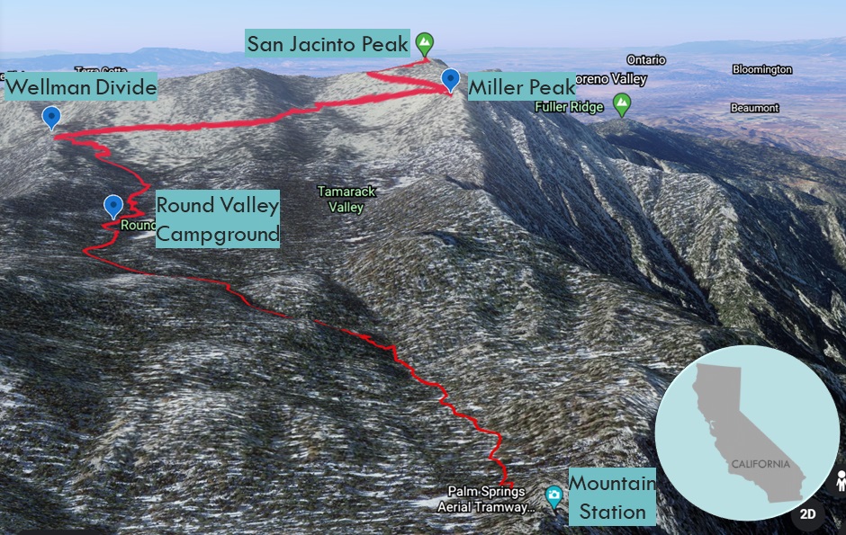
Map
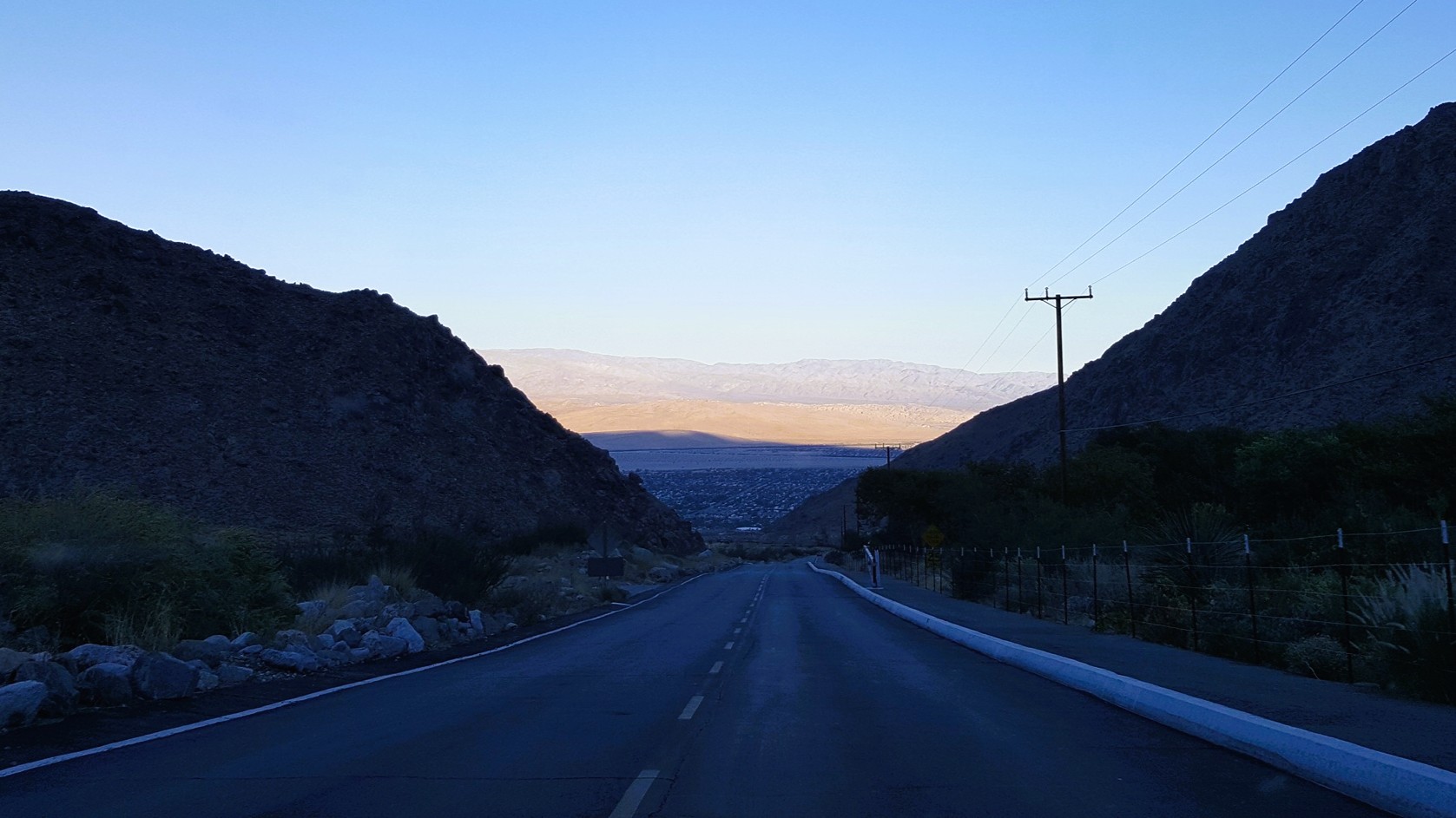
Directions to Trailhead
| Drive east on the 210. Head east on the 10. After Cabazon, take exit 111 for CA-111. Turn right on Tram Way and parking is at the end of the road. Take the tram to Mountain Station. |
Directions to Summit San Jacinto Peak
| Trailhead: At Mountain Station, follow the concrete path to the ranger station. 0.33 miles: Trailhead: Hike along the Round Valley Trail. 0.46 miles: At the junction sign “Round Valley 2 →”, turn right and hike along Long Valley Creek. 0.90 miles: At the junction, turn left and head southwest to Round Valley. 1.84 miles: At the junction, turn right and head west to Round Valley Campground. 2.22 miles: At the junction, keep left. 3.10 miles: At Wellman Divide, turn right at the junction to go north on Wellman Divide Trail. 4.80 miles: At the junction, make the final push up San Jacinto Summit Trail. There is Class 2 scrambling below the top. 5.10 miles: You have reached the summit. Turn around and head back. 5.70 miles: At the bend, leave the trail for Class 3 scrambling to Miller Peak. 5.80 miles: Return to Mountain Station. Take the tram down. |
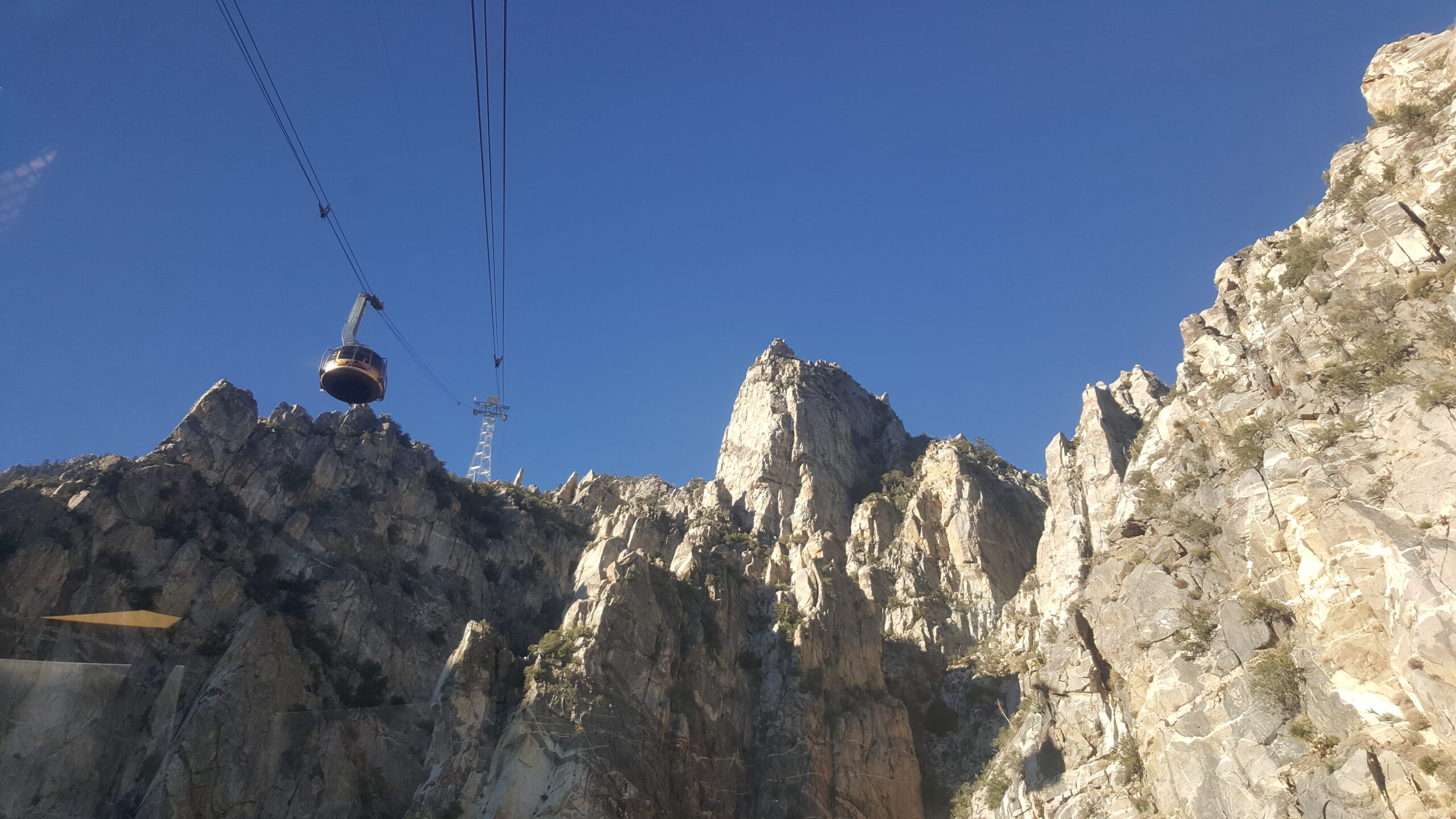
Fly the Aerial Tramway to Mountain Station
Palm Springs Aerial Tramway shaves 5,873′ of elevation gain and 11 miles off the legendary Cactus to Clouds hike. The ride is one of the highlights and while passing each tower, the tram disconcertingly sways like a yo-yo. The tram rotates so everyone has great views of the crags and sheer granite walls. Once the tram doors open with a hydraulic whoosh, the expedition begins down a concrete path from Mountain Station. At the ranger station, you must fill out a self-issued permit, where you can also purchase souvenirs.
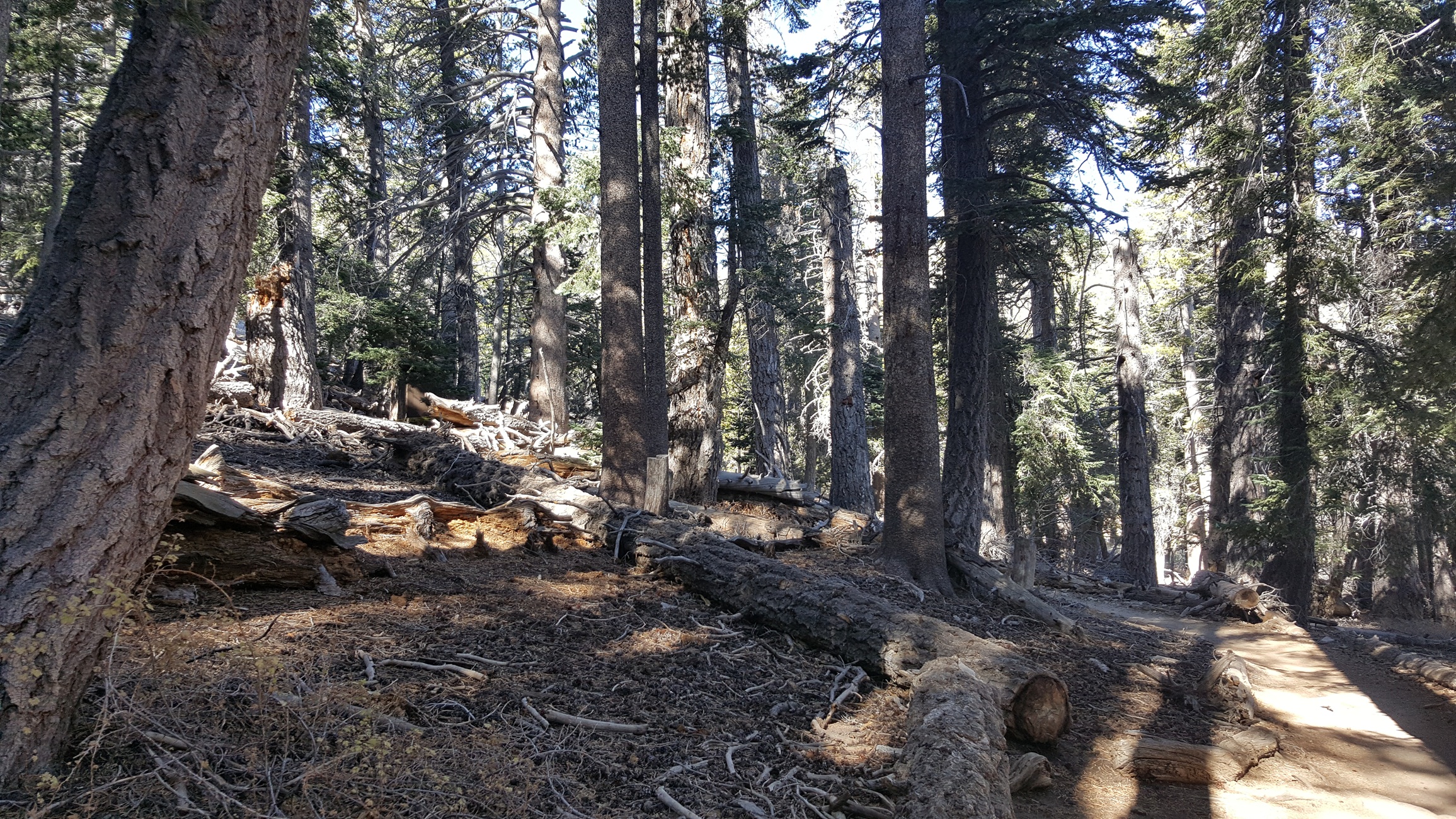
A Comfortable Start through Round Valley
The Round Valley Trail starts off relatively flat as it rambles through Long Valley. At the junction to Round Valley, fork right as the trail climbs tight switchbacks and negotiates some bridges and boulders. The route progresses through a nicely shaded pine and fir forest and passes a green meadow.
Well Man, We Need to Unify, Not Divide
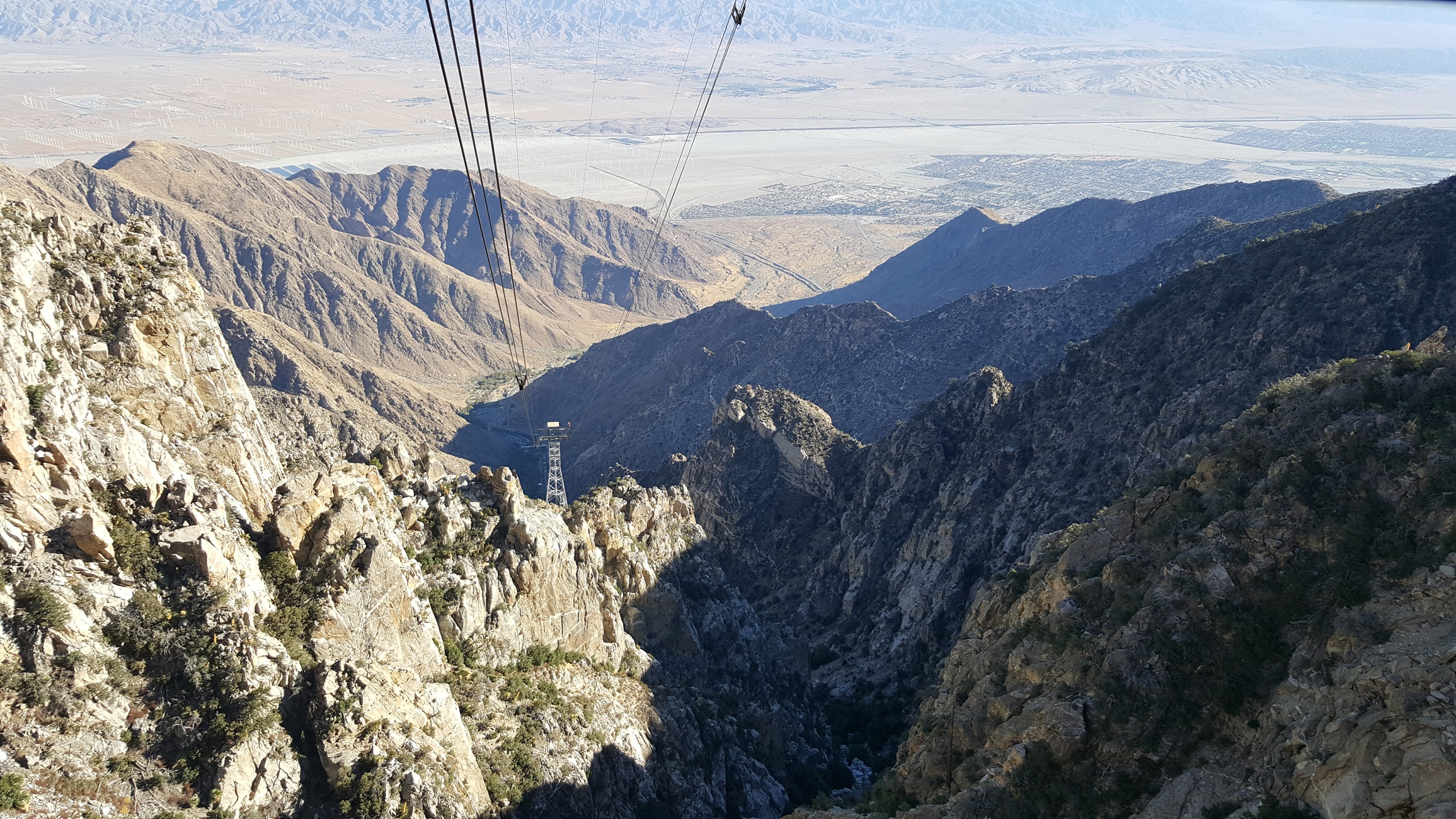
From the Round Valley Campground, you steadily ascend a slope to a saddle between Jean Peak and Marion Mountain. The combination of steepness and distance is rather strenuous. Wellman Divide provides a sweeping look at the southern ridges and valleys all the way to the Salton Sea.
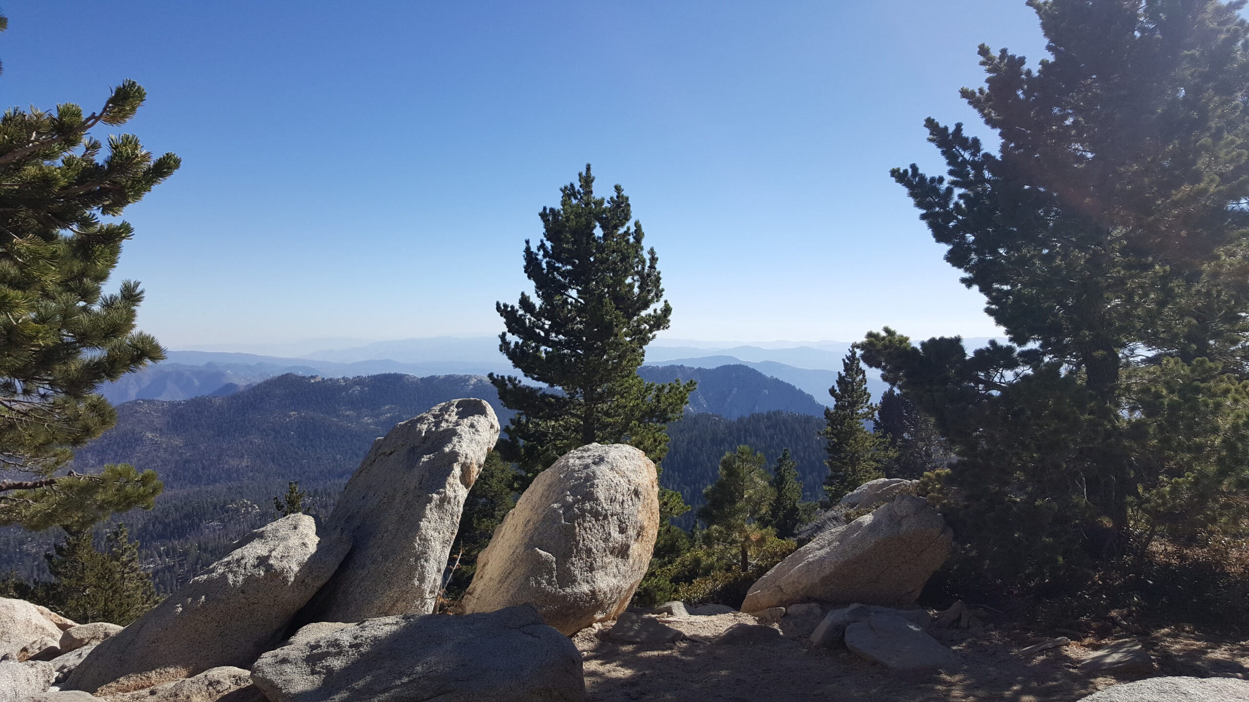
Just below the Last Ridgeline
The trail parallels the ridgeline above connecting Jean Peak and San Jacinto Peak. After a spot where it looks like many boulders have fallen, climb the long, sunny, unswerving side of the mountain. The slope looks like a bed of pesto green bushes with white burrata cheese balls. The path makes a 180 degree turn near the saddle between San Jacinto and Jean Peak.
Gimme Shelter
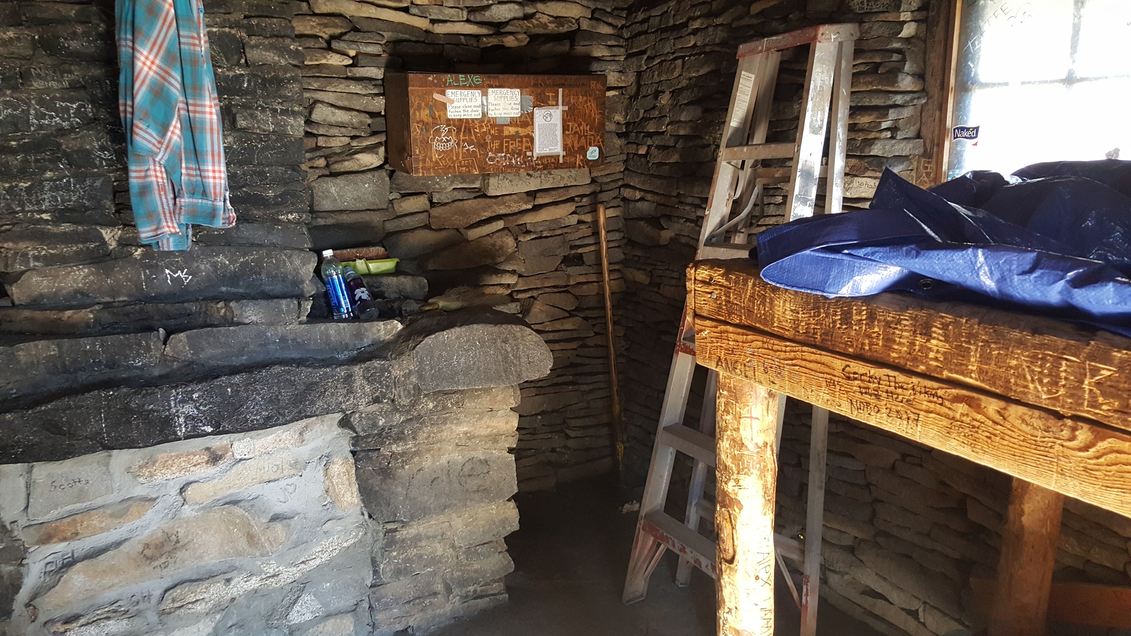
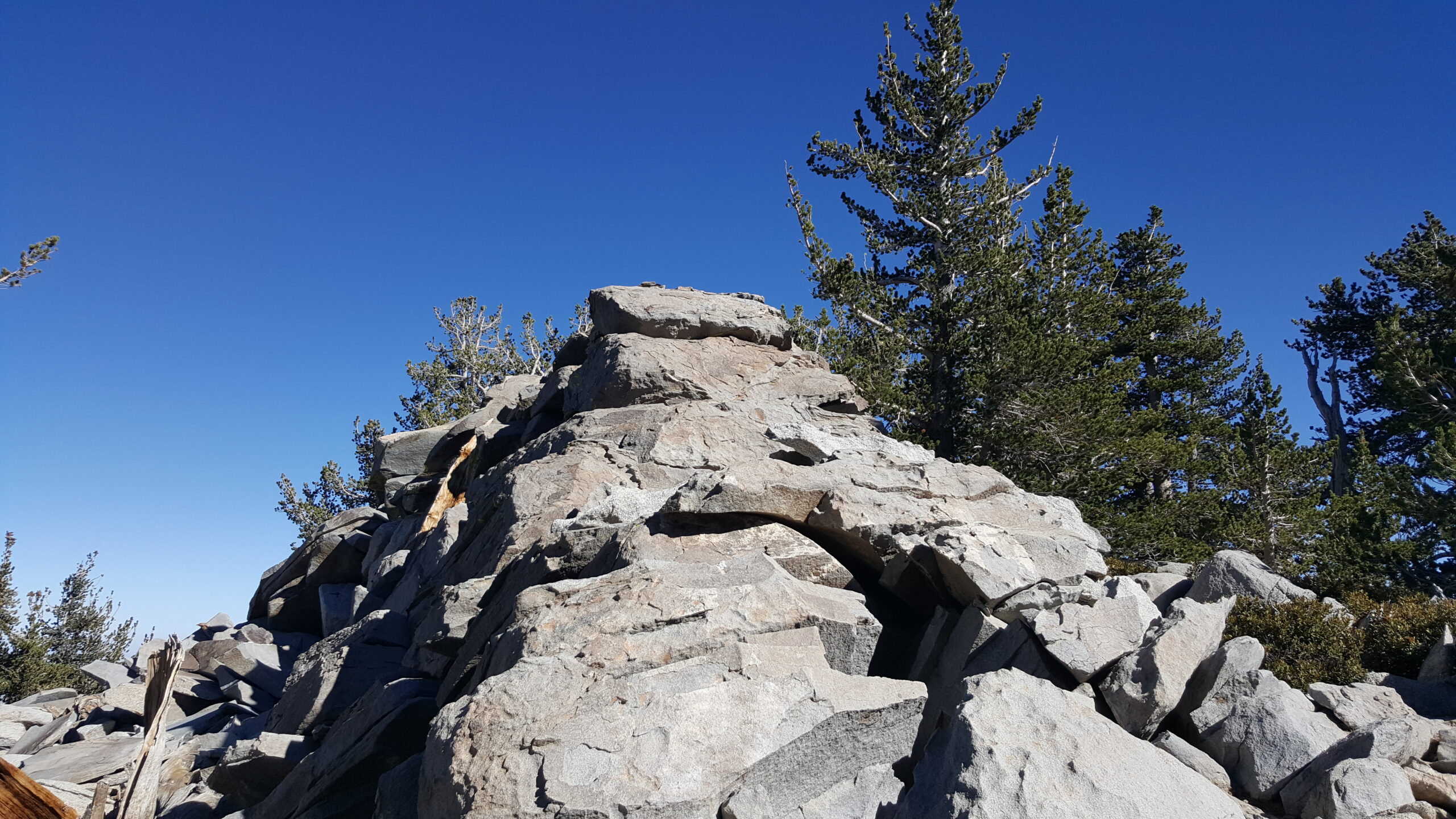
The Summit Trail quickly zig zags up some switchbacks past the San Jacinto Peak Shelter. The Civilian Conservation Corps built the shelter in 1933. You can slide the bolt and look inside the historic shelter. There’s a sign on the emergency supply box on the stone slab wall. It lists some rules about taking care of the shelter. It also says that “a good mountain tent is better than the shelter.”
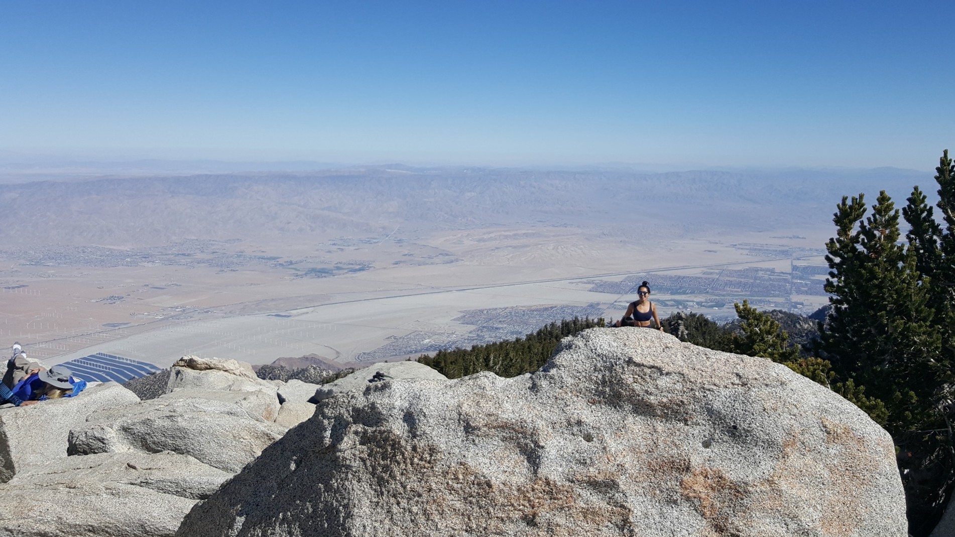
Never-ending Views from the Peak
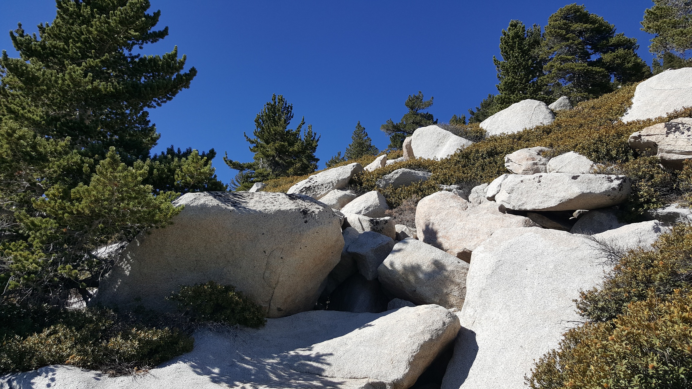
Soon, the trail disappears and it becomes an easy Class 2 scramble to the giant boulders atop San Jacinto Peak. Due to the prominence of the peak, you can survey the lands below for many miles in every direction.
It’s All Downhill from Here (Mostly)
As a bonus, you can backtrack to the sharp bend, go off-trail until reaching the rising pile of stone slabs. Execute some Class 3 scrambling to gain Miller Peak.
Red Tape
- Parking at the Palm Springs Aerial Tramway lot costs $15.
- A roundtrip ticket on the Palm Springs Aerial Tramway starts at $36.95.
- You must fill out a self-issued permit online.
Historical Factoids
San Jacinto Peak is the high point of the San Jacinto Mountains and Riverside County, CA. John Muir wrote, “The view from San Jacinto is the most sublime spectacle to be found anywhere on this earth!”
Video Tour of San Jacinto Peak
Interactive Map
Frequently Asked Questions
| How much does the Palm Springs Aerial Tramway cost? A round-trip tram ticket costs $36.95 for adults, plus $5 for parking at the Valley Station lot. Discounts are available for children, seniors, and locals. Do you need a permit to hike San Jacinto Peak? How difficult is the San Jacinto Peak hike via the tram? Is there water available on the trail? When is the best time to hike San Jacinto Peak? |
Other Challenging Peaks in SoCal
Consider climbing these other challenging peaks. San Gorgonio Mountain is the highest peak in Southern California. San Bernardino Peak is the third highest peak in SoCal. Mount Baldy is the highest peak in Los Angeles County.
Hike Mt. Baldy via Ski Hut and Devil’s Backbone | San Gabriel Mountains Trail Guide