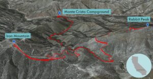
| Objective: Summit Rabbit Peak #1 and Iron Mountain #3, San Gabriel Mountains, California Distance: 9.5 miles (loop, counter-clockwise) Peak Elevation: Rabbit Peak: 5,307’, Iron Mountain: 5,040’ Elevation Gain: 2,730’ Difficulty: Strenuous |
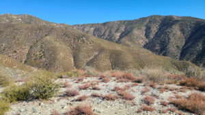
Iron Mountain #3 is not the third Iron Man movie. It is the third peak with that name on the Sierra Club’s Hundred Peak Section list. Iron Mountain and Rabbit Peak traverse a round ridgeline that also connects to Granite Mountain and Round Top. The area is typically hot and shadeless.
Directions to Trailhead
| From the 210 East in La Cañada, drive 9 miles on Angeles Crest Highway (CA-2). Turn left onto the Angeles Forest Highway (N3) and drive 9 miles to Monte Cristo Campground. Park by the entrance sign. |
Directions to Summit
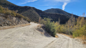
| Trailhead: From the entrance sign, head to the campground. Turn left onto Forest Service road 3N23, and pass the gate. 0.9 miles: At the junction, keep to the right to stay on the road. (The trail to the left heading north shaves a mile one-way.) 1.59 miles: At the junction by Black Cargo Mine, make a sharp right onto Forest Service road 4N18. 2.25 miles: At the junction, make a sharp left. 2.53 miles: At the junction, leave the trail and continue straight ahead. 2.98 miles: You have reached Iron Mountain. Turn around. 3.44 miles: At the junction, turn left onto the trail. 3.71 miles: At the junction, make a sharp right. 4.38 miles: At the junction by Black Cargo Mine, make a right to continue on 4N18. 4.81 miles: At the junction with the road to Monte Cristo Mine, make a big left turn to stay on 4N18. 5.32 miles: You will pass a power line tower just before the road turns to the north. 5.84 miles: After passing the towers on the right, at a gully, look carefully for a faint use trail heading south. The use trail will connect with the southern ridgeline. 6.05 miles: You have reached Rabbit Peak. Turn around and head back to the trailhead. |
Trek Highlights: Iron Mountain
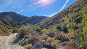
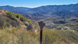
From the entrance of Monte Cristo campground, pass the gate and follow fire road 3N23. The dirt road is above Monte Cristo Creek at the start. It becomes level with the creek, and then gradually rises with the canyon wall.
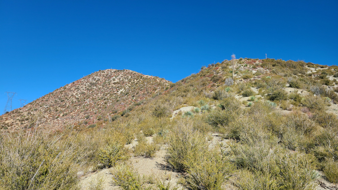
At Forest Service road 4N18, make a 180-degree right turn. The road is steep. After making a big left turn near the ridge, you have a great view of Rabbit Peak on the left. At this section, the plants almost block the path. You get a free massage from the vegetation like one of those Russian ones where they smack you with a leafy branch.
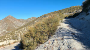
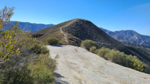
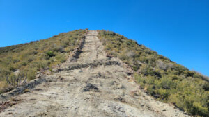
When the trail bends to the left, leave the trail and follow the wide path ahead on the ridgeline. The ground has been bulldozed right to the top of Iron Mountain. The last climb is freaking steep. You really must lean forward to prevent sliding backwards. It is one of the longest straightaway climbs in the San Gabriels just below the summit.
Trek Highlights: Rabbit Peak
After descending the ridge and returning to the trail to Rabbit Peak, the path ducks under some low hanging tree branches. The road flattens out and is covered with fine gray sand.
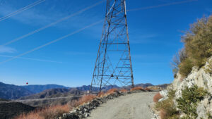
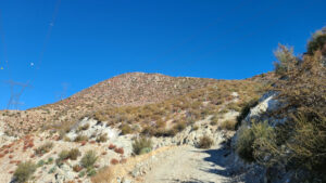
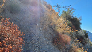
After 0.43 miles, skip the mining area road to the right. Turn left to stay on the road as it climbs to the power lines. Climb another 0.51 miles, pass the first power line tower, and pass the second tower. There is a gully, but look for a hard to see use trail that climbs to the right. Take the narrow path to the second and third towers. Scramble over some brush and connect with Rabbit Peak’s southern ridgeline. Head north on the steep ridge covered with spiky yucca. Climb to the first bump before the peak. The ridge gets much steeper until you reach Rabbit Peak.
Retrace your steps back to the trailhead. The ridge is slippery, so take your time to avoid falling or getting stabbed by the yucca.
Along Monte Cristo Creek, a birder mentioned that there are blue-gray gnatcatchers and flickers (a type of woodpecker). There are also rattlesnakes in the area.
Red Tape
Display your adventure pass.
Caution
Watch out for rattlesnakes, which are active at night and in the morning.
Photos