| Objective: Summit Pleasant View Ridge, San Gabriel Mountains, California Distance: 12.2 miles (out and back) Peak Elevation: 7,983′ Elevation Gain: 3,900′ Difficulty: Strenuous |
Pleasant View Ridge has its share of ups and downs. For every out and back climb to Pleasant View Ridge, you have to scale Will Thrall Peak twice. From this summit, enjoy one of the best viewpoints for surveying the Antelope Valley. Down in Cooper Canyon, relax by the cool waters near Cooper Canyon Falls.
Directions to Trailhead
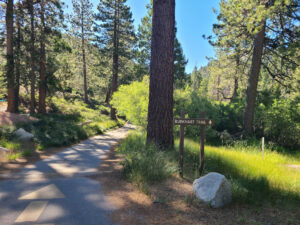
| From the 210 East in La Cañada, drive 33.8 miles on Angeles Crest Highway (CA-2). Continue until you pass the Mt. Waterman ski lift on the right. From the Buckhorn Day Use Area entrance, drive to the trailhead parking area. If the gate is locked, park by the campground exit 0.8 miles to the east of the entrance. From the exit, you must walk 0.7 miles to the trailhead. |
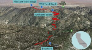
Directions to Summit
| Parking Exit: Hike 0.7 miles to the trailhead. Trailhead: Hike northeast along Burkhart Trail. 1.5 miles: At the junction with the trail to Cooper Canyon Camp, keep right to head east on the PCT. 1.8 miles: Cross Little Rock Creek and travel 100’. At the junction with the PCT (Rattlesnake Trail to the right), keep left to stay on Burkhart Trail. 5.1 miles: At Burkhart Saddle, climb the use trail to the left up Pleasant View Ridge. (You could go right to summit Pallett.) 5.6 miles: You have reached Will Thrall Peak. Follow a use trail heading northwest on the ridge to a saddle. 5.8 miles: From the saddle, continue following the use trail to the summit. 6.1 miles: You have reached Pleasant View Ridge. Turn around and head back. |

Trek Highlights
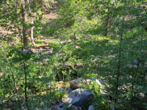
From Buckhorn Campground, the Burkhart Trail starts with a slight decline for the first mile and a half. Pine and fir trees provide ample shade and a little stream soaks a stretch of the path. After a big turn into Cooper Canyon, the trail follows above a branch of Little Rock Creek. Cooper Canyon Falls is a popular swimming destination in the summer.
There are a few creek crossings where the trail bends and climbs. After crossing Little Rock Creek, Burkhart Trail diverges from the PCT, and follows a rocky uphill path. The trail hugs a few v-shaped drainages. There are spiky yuccas, acorns, and pesky gnats along the pine needle carpet.
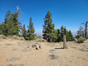
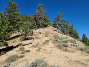
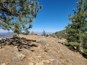
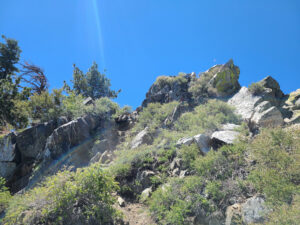
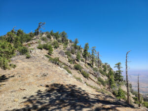
There is a light breeze on Burkhart Saddle above the gnats, cosmic gray squirrels, and space gray lizards. Now the climb begins up the windy, sunny, shadeless use trail with tight and painful switchbacks. The path evens out near the top of Will Thrall Peak. During your first visit of Will Thrall Peak, read the plaque.
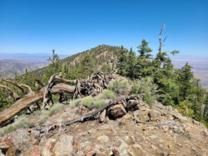
Look toward the summit of Pleasant View Ridge, and follow the northwest ridgeline down and then up. A better name would be rocky ridge although there are definitely pleasant views on both sides. There is a big boulder obstacle before the dip. From the saddle, there is one last 0.3-mile climb to the top. Celebrate by breaking open a bottle of PBR, pop, on top of PVR!
Red Tape
Display your adventure pass.
Photos