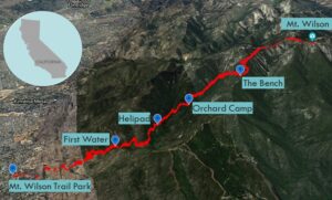
| Objective: Mt. Wilson, San Gabriel Mountains, California Distance: 15 miles (out and back) Peak Elevation: 5,710′ Elevation Gain: 4,800′ Difficulty: Strenuous |
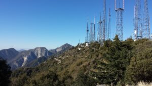
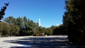
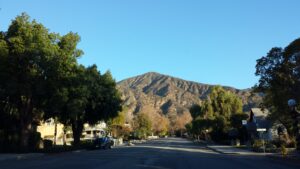
Do you ever have the urge to head straight to the base of a mountain and climb to the top? From the northern edge of Sierra Madre, you can leave civilization behind and climb up Little Santa Anita Canyon all the way to the top of Mt. Wilson. Edwin Hubble used the 100-inch telescope at Mt. Wilson Observatory to discover that the universe is expanding.
Directions to Trailhead
| From the 210, exit and head north on Baldwin Ave. Drive 1.5 miles and turn right on E. Mira Monte Ave. After two blocks, the hike begins at Mt. Wilson Trail road, left of Lizzie’s Trail Inn. |
Directions to Summit
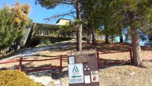
| Trailhead: Mt. Wilson Trail begins from Sierra Madre. 1.5 miles: Keep left at the First Water junction. 2.6 miles: Keep right at the junction connecting to Jones Peak. 2.7 miles: On your right is a helipad. 3.5 miles: You have reached Orchard Camp. 5.5 miles: At Manzanita Ridge (the bench), the route converges with the Winter Creek Trail. 6.1 miles: At the Mount Wilson Toll Road just east of Mt. Harvard, turn right onto the Mt. Wilson Trail. 7.5 miles: At Mt. Wilson, check out Mt. Wilson Observatory and return to the trailhead. |
Trek Highlights
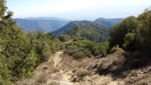
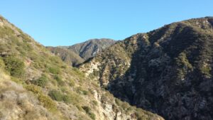
This is a long hike, so get an early start. There is very little shade, so a bit of sunshine will heat things up rather quickly. The Mt. Wilson Trail winds around some homes for almost half a mile until you reach the official trail sign. A mile later after the First Water junction, the trail rises steeply through the chaparral. After 1.1 miles, there is another trail leading up to Jones Peak. Just a bit further, there is a flat clearing on the right, which serves as a helipad.
At a crossing of one of the drainages, you have to scramble over some wet boulders. The mile before Orchard Camp is somewhat chilly in the shade. Orchard Camp contains terraced stone remnants. This is the midpoint of the route, and the last place for water.
From the camp until the ridge, the severity of the incline is relentless. After a grueling two-mile climb, you arrive at Manzanita Ridge (and its famous bench), where the Mt. Wilson Trail merges with the Winter Creek Trail.
At the Mount Wilson Toll Road just east of Mt. Harvard, turn right onto the Mt. Wilson Trail.
In about 0.6 miles, you will reach the road again. Stay on the trail to the right. The final push traverses a gully. There is a lot to see at the summit. You can tour the Mt. Wilson Observatory or grab a snack at the Cosmic Cafe if it is open.
Factoids
Mt. Wilson is the most prominent peak in the San Gabriel Front Range overlooking Pasadena. This route begins in the Sierra Madre foothills, climbs to Mt. Wilson, and returns back down to town. In 1864, Benjamin David Wilson upgraded an old Native American footpath into the first modern trail in the San Gabriels. Once upon a time, the Gabrielino people used this path to access the San Gabriel Mountains and beyond to the Mojave Desert. Nowadays, the summit is full of radio and TV antenna towers plus the telescope observatories. You can even drive your car all the way to the top, but where’s the fun in that?
Photos