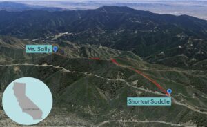
| Objective: Summit Mt. Sally, San Gabriel Mountains, California Distance: 2.2 miles (out and back) Peak Elevation: 5,408′ Elevation Gain: 600′ Difficulty: Moderate |
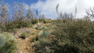
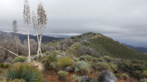
The ridge to Mt. Sally is mild in terms of elevation gain. The trick is dodging and weaving around the Spanish bayonets. Without the overgrown shrubs, the route would be a cakewalk.
Directions to Trailhead
| From the 210 East in La Cañada, drive 18.5 miles on Angeles Crest Highway (CA-2). Park at Shortcut Saddle. There is large parking area on the northern side. |
Directions to Summit
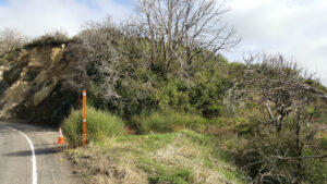
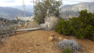
| Trailhead: Cross the road and walk east for 100 yards. The trailhead is on the south side of the highway where it bends a bit. The path heading east to the ridgeline is steep. 0.6 miles: Follow the firebreak along the ridgeline. 0.75 miles: There is a bump along the ridge that is not Mt. Sally. Keep going east. 1.1 miles: After a dip, there is a pile of rocks marking the true summit. You have reached Mt. Sally. Turn around and head back. |
Trek Highlights
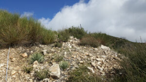
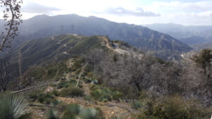
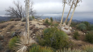
West Ridge Approach: The rocky path shoots straight up and connects with the ridgeline. There is a firebreak along the ridgeline with strategically placed yucca and chapparal that will try their best at preventing you from keeping a straight line. You will reach a bump where you will realize that Mt. Sally is still just a bit away. A couple of dips later, and you are next to a pile of rocks at the summit. From the top, you have a great view of the peaks of the front range of the San Gabriel Mountains.
Red Tape
Display your adventure pass.
Factoids
Stella (Sally) Neuman was a clerk on Forest Supervisor William Mendenhall’s staff. Sally’s name was placed on the map as a joke by one of her admirers.
Photos