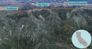
| Objective: Summit Mt. Pinos and Sawmill Mountain, San Emigdio Mountains, California Distance: 7.2 miles (out and back) Peak Elevation: Mt. Pinos: 8,831′, Sawmill Mountain: 8,818′ Elevation Gain: 1,200′ (Mt. Pinos: 600′, Sawmill Mountain: 600′) Difficulty: Moderate |
Hike along a gentle ridge separating Ventura County and Kern County. You will quickly reach the broadcast tower on top of Mt. Pinos. After a stop on the condor lookout, follow the Tumamait Trail to the Chumash monument on Sawmill Mountain. Mt. Pinos is the high point of Ventura County. Sawmill Mountain is the high point of Kern County.
Directions to Trailhead
| From the 5 N past Tejon Pass and Gorman, take the Frazier Park exit. Turn left (west) and drive 7.2 miles to Lake of the Woods (where the Lockwood Valley Road forks left and the Cuddy Valley Road goes straight). Head straight and drive 12.4 miles to the junction with Mount Pinos Road and Mil Potrero Road. Continue straight on Mount Pinos Road. Drive 22.5 miles to a large paved parking area. |
Directions to Summit
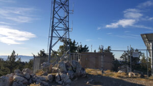
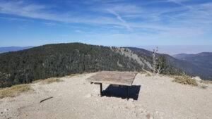
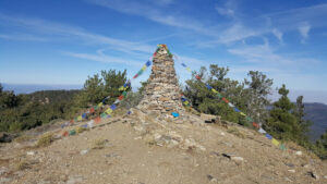
| Trailhead: From the gate, hike along Cuddy Valley Road (9N24) from the parking lot to the summit. 1.6 miles: You have reached Mt. Pinos. There is a register is by a rock pile just southeast of the radio facility. 1.8 miles: This is the condor lookout after the Chumash Wilderness sign. Head west on the Vincent Tumamait Trail (21W03). The trail descends into a saddle between Mt. Pinos and Sawmill Mountain. You will have to climb out of the saddle to reach the summit. 3.4 miles: Leave the main trail and follow the use trail to the right (north) up the ridge. There is a small cairn that marks the spot. 3.6 miles: You have reached Sawmill Mountain. There is a tall spiritual stone monument on the summit containing the register. Turn around and head back. |
Trek Highlights
Do not, I repeat, do not follow the campground trail starting in front of the Mt. Pinos Nordic Base. You should use the trail above and to the left (west) of the station.
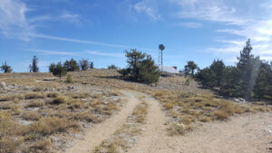
The hike to Mt. Pinos is a cake walk up a gentle, sloping dirt path until you reach the radio tower at the top. Mt. Pinos is known to the Chumash people as Iwihinmu. The Chumash sought balance with the natural world and looked to the single-leaf pinyon pine trees for their delicious and highly nutritious pinyon seeds (pine nuts). To them, the summit was the center of the cosmos, Liyikshup, the point where everything is in equilibrium.
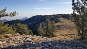
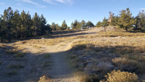
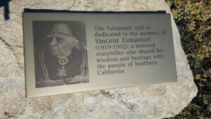
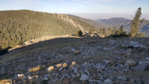
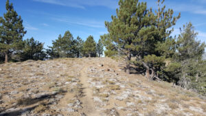
The Vincent Tumamait Trail follows the ridgeline between Mt. Pinos and Sawmill Mountain. Just west of Mt. Pinos, there is a condor lookout, so you might be fortunate enough to spot a California condor in flight. At first, the path is not in a hurry and consists of curves and ambling switchbacks. Then, you drop down the saddle into a wide gully next to boulders and fields of yellow invasive gorse flowers. It is never easy climbing down one mountain just before having to climb up another. The ascent will definitely raise your heart beat a bit before the trail levels off. There is a cairn that marks the spot of a spur trail that heads northwest to the peak. Sawmill Mountain is topped with a self-proclaimed Chumash Spirit Tower with colorful streaming Tibetan prayer flags. We should all learn from this graceful coexistence of diverse spiritual leanings.
Red Tape
Display your adventure pass.
Photos