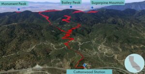
| Objective: Summit Monument Peak #2, Bailey Peak, and Sugarpine Mountain, San Bernardino Mountains, California Distance: 11.4 miles (loop) Peak Elevation: Monument: 5,290′, Bailey: 5,699′, Sugarpine: 5,478′ Elevation Gain: 2,841′ Difficulty: Strenuous |
Why climb one mountain at a time? Score a triple with Monument Peak, Bailey Peak, and Sugarpine Mountain. The peaks on this summit ridge overlook the Inland Empire directly below.
Directions to Trailhead
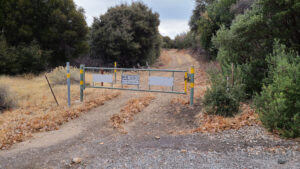
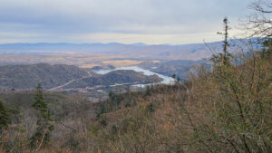
| From the 210 E in Rancho Cucamonga, take exit 64A. Merge onto 15 N and drive 14.8 miles. Take exit 131 and turn right onto CA-138 E. Drive 11.2 miles to Silverwood Lake. Turn right onto 2N45 and park by Cottonwood Station. The trailhead is to the east, opposite the station. |
Directions to Summits
| Trailhead: From Cottonwood Station, pass the gate, and begin hiking on 2N45. 0.8 miles: Turn right onto 2N59. 0.9 miles: Turn left onto 2N45. 2.2 miles: Turn left onto Powerline Road. 3.1 miles: Turn left onto 2N49. 4.0 miles: You have reached Monument Peak. Turn around. 4.9 miles: Keep left to stay on 2N49. 5.5 miles: Leave the road and follow the use trail to the summit. 5.6 miles: You have reached Bailey Peak. Continue following the use trail. 5.9 miles: At the junction, turn left onto 2N49. 6.0 miles: Turn left to return to 2N49. 6.7 miles: At the junction, follow the road to the summit. 6.8 miles: You have reached Sugarpine Mountain. Turn around. 7.0 miles: Turn right to return to 2N49. 7.7 miles: Turn left onto 2N45. 7.7 miles: Turn left onto 2N45. Return to the trailhead. |
Trek Highlights
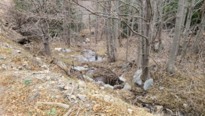
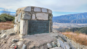
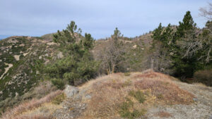
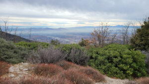
From Cottonwood Station (south of Silverwood Lake), the trail begins with hedge-like bushes on each side. The route is rather rocky, crosses a creek, and climbs several switchbacks. The path gradually rises along a creekside until it reaches the level ridgeline of the summits. Follow the ridge to the southeast. A tiny spur trail climbs slightly up to Monument Peak. At the summit, there is a stone monument to the Mohave Indian Trail. From this peak, there are great views of San Bernardino.
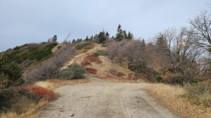
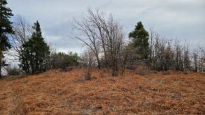
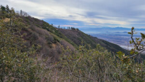
Backtrack along the ridge for a mile and a half, and then leave the road. Climb a steep use trail to tag Bailey. From this summit, all you can see are trees. If you aren’t careful, it is easy to stray from the ridgeline.
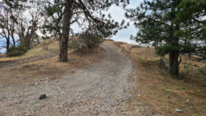
After reconnecting with the ridge road, stroll in a northwest direction. Sugarpine is up a truck road with soft sliding dirt. During the hike, watch for off-road vehicles puttering about the dirt roads in this area.
Red Tape
Display your adventure pass.
Video Tour of Monument, Bailey, and Sugarpine
Photos