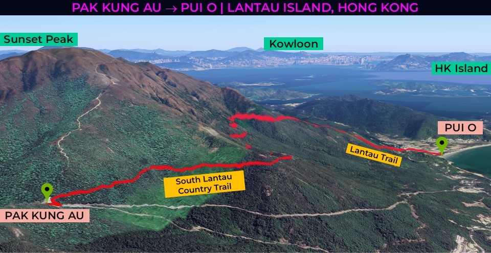
| Location: Pak Kung Au to Pui O, Lantau Island, Hong Kong, China Distance: 3.8 miles (point-to-point) Peak Elevation: 1,272 feet Elevation Gain: 1,414 feet Difficulty: Easy |
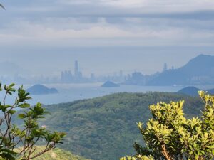
On Lantau Island’s trails, explore a natural oasis just an hour away from the shadows of Hong Kong’s skyscrapers. Pak Kung Au is a pass between Lantau’s two tallest mountains: Lantau Peak and Sunset Peak. The trail is pretty much level as it hugs the southern flanks of Sunset Peak. After a waterfall, it descends through some dense foliage for just over a mile to Pui O Beach. During this hike through Lantau’s remote countryside, enjoy great views of Lantau’s southern coast and HK Island in the distance.
| Directions to Trailhead | Hiking Directions | Southern Flanks of Sunset Peak | Through the Thicket | Pui O Beach |
Directions to Trailhead
| From Hong Kong International Airport, catch the N35 bus. It heads south on Tung Chung Road for about 30 minutes. After about 10 stops, exit the bus at Pak Kung Au. Walk north a couple minutes. The trailhead to the South Lantau Country Trail will be on the eastern side of the road. After the hike, you can either return to the airport or take the ferry from Mui Wo to Central. |
Hiking Directions
| Trailhead: Head southeast on South Lantau Country Trail. 2.06 miles: Waterfall 2.6 miles: At the junction, turn right and descend the use trail. 3.0 miles: At the junction, turn left onto Lantau Trail. 3.4 miles: At the junction, turn right onto South Lantau Road. 3.57 miles: Turn right and head to Pui O Beach. 3.8 miles: You have reached Pui O Beach. |
Southern Flanks of Sunset Peak
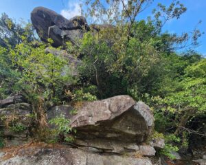
Someone conveniently added a bus stop at Pak Kung Au, the mountain pass crossing between Lantau Peak and Sunset Peak. Follow the signs along the sidewalk to the starting point. There are a couple picnic tables and a restroom. If you are feeling adventurous, you can head up the steep path that climbs to the top of Sunset Peak. The South Lantau Country Trail veers to the right along the southern flanks of Sunset Peak. The trail is well groomed with ample shade from the trees on the sloping side. While the path gently traverses the slope facing the ocean, you encounter little gullies and small bridges.
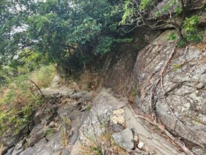
Along the way, there are massive rock slabs overlooking the coast. At one of the gullies, a small creek flows next to a rock outcropping. A little waterfall cascades next to truck-sized boulders and clumps of feathery silver grass and ferns. Murky ponds at the base of the waterfall contain tiny wriggling fish.
Through the Thicket
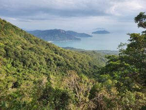
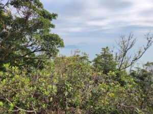
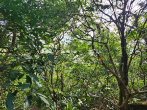
After a few minutes, a use trail leads directly through the dense foliage. The thicket’s green leafy branches almost block the path in certain sections. I’m sure the dark shade feels really good on a sunny day. Round sand dollar-shaped mushrooms cling to twisting tree trunks. Low to the ground are clusters of vibrant violet berries, unnaturally purple in color. From between the bushes, you get glimpses of Hong Kong Island.
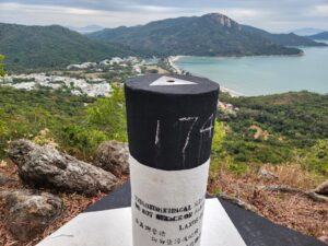
About half the distance to the bottom, there’s a surveyor’s benchmark post. At the top of the pole, a triangle points to the beach.
Pui O Beach
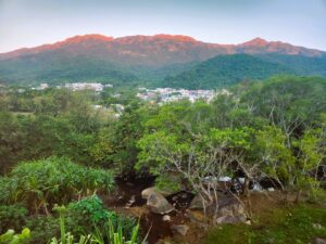
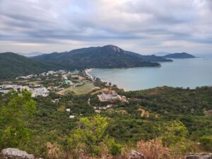
From this point, enjoy clear views of Ham Tin village below and turquoise waters of crescent-shaped Pui O Beach. A few twists here and few twists there, and the path becomes covered in big stones. After 0.5 miles, the trail reaches Lantau Road. Turn south to access Pui O Beach. Take a quick dip in the sea or rest your legs on the sand. You can grab western food at the beachside restaurant. Watch your step as the beach is a popular lounging area for water buffaloes. From the seaside village of Ham Tin, at sunrise you can see the glowing ridges of Sunset Peak.