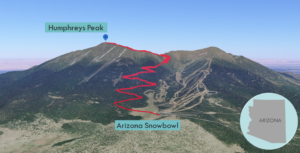
| Objective: Summit Humphreys Peak, San Francisco Peaks, Arizona Distance: 10.5 miles (out and back) Peak Elevation: 12,633′ Elevation Gain: 3,343′ Difficulty: Strenuous Caution: Lightning, altitude |
Humphreys Peak dominates the Flagstaff skyline and at 12,633′ is the high point of Arizona. Humphreys was once part of a giant volcano that blew its stack leaving just a partial caldera of seven jagged peaks (San Francisco Peaks).
Directions to Trailhead
| From Flagstaff, go north on US-180 about 7 miles to the Arizona Snowbowl Road (Forest Road 516). Turn right onto FR-516 and drive 7.4 miles to the Snowbowl lower parking lot. |
Directions to Summit
| Trailhead: The Humphreys Peak trailhead is at the northernmost point of the parking area. 0.89 miles: At the first junction, take the left fork and head northeast on the Humphreys Peak trail via long and steep switchbacks. 4 miles: Once you have reached the saddle, at the second junction (with the Weatherford Trail), take the left fork and head north on the Humphreys Peak trail. 5.25 miles: You have reached the highest point in Arizona. Return to the trailhead. |
Trek Highlights
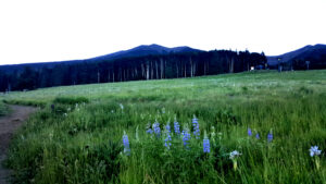
The Humphreys Peak Trail begins in a meadow with tall grass and bluebonnets under the Arizona Snowbowl ski lift and enters a dark forest of fir, pine, and spruce trees. The shady path is covered by a conifer needle carpet, a couple fallen trees, and many roots.
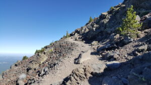
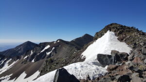
As the steadily rising trail approaches the ridge, it becomes lousy with rocks. The switchbacks are a bit steeper and more frequent. At the breezy saddle between Humphreys Peak and Agassiz Peak, there are some grizzled bristlecone pine trees.
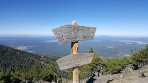
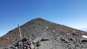
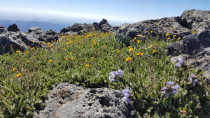
The craggy trail hugs the ridgeline north for a mile to the summit and is studded with little marble and baseball sized scree. Stay off the rare and delicate tundra covering the slopes – yellow and blue alpine tundra (San Francisco Peaks groundsel found only on the ridge). Follow the white wooden trail posts as they will keep you on the most efficient route. There are about three false summits along the ridgeline, with a small patch of big rock slabs. There is snow next to the ridge, but not on the trail or on top. The final push to the peak is covered with light, red, volcanic talus.
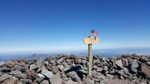
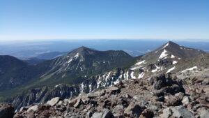
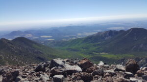
From the top there are 360-degree views of green hills and plains all the way to Nevada, Utah, New Mexico, and Mexico.
Factoids
The Navajo call this caldera Dook’o’oosliid, the summit that never melts. The Hopi used the caldera to calculate winter solstice. (The Hopi call Humphreys ‘Aaloosaktukwi’ after a kachina spirit. The kachinas reside on the San Francisco Peaks.) The Conquistadors tried to name this the Sierra Sinagua, mountains without water. Friars named the peaks after St. Francis of Assisi. Humphreys was named after a survey expedition leader.
Photos