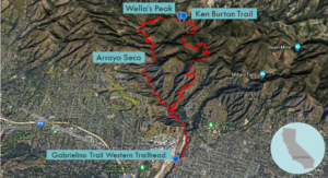
| Objective: Arroyo Seco, San Gabriel Mountains, California Distance: 13.5 miles (loop) Peak Elevation: 2,948′ Elevation Gain: 2,200′ Difficulty: Strenuous |
The trails of Arroyo Seco are located in the foothills along the southern face of the San Gabriels. This makes them easily accessible after work or with little driving. This loop follows the Gabrielino Trail beside the Arroyo Seco and turns to Brown Mountain via the Ken Burton Trail. It then returns through Brown Mountain Road.
Arroyo Seco
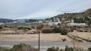
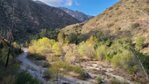
The Arroyo Seco is a “dry stream” with a long journey and equally storied history. The Arroyo’s watershed begins at Red Box Saddle below Mt. Wilson. The industrious waterway flows between La Cañada and Altadena, through Pasadena, beside the Rose Bowl, under the Colorado Street Bridge. Cars on the thrilling Arroyo Seco Parkway zoom by the stream as it passes many neighborhoods. Eventually, it connects with the Los Angeles River just north of Dodger Stadium.
Chief Hahamog-na met the explorer Gaspar de Portola who named the Arroyo. The Tongva were forced to build the San Gabriel Mission and were called Gabrieleños. After the Missions era, the Mexican land grant, Rancho San Pascual, delineated present-day Pasadena on the Arroyo’s edge. Then came the Indiana Colony with settlers from Indiana; the Arroyo serving as a natural divide between LA and Pasadena.
Brown Mountain bears the name of the abolitionist John Brown from his two sons who lived near El Prieto Canyon.
In 1995, mountain bikers built a 2.7-mile trail connecting the Gabrielino Trail with Brown Mountain. Ken Burton was a fire department chief who used to ride horses on this path. The Station Fire shut down the trail for seven years until major renovation work in 2016.
After all that, let’s talk about the actual route.
Directions to Trailhead
| Head north on the CA-2. Merge onto the 210 E and continue for 0.8 miles. Take exit 22B and turn left (north) onto North Arroyo Boulevard. Continue on Windsor Avenue and drive 0.8 miles. Make a sharp left at the parking area for the Gabrielino Trail Western Trailhead. |
Directions to Summit
| Trailhead: Head to the intersection with roads in every direction. Pass the gate marking the entrance to the Gabrielino Trail. 1.2 miles: At the junction, keep left to stay on the Gabrielino Trail. 5.2 miles: At the junction, keep right to stay on the Gabrielino Trail. 5.3 miles: At the junction, make a sharp right onto the Ken Burton Trail. 7.5 miles: At the junction, keep right to stay on the Ken Burton Trail. 8.8 miles: At the junction, turn left onto the Brown Mountain Road. 10.1 miles: At the junction, turn right onto the Fern Truck Trail. 12.9 miles: At the junction, turn left onto the Gabrielino Trail. |
Trek Highlights
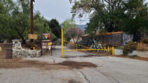
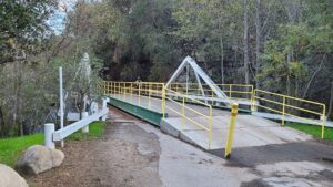
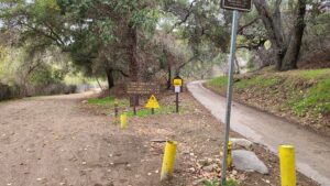
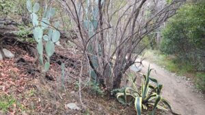
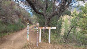
From the Gabrielino Trail Western Trailhead, the Gabrielino Trail is above the Hahamonga Watershed. Off to the west is the Jet Propulsion Laboratory. After JPL, Millard Canyon greets you at the base of the San Gabriel Mountain range. The Gabrielino Trail closely follows the path of the Arroyo Seco. There are a couple wooden bridges and a couple stream crossings. As this route is a loop, keep left on the Gabrielino Trail as it enters lush El Prieto Canyon. After a couple bends, you head past Fern Canyon. About 2.5 miles in, you pass Gould Mesa Trail Camp on the left, followed by Agua Canyon. At this point, there are a lot of hikers, mountain bikers, and a couple horse riders.
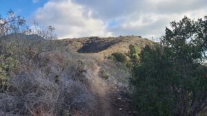
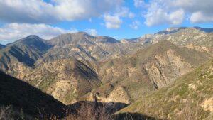
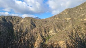
After another 1.5 miles, the path becomes simultaneously rocky and steep at the same time. After this peaklet, the trail loses all the elevation you have just gained and enters a flat rocky wash. The next two miles are tough with a dozen switchbacks and 1,000’ in elevation gain. When you have arrived at the ridge, the Ken Burton Trail connects the Gabrielino Trail with Brown Mountain. There’s a nice bit of singletrack with a steep drop-off on the northern side. Somewhere on the Wella’s Peak ridgeline, you will reach the highpoint of the journey. At the saddle below Wella’s Peak, you can climb to the peak or begin the descent.
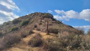
Follow Brown Mountain Road as it keeps snaking to the left and wraps around Pine Canyon and then Fern Canyon. As you get lower, you can see the rooftops of Altadena.
Photos