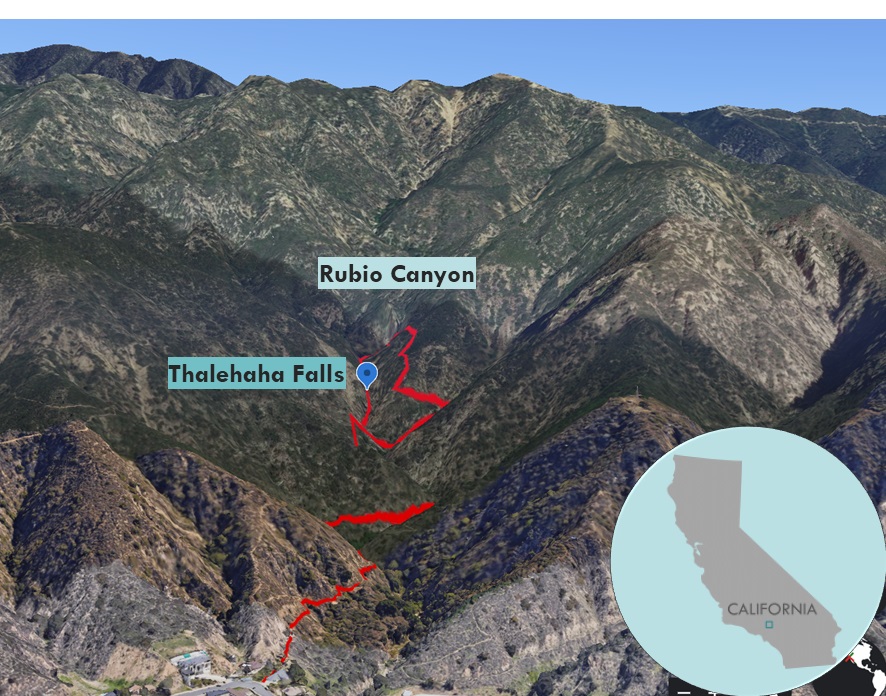
| Objective: Canyoneering Rubio Canyon, San Gabriel Mountains, California, USA Distance: 3 miles (loop) Elevation Gain: 710′ Trip Length: 1/2 day Rating: 3B II |
Canyoneering in Rubio Canyon is a great introduction to the technical climbing skills and swimming necessary for descending canyons. Go earlier in the year, as robust water in Rubio Creek will make this a more traditional canyoneering experience.
| Ascent | Descent | Directions | Plan Your Visit | Red Tape | Gear | Route |
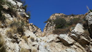
Ascent
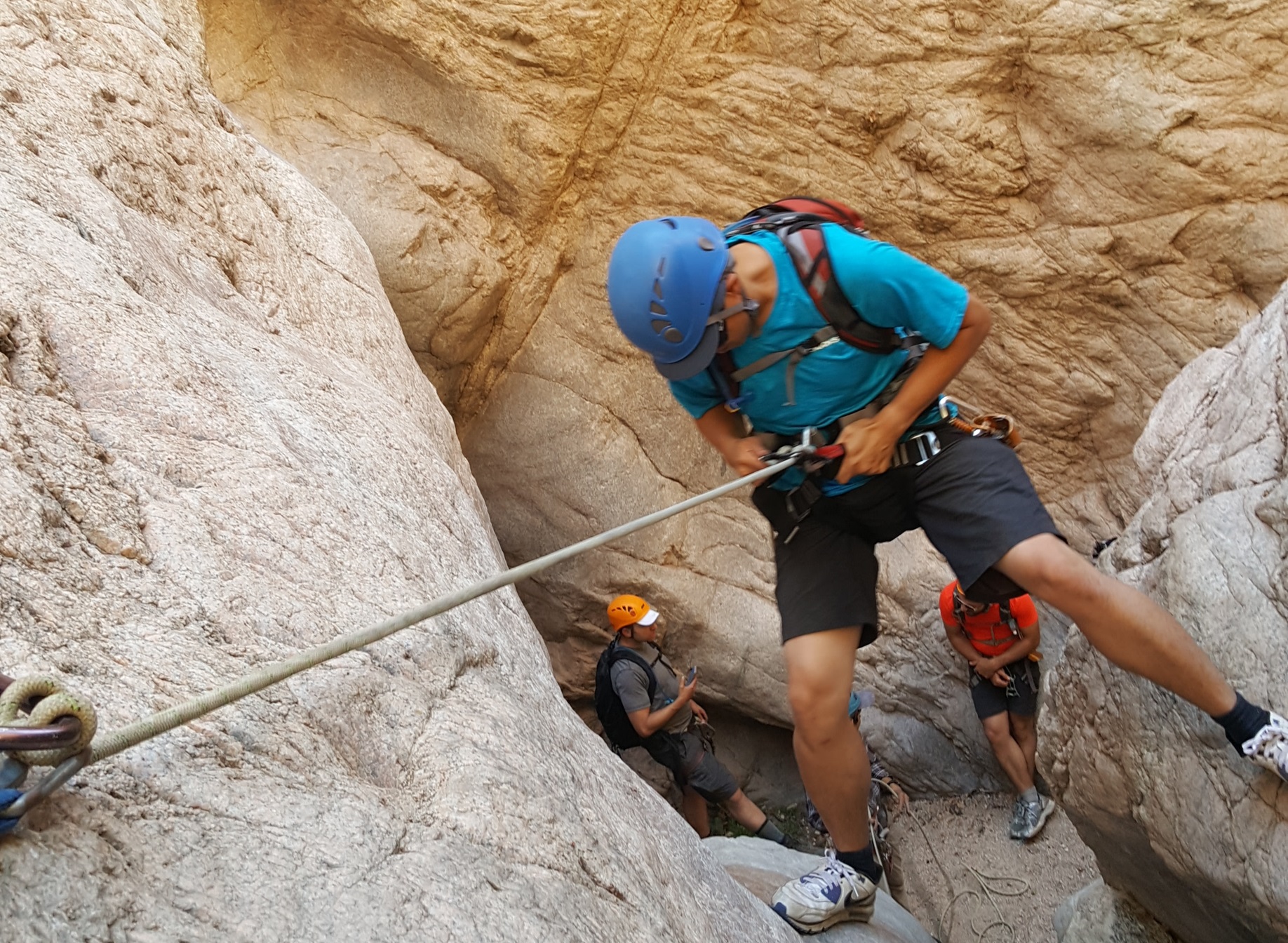
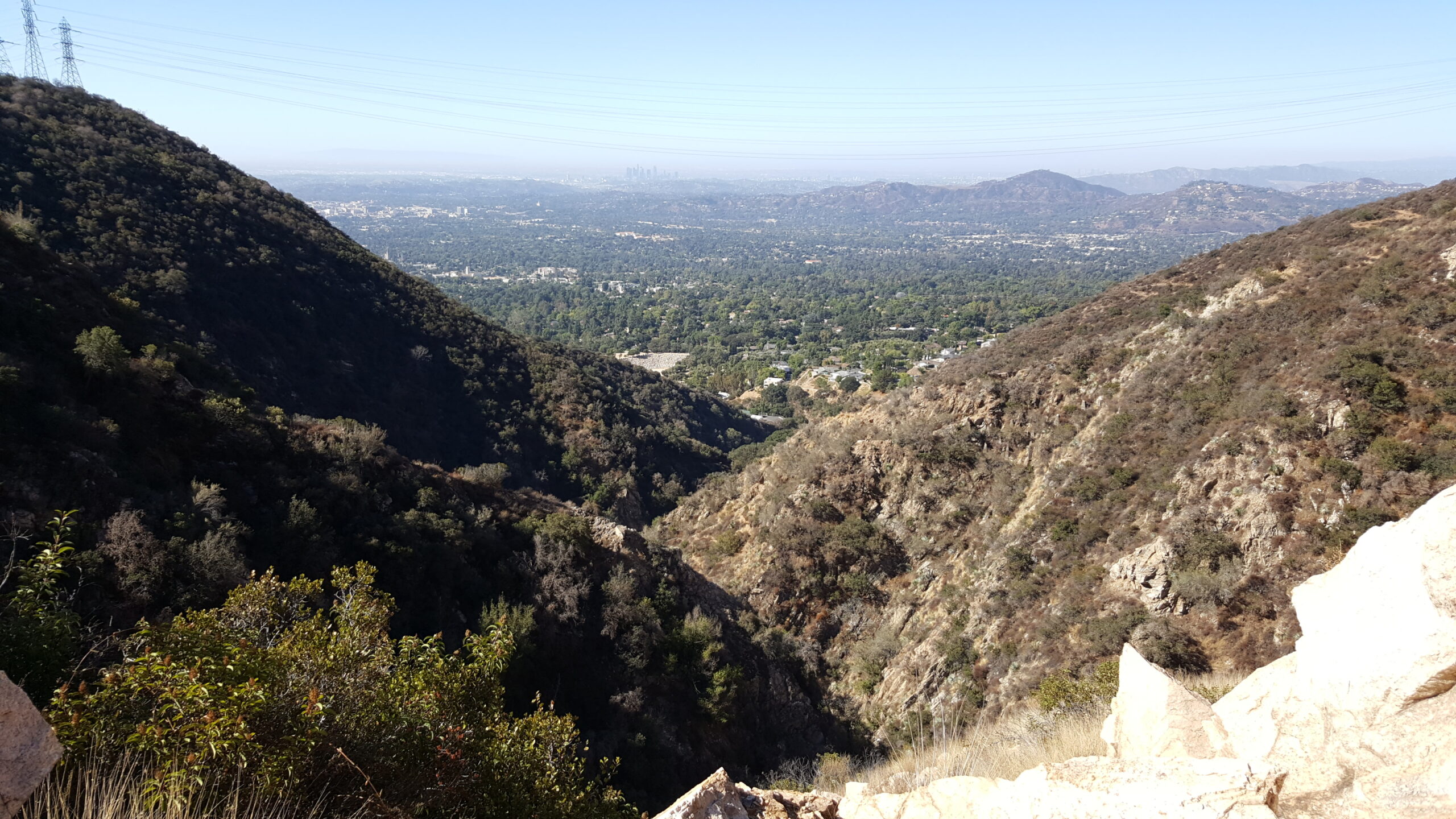
The first half of the approach is a simple hike up the canyon passing rusty pipes from a reservoir. The route soon becomes steep and covered by scree while you are on the lookout for rattlesnakes. From a rocky promontory, you can see Thalehaha Falls in the distance. At this spot, you put on a harness and helmet. After another steep section, you have reached the conclusion of the ascent for the trip. There is a clearing with some bolts marking the entrance for the descent stage.
Descent
The downward traverse through the canyon is a series of eight rappels and short walks linking the drops. Two bolts anchor each drop. The first rappel is down a somewhat unstable, rocky, and dusty 80′ chute that could probably be down climbed. After scrambling past a fallen tree, there’s a perch on a sloping ledge above another rocky and craggy 30′ wall.
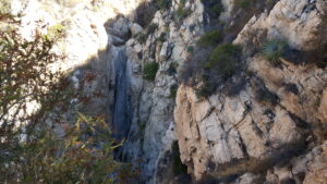
The highlight of the descent is a dramatic rappel down the 100′ sheer face of Thalehaha Falls. The first step off the abrupt cliff’s edge is exhilarating as you climb down the vertical rock of the waterfall. After reaching the bottom, your hands may become black and hot from the rope and the metal descender. Stick to the cool canyon wall to avoid the extreme sunshine.
There is a short 20′ sheer face. Then, you navigate another 20′ climb into a shady slot with slippery rock and odd angles. After a pair of 25′ descents, you make it to the final rappel, a 30′ drop next to the trail.
Directions
| From the 210 E in Pasadena, take the Lake exit and turn left (heading north) onto Lake. After 3 miles, in Altadena, turn right onto Dolores Drive. Make a slight left onto Maiden Lane. Turn right onto Rubio Canyon Road. Turn left onto Rubio Crest Drive. Rubio Crest Drive turns right and becomes Pleasantridge Drive. Park at the corner. The trailhead to the Mt. Lowe Railway Trail begins at the northeast corner of Pleasantridge Drive. |
Route
| R1: 80′, rocky and dusty R2: 30′, rocky and craggy R3: Thalehaha Falls: 100′, water depending on season, bump near bottom, need chest harness and rope brake on second rope R4: 20′ R5: 20′, slippery rock, slot R6: 25′, sun exposure R7: 25′, requires swinging to the left at the bottom R8: Ribbon Rock Falls: 30′ |
Plan Your Visit
Schedule a guided adventure with So Cal Adventures at: https://www.socaladventureco.com/classes/canyoneering-los-angeles-day-trip/
Red Tape
The Arroyos and Foothills Conservancy (AFC) closes the property from sundown to sunup. Real time cameras monitor the area. To enter AFC property at night, send a request to https://arroyosfoothills.org/contact-us/. Provide the date and number of people.
Gear
| Day-pack: Two liters of water (or more in hot weather), sun hat, sunglasses, sunblock, warm hat, warm upper body layer (preferably non-cotton), raingear, gloves, lunch, extra snacks Wear: t-shirt (preferably non-cotton), comfortable pants or shorts (preferably non-cotton), closed toed-shoes that you don’t mind getting wet Provided: helmet, harness, chest harness, rope brake, descender belay device |