
| Distance: 28.5 miles (loop) |
Elevation Gain: -4,780 feet (descent to canyon floor) 4,380 feet (ascent to South Rim) |
|
| Trip Length: 3 days |
Terrain: Canyon, river, waterfall |
Best time to visit: March, April, October |
| Objective: Backpacking to Bottom of Grand Canyon, Arizona, USA |
Caution: Heat, dehydration |
|
Don’t just stand at the edge like everyone else. Grab a pack and hike from the South Rim to the canyon floor of the Grand Canyon. Spend a couple days exploring the Colorado River and then climb out again. Every step you take transports you to another era of the Earth’s vast geological timescale. This mighty river carved a colossal rift, revealing the story of past eons painted as colorful stripes on canyon walls.
| South Rim down to River | Ribbon Falls | River up to South Rim | Plan Your Visit | Directions | Video Tour | Interactive Map | Trek Statistics | FAQ |
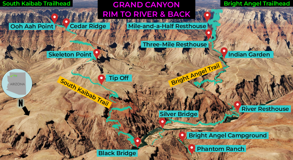
Trail Guide
| ⬇️ South Rim to River (South Kaibab Trail) South Kaibab Trailhead: From the South Rim (7,260′), head north on the South Kaibab Trail and descend steep switchbacks. 1.5 miles: Cedar Ridge (6,120′) 3.0 miles: Skeleton Point (5,220′) 4.4 miles: Tip Off (4,000′) 7.0 miles: Cross the Colorado River using the black suspension bridge, taking you to Bright Angel Campground (2,480’) and Phantom Ranch. |
| ⬆️ River to Ribbon Falls (North Kaibab Trail) Start: From Phantom Ranch (2,480′), head north on the North Kaibab Trail. 6.0 miles: You have reached the waterfall. Turn around and return to Phantom Ranch. |
| ⬆️ River to South Rim (Bright Angel Trail) Start: From Phantom Ranch, head south on the Bright Angel Trail. 1.5 miles: River Resthouse (2,480′) is the last spot next to the river before the trail begins its climb. 4.7 miles: Indian Garden (3,800′) is an oasis in the canyon with cottonwood trees that was used by the Havasupai. 6.4 miles: Three-Mile Resthouse (4,748′) 7.9 miles: Mile-and-a-Half Resthouse (5,729′) 9.5 miles: South Rim (6,860′) |
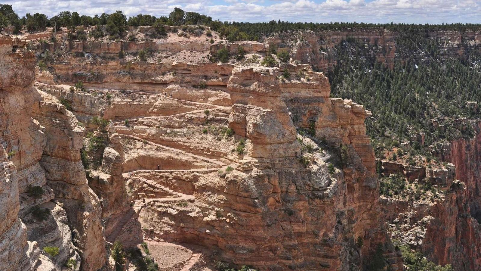
⬇️ Descent from the South Rim to the Colorado River
| Distance: 7 miles (one-way) Elevation Loss: 4,780′ from South Rim to canyon floor |
This is the rim to canyon segment of the trip. In the morning, you will start at the top of the South Rim. Tonight, you will camp at Bright Angel Campground. Prepare your knees!
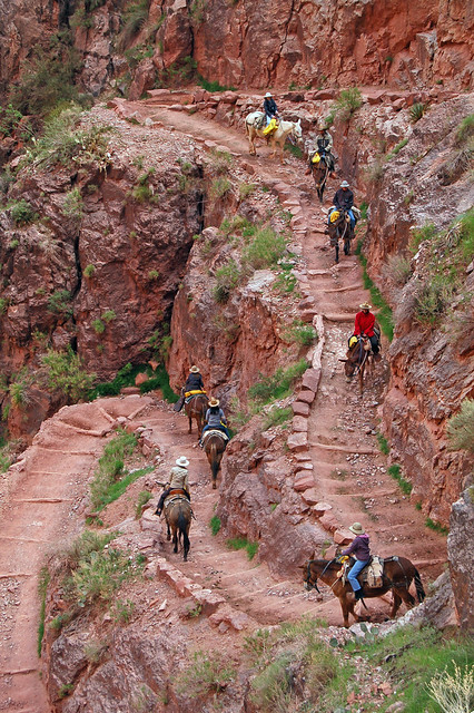
From the Yaki Point trailhead, the South Kaibab Trail descends ridgelines and ravines. The trail has a steep set of tight north facing, knee busting switchbacks, and practically no shade. You descend a west-facing slope to Coconino Sandstone and Ooh Ah Point. From here, the trail shifts to Cedar Ridge, descending on its east and west sides. Watch out for the sure-footed mule trains. They need a wide berth to avoid tumbling over the edge.
From Cedar Ridge, the trail shoots straight below O’Neill Butte all the way to Skeleton Point. The trail walks right off the plank at Skeleton Point and tumbles down steep switchbacks dynamited from the limestone. The erosion is more pronounced the closer you are to the river. The fractured river bank becomes crumblier and filled with jagged crags once you descend below the sandstone of Tonto Platform. The Grand Canyon is a never-ending fractal. The curlicue terrain at the bottom resembles the overall shape of the canyon as seen from the sky.
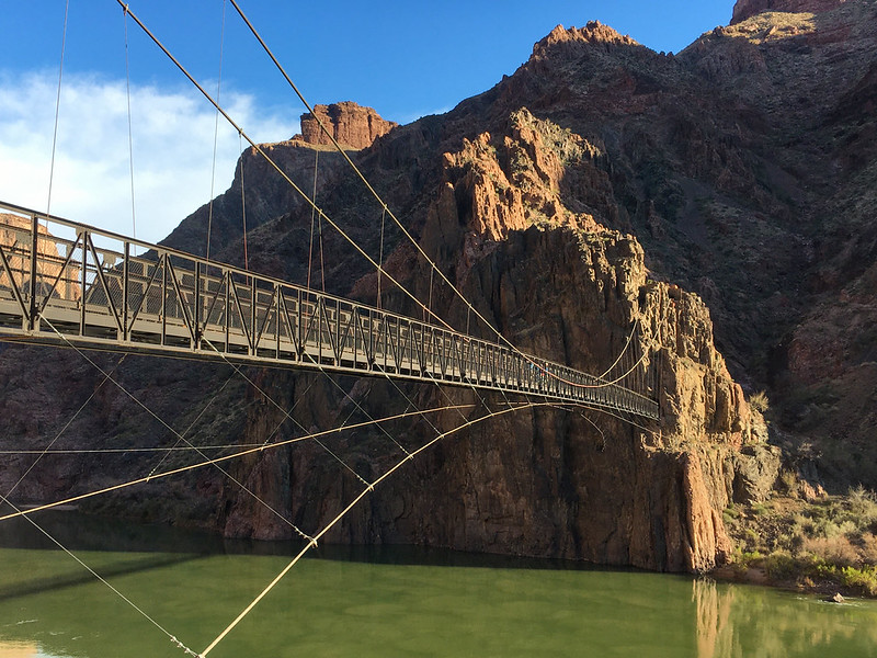
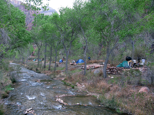
The Vishnu Basement Rocks form the oldest layer along the river’s edge deposited 1.8 million years ago. Above the Colorado River, cross the steel Black Bridge to Bright Angel Campground. Before setting up camp, take a well-deserved break and dip your toes in the icy cold Bright Angel Creek. Phantom Ranch consists of log cabins where you can find snacks.
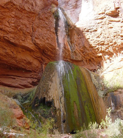
Ribbon Falls
| Distance: 12 miles (round-trip) Elevation Gain : 1,260′ from the canyon floor (2,480′) to Ribbon Falls (3,740′) |
From Phantom Ranch, the North Kaibab Trail follows the Bright Angel Creek into the Inner Gorge. This narrow canyon is essentially an oven during midday. After criss-crossing the creek, you reach a point where you turn toward the waterfall. The path climbs up and down Asinine Hill, and crosses a bridge. Ribbon Falls is located in a grotto on the west side of Bright Angel Creek. Within all this red rock is a sliver of water, which paints a green mossy stripe.
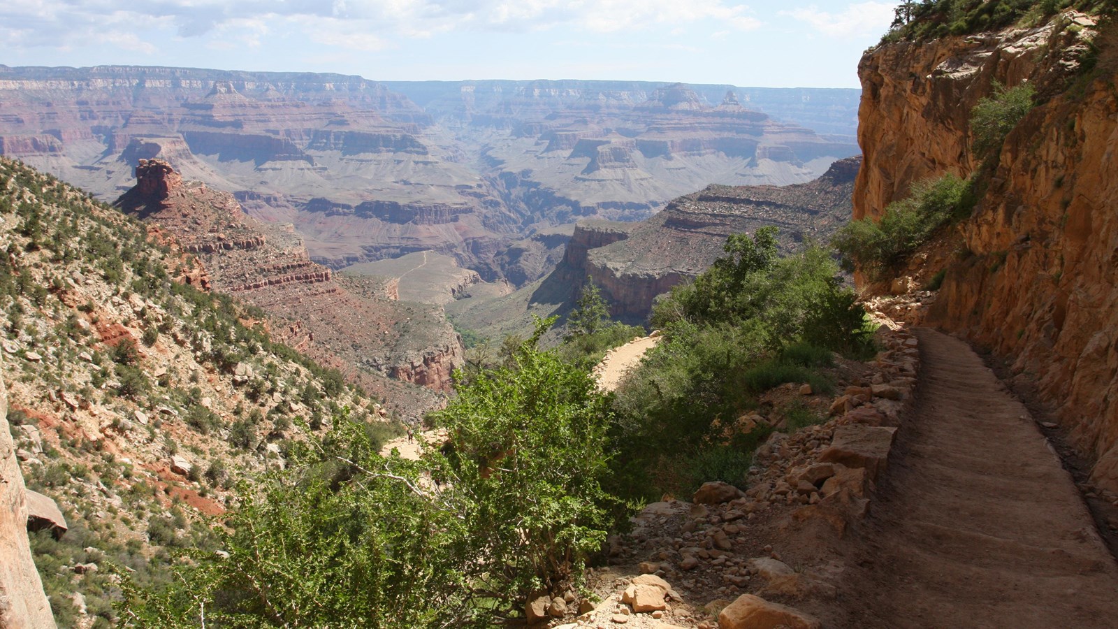
⬆️ Ascent to the South Rim
| Distance: 9.5 miles (one-way) Elevation Gain: 4,380′ from canyon floor (2,480′) to South Rim (6,860′) |
This is the canyon to rim segment of the trip. In the morning, you will start at Bright Angel Campground. Today, you will return the top of the South Rim.
The Bright Angel Trail follows a rift formed by the Bright Angel Fault. From Bright Angel Campground to River Resthouse, the trail passes sand dunes until the Silver Bridge crosses the Colorado. The trail rises at the Devil’s Corkscrew where a gully drains into Pipe Creek. The little crooks in the red walls of the canyon shelter young cottonwood trees providing ample shade and contrasting colors. If you are lucky, you may spot a Bighorn sheep in one of these jagged gully nooks.
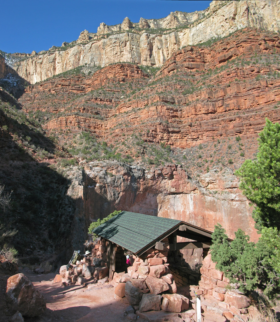
From the oasis of Indian Garden, the real work begins via a stretch of tough switchbacks. The resthouses and water sources are welcome refuges during the steep climb to the top. The trail has massive vermilion walls and orange cliffs providing shade and water for plants and animals. Celebrate atop the South Rim after you have finally emerged from the scorching and infernal depths.
Plan Your Visit
Get a permit for overnight camping. Follow the procedures for submitting a permit request online at: Grand Canyon Backcountry Permit
Directions to Trailhead
| Take the 40 E to Williams and use exit 165 for AZ-64 N. Drive 54.9 miles and turn left at Center Drive. Continue 1.6 miles to Village Loop Drive. Park at the Backcountry Information Center (Lot D), and walk 5 minutes or park at the Visitor Center. Then, take the free shuttle bus (20 minutes). The South Kaibab trailhead is near Yaki Point. |
Video Tour of Grand Canyon Rim to River Hike
INTERACTIVE MAP
TREK STATISTICS
| From | To | Distance |
| South Kaibab Trailhead | Cedar Ridge | 1.5 |
| Cedar Ridge | Skeleton Point | 1.5 |
| Skeleton Point | Tip Off | 1.4 |
| Tip Off | Phantom Ranch | 2.6 |
| Phantom Ranch | Ribbon Falls | 6.0 |
| Ribbon Falls | Phantom Ranch | 6.0 |
| Phantom Ranch | River Resthouse | 1.5 |
| River Resthouse | Indian Garden | 3.2 |
| Indian Garden | Three-Mile Resthouse | 1.7 |
| Three-Mile Resthouse | Mile-and-a-Half Resthouse | 1.5 |
| Mile-and-a-Half Resthouse | Bright Angel Trailhead | 1.6 |
| Total | 28.5 miles | |
FREQUENTLY ASKED QUESTIONS
Difficulty |
| How long does it take to backpack to the bottom of the Grand Canyon and back? This plan takes 3 days to hike from the South Rim to the river and back. The first day is a 7-mile hike down the South Kaibab Trail with an overnight stay at Bright Angel Campground. The second day includes a 12-mile day hike up the North Kaibab Trail to Ribbon Falls and back to camp. On the third day, it is a 9.5-mile climb up Bright Angel Trail back to the south rim. |
How hard is the climb down and out of the canyon?
|
Planning |
| Do you need a permit to day hike in the Grand Canyon? No, you do not need a permit to hike to the bottom of the Grand Canyon and back in a single day. |
| Do you need a permit to camp overnight in the Grand Canyon? Yes, get a permit for overnight camping. Follow the procedures for entering the lottery and submitting a permit request online at: Grand Canyon Backcountry Permit. |
| Is there parking near the trailheads? Use the park shuttle system. There is no parking by South Kaibab trailhead and limited parking by Bright Angel trailhead. |
| Where can you find water? During summer months there is drinking water at Bright Angel Campground, Indian Garden Campground, Three-Mile Resthouse, and Mile-and-a-Half Resthouse. From mid-October to early May, water is only available at Bright Angel Campground and Indian Garden. Bring a form of water treatment, such as iodine tablets or a water filter. |
| When is the best time to hike below the rim in the Grand Canyon? The best time to hike to the bottom of the Grand Canyon is from March to April and October. This is when canyon temperatures are safest and most comfortable. |
More Backpacking Adventures
If you have some extra time while you are in the area, consider backpacking down to Havasu Canyon to explore its magnificent waterfalls.