| Objective: Summit Kilimanjaro, Tanzania, Africa Distance: 56.6 miles/91.1 km (round-trip) Peak Elevation: 19,341’/5,895 m Elevation Gain: 13,305’/4,055 m Trip Length: 6 days Terrain: Rainforest, heath, moorland, alpine desert, arctic, glacier Best time to visit: January to March, June to October Caution: Altitude sickness, snow, and wind |
SUMMIT KILIMANJARO
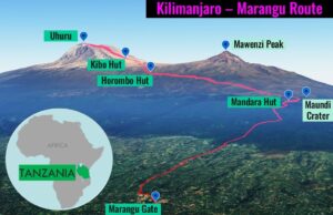
There are seven routes to the roof of Africa, so choose a path that balances time versus elevation gain. The Marangu Route is the fastest way up the mountain, but offers the shortest time to acclimate. Starting at Marangu Gate, Marangu Route climbs the southeastern flank of Kilimanjaro along a hut-to hut path.
After rising from the rainforest, the first night is in an A-frame at Mandara Hut by Maundi Crater. The second day transitions from heath to moorland, with bunks at Horombo Hut above the clouds. This route has the lowest success rate because it has the shortest acclimatization window of the seven routes. This is why the third day is an acclimatization layover at Horombo. On the fourth day, you cross the alpine desert west of Mawenzi Peak, and reach the lodge of Kibo Hut. With an alpine start at midnight of Day 5, you hike the steep slope to Kibo Peak. With the crater rim in sight, this is the last climb to the top of Uhuru. After the summit, descend from the arctic conditions to spend the night at Horombo. The final day descends and retraces the way back to Marangu Gate.
Day 1: Marangu to Mandara | Day 2: Mandara to Horombo | Day 3: Horombo | Day 4: Horombo to Kibo | Day 5: Kibo to Uhuru to Horombo | Day 6: Horombo to Marangu | Plan Your Visit | Video Tour
MARANGU GATE TO MANDARA HUT (DAY 1)
| Distance: 5 miles/8 km: Marangu Gate (6,036’/1,840 m) to Mandara Hut (8,907’/2,715 m) Elevation Gain: 2,871’/875 m |
Our day begins in the idyllic setting of Honey Badger Lodge, with its pool and gray monkeys. We have a fortifying breakfast of toast, chapati (crepe-style pancakes), sausage, eggs, juice, and coffee. We leave some luggage and take our packs and duffel bags for the porters.
The van takes us all past villages, banana fields, and coffee farms to Marangu Gate, about an hour away. Here we sign in, and place our lunches and water in our packs. The excitement to start the trek has been building for many months, and for some of us, possibly many years.
Our head guide’s name is Hebron and he has an interesting manner of communicating. He always starts to say something important and then pauses for dramatic effect. We are eager to begin the journey.
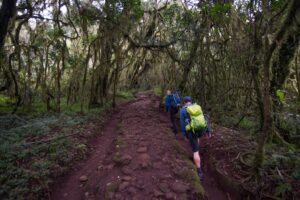
Tropical Rainforest
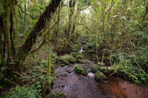
The towering juniper and camphor trees block the sun and form a dense canopy above, alternately scattering sunbeams and shade. Parasitic vegetation such as figs and orchids intertwine their vines around any available trunk or branch. Green and silver mosses provide a blanket by muddy streams and miniature cascades. Abundant moss even tops the rocks. Hanging vines seem to invite you to swing like Tarzan.
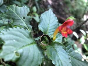
Hidden below the green wall of massive fern fronds, are the occasional little red begonias and tiny yellow mimulus. There are African fireball lilies (scadoxus multiflorus), purple violas (viola eminii), and red and yellow pointy-shoe-shaped Kilimanjaro impatiens (impatiens kilimanjari). On each side is a thick entanglement of emerald vegetation. The murky underwood is so impenetrable. It makes you appreciate how well-groomed the trail is and how much effort must have gone into building it.
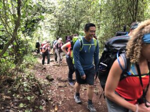
Po-le, Po-le
Immediately after crossing the Marangu Gate, the guides instruct us to hike po-le, po-le, which is Swahili for slowly, slowly. This will conserve energy for the summit attempt. The pace keeps the group together and offers a clear view of the boots in front. It also lets you focus on the tropical rainforest surroundings.
We also need to drink three liters of water per day to prevent altitude sickness. So, the group invents the companion phrase to po-le, po-le, which is sippy, sippy.
Our Group
Another benefit of the gentle pace is the opportunity to get to know the group better. As one hiker gains or loses steam, we each reflect on our mutual love of travel and adventure. There are 13 of us in the group.
Brian and Jack are police officers from Buffalo and they are my bunkmates. Bill is the head concierge of the San Francisco Intercontinental and he is the nicest person you will ever meet and is not afraid to just goofily dance and entertain us all. That is why the guides call him Baba (Daddy). Kate is the head of marketing at OneSeed and has experience climbing Mt. Meru and some Colorado 14ers. Courtney is a photographer with theClymb.com. There is a pair of couples, Sean and Nicky, and Caffrey and Julie, and their friend Dan. Caffrey and Julie have sold everything so that they can travel for a year. JuJu just spent some time in Israel before the trip. Stacey has trained in an altitude chamber.
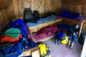
Mandara Hut
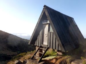
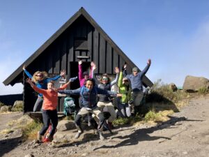
After a couple more hours of comfortable hiking, we arrive at Mandara Hut. We give each other high fives and sign in. Mandara Hut is a camp of A-frame wood cabins along a rather flat and open clearing.
Maundi Crater
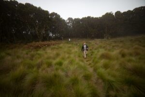
We take a half mile acclimatization hike to Maundi Crater. We walk halfway around the rim and then descend quickly into the small indentation. The tall grasses are soft and feathery, and people lie down smack dab in the middle of it. In the crater, we watch a cloud roll in and drift away. On the way back, an angry, plump tree hyrax screeches at us in the dusky moonlight.
We receive tubs of warm water for cleaning up. At teatime, as we munch on popcorn, there is a choice of coffee, hot chocolate, tea, and ginger tea. Dinner follows soon after, and it consists of a meaty soup and some starchy pasta dish. After dinner, Hebron briefs us on tomorrow’s plan. Then, we have to perform our first daily medical exam. We place our finger into the oximeter to read our oxygen level and resting pulse rate. Now, we are free to sleep.
MANDARA HUT TO HOROMBO HUT (DAY 2)
| Distance: 7.2 miles/11.6 km: Mandara Hut (8,907’/2,715 m) to Horombo Hut (12,155’/3,705 m) Elevation Gain: 3,248’/990 m |
Early Start
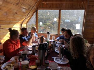
Before sunrise, there is a lively knock at the door of the hut. I check my watch and it is 6:15 a.m. Someone asks us if we want ginger tea or coffee. There are four feeble replies of “ginger tea.” We open the door, find two thermos bottles on the top step, and pour four mugs of ginger tea. At 6:30, we go about our morning business using washbasins.
The mess hall is at the bottom of the camp. We have plenty to eat, a full plate with porridge, honey, chapati, toast, and eggs. After filling our Nalgene bottles and hydration bladders with iodine-treated water, we are on the march again.
Heath and Moorland
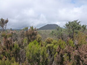
We take the trail leading away from Mandara and follow the right fork that skirts the rim of Maundi Crater. The trees and vines soon give way to the waist-high shrubs and heather bushes of the heath and moorland. Candy corn-colored, red-hot pokers (kniphofia thomsonii) and mountain thistles (carduus keniensis) are in a clump below thin strands of moss.
Far off in the distance, we spot a small wooden structure at the top of a rising slope. We find a table, drink ginger tea, and eat butternut squash soup and spaghetti with curry vegetable sauce. An intimidating pair of white-necked ravens boldly circles directly over our tables and lands a few feet away. They are black, big as cats, with crooked beaks resembling garden shears, and a white patch on their necks.
The remainder of the hike revolves around watering the plants due to the remarkable amounts of water we’ve been drinking. We learn that if you need to go, just tell someone you are searching for a “WiFi” signal.
Seussian Landscape
The reduction of moisture and nightly frost in the moorland has resulted in a surreal, Seussian landscape of bizarre plants. They are great at conserving water and defending against chill. The enormous lobelia (lobelia deckenii) looks like a cross between a giant pinecone and a pineapple above clumps of grass.
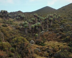
Most spectacular of all are the giant groundsel trees (dendrosenecio kilimanjari). The giant groundsels protect their core warmth with trunks topped by candlestick branches wrapped with withered leaves. They resemble bushy brown beards blooming in a crown of green elephant ears sprouting in every direction.
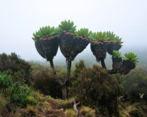
When we arrive at Horombo, our A-frame hut overlooks a little creek bordered by giant groundsel groves. After the routine of washing up, tea, and a large carbohydrate-rich meal, we watch clouds roll by way below us. The setting sun peeks out, and Moshi too, while shades of pink, blue, and yellow dance above the horizon.
HOROMBO HUT: “ACCLIMITIZATION DAY” (DAY 3)
Stroll to Zebra Rocks
Today is going to be nice and easy layover. We get to sleep in one extra hour since we are only doing an acclimatization day hike. We head up an access road and start noticing piles of rocks. While normally used for navigation, each stacked rock represents someone’s wish. We stop at a small hill and each of us adds to the mounds of dreams.
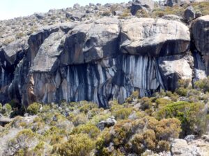
After a short climb, we reach Zebra Rocks, at 13,188’. The Zebra Rocks are true to their name, with large vertical black and white stripes.
For lunch, we enjoy the best starch bomb of the trip, the infamous egg chop. This is a hard-boiled egg with a generous layer of mashed potatoes. The hulking fried snowball is then coated with curry vegetable sauce.
The Old Song and Dance
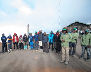
By the Horombo Hut sign, we get to know all the guides, cooks, and porters. This amazing team has formed a half circle and the hikers have completed the circle on the other side. Soon, someone spits some freestyle lyrics, and then everyone is singing and dancing. Each guide walks into the center of the circle, and then each hiker joins the circle. What a wonderful welcome to Kili!
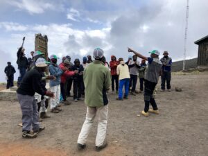
As the day gets chilly around Horombo, the group spends time talking and stealing glimpses of the clouds. The sunbeams seem to tickle the snow atop Kibo, perhaps at the very spot of the legendary frozen leopard.
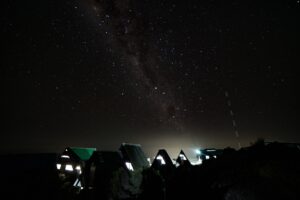
Once the Sun begins its well-deserved slumber, the teeming stars start to twinkle. And the majestic, swirling Milky Way finally reveals its mysteries.
HOROMBO HUT TO KIBO HUT (DAY 4)
| Distance: 6 miles/9.7 km: Horombo Hut (12,155’/3,705 m) to Kibo Hut (15,518’/4,730 m) Elevation Gain: 3,363’/1,025 m |
After another early wake-up, we put on our wind jackets. Today’s hike will take me above my previous high of 14,000’. At this point, I have completely deferred to the excellent wisdom of the guides. When they tell me to hike slowly, I hike slowly. When they tell me to drink so much water that I have to urinate every hour, I drink water. When they tell me to eat as much as possible because I may lose my appetite later, I keep eating. So far so good, I have not experienced any headaches as a couple of others have. A couple others and I have not taken Diamox. (By the way, you should just take the Diamox, since it is too late once you feel symptoms.) It’s all about avoiding altitude sickness before summit day.
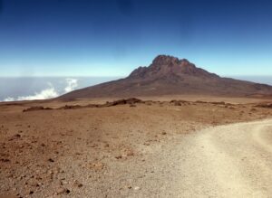
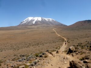
Out in the alpine desert, it’s mainly rocks and dirt. The only floras here are lichen and the hardy everlasting flower (helichrysum newii). In addition, the trail is straight and you can see ahead for miles even though our pace moves so slowly. Along the side of the trail, other hikers have left messages using the stones.
JuJu leads us through various games to kill time, and this is a really nice bonding moment with the group. On the way, we pass a stretcher on wheels being rolled down the trail by a handful of guides. The patient is in a sleeping bag and strapped to the stretcher.
Saddle Plateau
At 14,400’, we pass a sign marking the Saddle Plateau between Kibo Peak and Mawenzi Peak. Kibo is the largest of the three volcanic cones (Kibo, Mawenzi, and Shira), and is more than 15 miles wide. Here, the trail seems to go on for miles in a straight line. Looking back, you can see the jagged edges of Mawenzi Peak, and in front is snowy Kibo Peak.
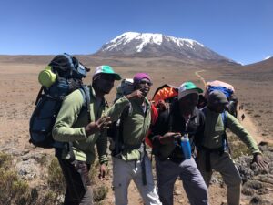
At lunch, we sit by a rocky outcropping and chomp on a honey donut, chicken, chocolate bar, and juice box. We are also on the lookout for aggressive grass mice.
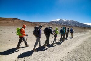
Kibo Hut
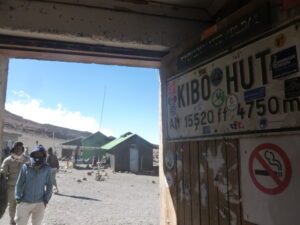
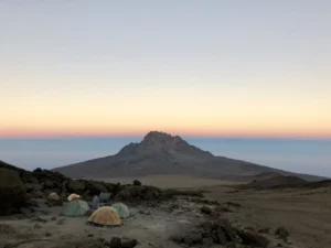
For the longest time, we can see Kibo Hut above us. After searching for “WiFi” in the open field, we keep closing in on our target, slow and steady. Eventually, we cruise into the Kibo campground. Our entire group ends up bunking together in the same room. There are no more individual huts. This is a long lodge with a narrow hallway and large rooms on each side. Outside, there are yellow and green tents.
At this elevation, a little exertion can take your breath away. As usual, after dinner, Hebron briefs us on tomorrow’s plan. On a daily basis, I place my finger into an oximeter that reads my oxygen level and resting pulse rate. I have decided not to take any diamox, and so far so good. Some members of the group are experiencing serious headaches. One member will not be summiting with us tomorrow. At Kibo Hut, our remaining group of 12 ends up bunking together in the same room in a long lodge.
Last Bits of Advice
Teatime is early and sparse today as some try to get a little rest. Courtney, Sean, and I aren’t napping before dinner, so we eat all the popcorn. Dinner is on a bench in our room, and we eat meaty potato soup with chapati and grilled pineapple. Kibo is rather cold, and we are eager to get some sleep before the big ascent.
Hebron tells us that someone has headed back down the mountain. He gives us a rather frank speech about how headaches and difficulty breathing are normal. Not all of us might make it. The guides evaluate the symptoms of altitude sickness, and have the authority to send us down. There also won’t be too many stops and we can’t ask them how much farther the summit is.
After the discussion, we have less than four hours to try to sleep. Due to the early final ascent, it is lights-out at 6 p.m. We are all nervous about tomorrow’s summit attempt.
KIBO HUT UP TO UHURU DOWN TO HOROMBO HUT (DAY 5)
| Distance: 3.35 miles/5.4 km: Kibo Hut (15,518’/4,730 m) to Uhuru (19,341’/5,895 m) Elevation Gain: 3,823’/1,165 m: Kibo Hut to Uhuru Distance: 9.35 miles/14.5 km: Uhuru (19,341’/5,895 m) to Horombo Hut (12,155’/3,705 m) Elevation Gain: -7,186’/2,190 m: Uhuru to Horombo Hut |
Alpine Start
Our team is awake after a frosty few hours of tossing and turning, just before midnight. After munching on a chapati pancake and downing ginger tea, I pack my rain jacket and heavy gloves. My water bottle must be upside down to prevent freezing. I leave the water bladder since you have to blow back on the valve to prevent the line from freezing. We pile on all our layers and prepare for the frigid conditions outside. After suiting up, I am wearing five layers of tops (thermal shirt, hiking shirt, mid-layer shirt, fleece jacket, wind jacket, down jacket), four layers of pants (thermal pants, hiking pants, fleece pants, rain pants), gloves, buff, beanie, gaiters, socks, and boots.
We begin climbing the cold and windy trail rising up from Kibo Hut at 12:30 a.m. Our headlamps light up the dark path up the steep slopes. We form a single-file line and our light illuminates each step we take. This reminds me of Snow White, where the Seven Dwarfs go to work in the dark singing “Hi Ho.” As the trail begins climbing up Kibo’s steep switchbacks, the guides begin serenading us beneath the stars and the moon. Their chants include the following song:
Jambo, Jambo bwana
Habari gani? Mzuri sana
Wageni, Wakaribishwa
Kilimanjaro Hakuna Matata
Digging Deep
When the trail really steepens, they no longer have to tell us to go po-le, po-le. Our call back chants of “No Retreat…No Surrender” are getting slightly fainter.
After the first couple breaks, the water is already forming icy sheets. The team seems fine, and someone tells me that I am a machine. The summit guides have been walking next to us to check if we are still OK.
At about 17,000’, some of us begin to fade. The trail has hit a sharp angle with a soft and sandy composition. The slippery, scree slope makes it easy for your boots to slide a bit, so you need to dig in.
Along this stretch, my head begins to hurt faintly. I also feel a little light headed and sleepy as I encounter the thin oxygen. This is when I draw the deepest, longest, and loudest breaths. I forcibly pump air into my lungs as if they are bellows. I feel as if I have refueled my internal engine. Heat and consciousness return to my body. I feel like a furnace, with every breath like a shovel of coal, each inhalation brings power to my limbs. I am supercharged now. I am definitely a machine.
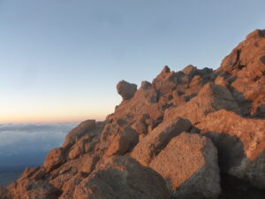
The sun is rising. A blue and orange glow illuminates the clouds below the horizon. The jagged mountain slope is bathed in a gentle orange glow as we switch our headlamps off.
Almost There
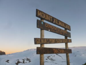
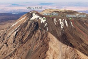
We have almost reached the summit block, but the path is rocky, irregular, and wavering. We navigate boulders, and climb straight up for at least an hour. Eventually, we see a sign declaring that we have reached Gilman’s Point at 18,638’ along the crater rim. One of the guides says that we are close, it’s “easy peasy, lemon squeezy.” We high five and hug each other as we realize what we have accomplished. We even jump in front of the sign. Soon after, another hiker starts shaking and has to descend with a guide.
To the right are slopes of smooth white snow leading into the center of the caldera. To the left is a wall of jagged brown rock. The trail follows the crater rim wall and dips up and down a bit. Then, the path rises up a slippery blanket of snow and ice. When we reach the next sign, this is only the second bump at Stella Point. Another hiker decides to return down with a guide.
Final Ascent
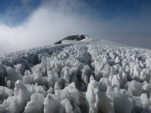
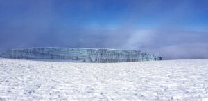
This is the final push to the summit. Uhuru is a steep ascent up a long, snow-covered slope. Across the frost, we see the long rectangular flattop of Rebmann Glacier far off in the distance to the left. Brian, Bill, and I follow Hebron up a treacherous snow bank, but are somewhat slowed by another struggling climbing party. We climb around the other group, and then we immediately feel the powerful blast of a blizzard. Sixty-mile gusts hit us from the right in violent waves.
As we navigate the tops of precarious icy fins, the wind smacks our faces with bits of ice and grit. Every time you take a step, the wind blows your leg off course. So, you either fight the wind to land the step or just let go. There are some stumbles, and some fall into the icy gullies between the fins from which they must climb. About 10-20 feet to the right is practically a void, a sheer vertical drop to unseen depths within the caldera. It is good the wind is blowing inward in the opposite direction. It is unnerving to fight back wind that can literally toss you around.
We Made It!
There are no whoops of joy or upraised arms of victory. The mountain has clearly triumphed. I pass my camera to Hebron to take a photo of our group. The temperature must be just below freezing, and with the wind chill, it feels lower. After changing my light gloves to heavy gloves, my fingers feel numb from just a few seconds of exposure. Any exposed hair, eyelashes, and beards quickly become frozen white. It’s too dangerous to keep taking photos, so we quickly leave the summit area.
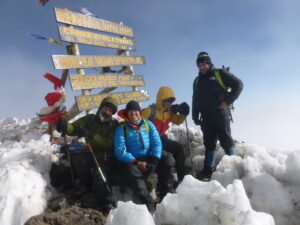
Now We Need to Leave in a Hurry
After a short stop at the summit, the conditions atop Kilimanjaro are severe and freezing. After a slow slog, still without decent oxygen, we make it off the heavy snow and ice to Stella Point. The entire group looks miserable, doubled-over on their poles, or sitting. We push along the wall until we reach Gilman’s Point, where we each take weary, heaving breaths.
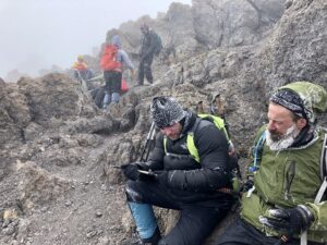
Once we see Kibo Hut, I walk down with Hebron. He explains how he grew up in southern Tanzania, moved around to study wildlife, and ended up as a guide. Hebron mentions a school in Uganda where he would like to pursue his interests in wildlife and guiding. I remark that his ability to take care of people would suit him well in that direction. At Kibo Hut, we are all ready for a quick rest and small lunch.
It’s All Downhill from Here
From Kibo Hut, it is another six miles down to Horombo Hut for the night. At 15,518’, Kibo Hut can still contribute to altitude sickness, which is why we aren’t sleeping there tonight.
We pass the otherworldly jagged spires of Mawenzi Peak and think about the effort required to climb that monstrosity. Po-le, po-le is now over, since haraka (Swahili for fast) is now your friend when descending from altitude. Back at Horombo Hut, I nap, nibble, and sleep soundly through the night for the first time on the trip.
It is such a relief to leave the exhausting and dangerous conditions of the peak.
HOROMBO HUT TO MARANGU GATE (DAY 6)
| Distance: 12.2 miles/19.6 km: Horombo Hut (12,155’/3,705 m) to Marangu Gate (6,036’/1,840 m) Elevation Gain: -6,119’/1,865 m |
After breakfast, the guides, cooks, and porters have assembled again for a last farewell. They have taken great care of us. My pack only contained water, snacks, warm layers, and a camera. We each had our own porter who carried a duffel bag up to 10 kg (my bag was 8 kg). They hauled our food and water and other group supplies and made sure we have been well fed and healthy. They have been singing to us up and down Kili. Last night, we pooled all of our tips together into labeled envelopes, and Kate handed them out. It is a pleasant celebration with singing and dancing, and we express our deepest gratitude. I can’t thank them enough for making this all possible.
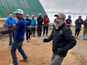
Back to Marangu Gate
So, this is our last day on Kili. We have a lot of hiking on the long road home, a little over 12 miles.
From Horombo Hut, the temperature is comfortable, the air is thick as molasses, and we are all well rested. As a result, we fly through the downhill path. In a couple hours, we reach Mandara Hut.
At Mandara Hut, we spot another tree hyrax and an assortment of birds hiding in the foliage. We have our last trail meal of spaghetti and a mound of potatoes. After another swift effort, we arrive at Marangu Gate.
Road to Moshi
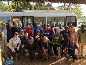
On the way back to Moshi, we stop at a roadside shop and obtain a couple cases of banana beer. Everyone (hikers and guides) in the bus revels in the amazing and memorable experiences on Kili.
We have one last festive dinner at Honey Badger Lodge as most of the group will be heading on safari. We all have been very lucky to be part of a remarkable group with so many good natured, adventurous spirits.
PLAN YOUR VISIT – SUMMIT KILIMANJARO
| Transportation: Catch a flight to Arusha, Tanzania. Drive to Moshi. Take a bus to Marangu. Hike to summit Kilimanjaro. Porters and Gear: Porters can carry up to 10 kg/22 lbs. Lodging: A-frame huts have bunk beds for four to six people. Food: Breakfast may have crepes, toast, and eggs. Lunch and dinner provide carbohydrates (pasta and rice) and proteins (chicken, beef, fish). |
VIDEO TOUR – SUMMIT KILIMANJARO
KEEP EXPLORING!
If you are great at planning, see if you can go on a safari either before or after climbing Kilimanjaro. Or, if you are like me, just visit Tanzania two separate times!