| Objective: Summit Telescope Peak, Panamint Range, California Distance: 15.4 miles (out and back) Peak Elevation: 11,049′ Elevation Gain: 4,249′ Difficulty: Strenuous |
Telescope Peak is named for the great distances that can be seen from its summit. It is an ultra-prominent mountain overlooking Badwater Basin, which is the lowest point in the US.
Directions to Trailhead
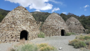
| From CA-14 N, take the CA-178 E near Inyokern. Drive 12.2 miles through Ridgecrest and turn right at N China Lake Blvd. After 2 miles, turn left at the CA-178 E. Continue on Trona Rd, pass through Trona, and descend into Panamint Valley. Turn right at Wildrose Rd, and drive up the dirt road to the Charcoal Kilns. If your vehicle has 4WD, continue on the dirt road for 1.5 miles to Mahogany Flat campground (to shorten your hike by 3.2 miles), otherwise park at Charcoal Kilns. |
Directions to Summit
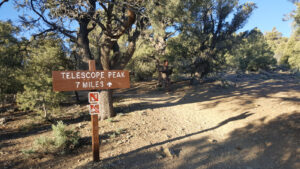
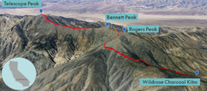
| Parking: Start at the Charcoal Kilns (6,800′). 1.6 miles: Trailhead: The trailhead begins at the entrance to the Mahogany Flat campground (8,133′). 3.7 miles: The trail climbs to a saddle below Rogers Peak to the northeast. 5.4 miles: The trail passes Bennett Peak to the east. 6.7 miles: The trail makes its final ascent up 14 switchbacks. 7.7 miles: You have reached Telescope Peak. Turn around and head back. |
Trek Highlights
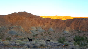
The road up to the Panamint Range passes scattered burro herds and swift jackrabbits. I slept in my truck the night before at Charcoal Kilns to get an alpine start and hopefully acclimate a bit. As the mountain alpenglow faded to black, I kept imagining that dreaded Morlocks would leap out of the kilns and attack under the full moon.
The hike has three stages: a tough initial climb, a level meadow walk, and finally the summit push.
Tough Initial Climb
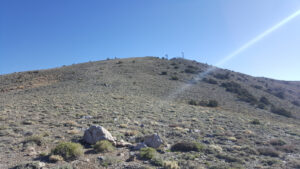
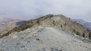
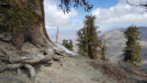
From Charcoal Kilns, it is a steep climb up a rugged 4WD road. The official trailhead begins at Mahogany Flat campground with nice shade from single-leaf pinyon, mahogany, juniper, and limber pine trees. Above the tree line, it is a straight beeline for the saddle next to Rogers Peak. The grade is steep, but it rises at a steady and manageable rate. You should expect to put in some work early on during this hike. Once you spot the saddle, it is somewhat of a slippery slope, as the trail is a bit narrow and exposed as it drops off the side, which requires your constant concentration. Nothing feels better than reaching the first plateau (and its big cairn). From this windy saddle, you can look up to the communications tower on Rogers Peak.
A Walk in the Meadows
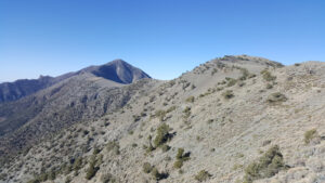
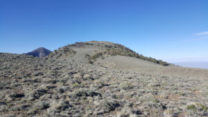
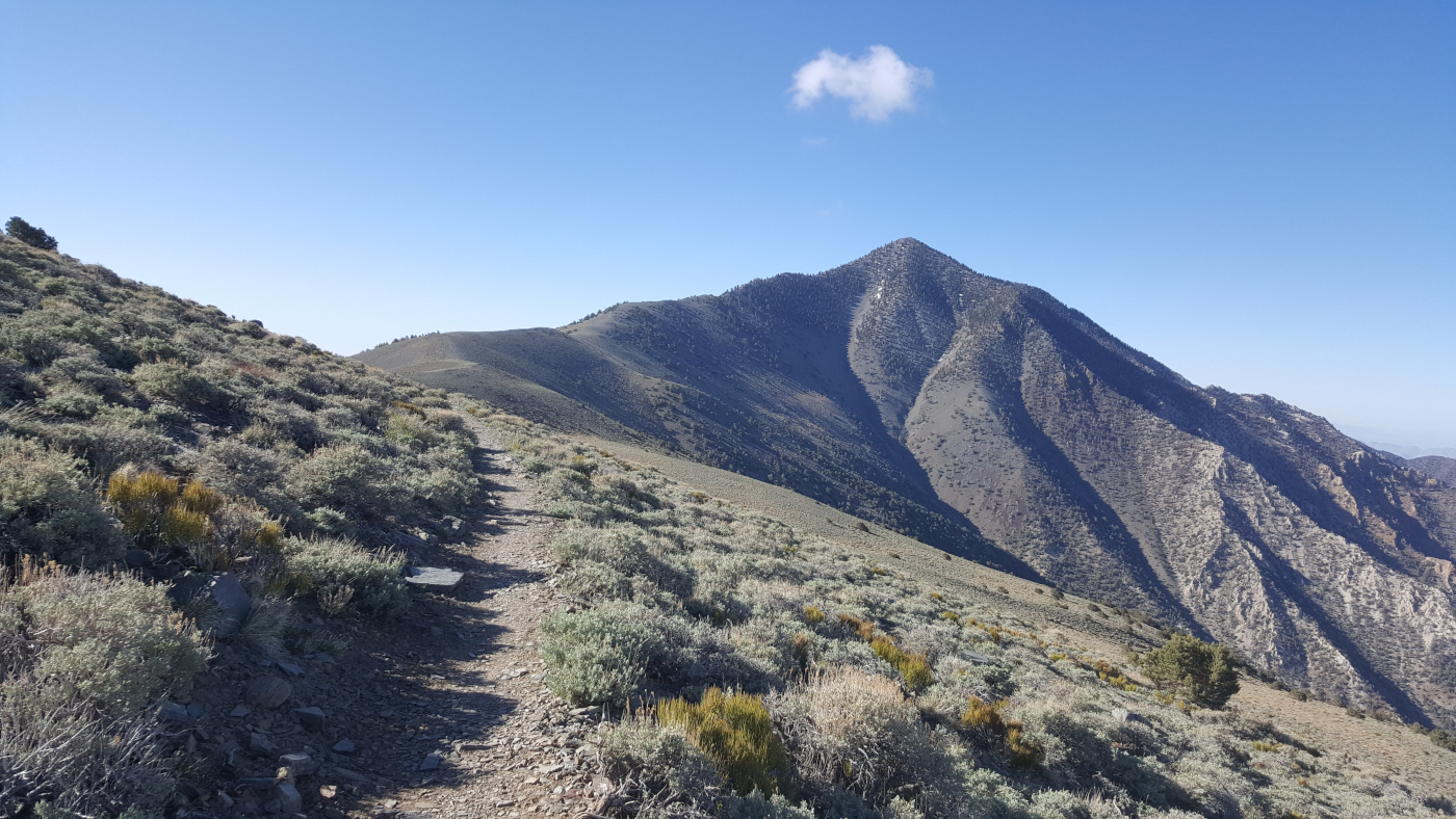
After the first climb, the path levels off. This flat section passes through Arcane Meadows with its light orange blooming chaparral and little green reeds. It also takes a circuitous path that skirts the western flank of Bennett Peak. At this spot, someone from the lost Arcane and Bennett pioneering families, looked back and uttered “Goodbye, Death Valley!” Gray rectangular shale flakes off and onto the trail where there is no ground cover on the slope above. Each step you take sounds like stepping on broken porcelain. This trail is unusual because of its distant sight lines. You can see the unbroken, unswerving, always climbing line of the pale brown trail ahead.
Summit Push
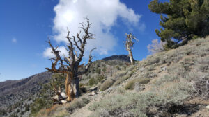
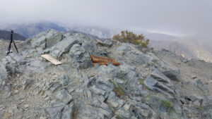
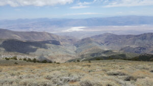
The trail dips slightly and climbs just before the triangular looming delta silhouette of Telescope Peak. Once you reach the northern face of the peak, the trail really begins to ascend again up the ridgeline. Near the top, there are occasional, gnarled and wizened ancient bristlecone pines with smooth, needle-less limbs contorting to the sky. There are about 14 switchbacks in the final push, followed by a short ridge walk to the little summit block. You can see miles across the flats to the western and eastern mountain ranges. Although there are some clouds rolling around at the top, the white glow of the salt-crusted depths of Badwater (the lowest point in the US at 282’ below sea level) really stands out. Unlike below, the upper reaches are refreshingly cool and breezy.
Red Tape
Trail Register, Death Valley National Park Fee
Photos