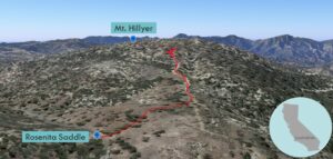
| Objective: Summit Mt. Hillyer, San Gabriel Mountains, California Distance: 1.2 miles (out and back) Peak Elevation: 6,200′ Elevation Gain: 269′ Difficulty: Easy |
If you want a quick walk after a visit to the Newcomb’s Ranch roadhouse, hike to the top of Mt. Hillyer.
Directions to Trailhead
| From the 210 East in La Cañada, take the Angeles Crest Highway (CA-2) for 26.5 miles to the intersection with Sulphur Springs Road (Three Points). Turn left (north) and drive 2.8 miles to a parking area on the left side of the road. |
Directions to Summit
| Trailhead: From Rosenita Saddle, follow the Mt. Hillyer Trail. 0.51 miles: After a slight incline through a meadow, the trail passes by a pile of rocks on the summit before turning left. 0.6 miles: You have reached Mt. Hillyer. Turn around and head back. |
Trek Highlights
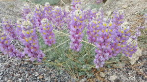
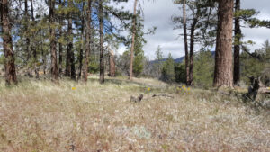
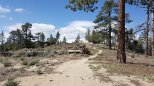
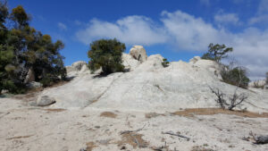
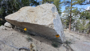
No disrespect here, but the real reason this mountain is named Mt. Hillyer is because it is more of a hill than a mountain. From Rosenita Saddle to the top, it is a leisurely stroll past purple, yellow, red, and blue wildflowers. The trail meanders past lovely grasslands and then dashes up for a brief moment. The summit plateau is covered with a bunch of rock piles, one of which presumably contains the highpoint.
Red Tape
Display your adventure pass.
Factoids
Tiburcio Vásquez was a horse rustler who stashed horses at Horse Flats by Chilao. His nickname was Chillia, hot stuff, for killing a bear using only a knife. He set up a hideout among the boulders at the top.
Photos