| Objective: Summit Mt. Baden-Powell, San Gabriel Mountains, California Distance: 8 miles (out and back) Peak Elevation: 9,407′ Elevation Gain: 2,807′ Difficulty: Strenuous |
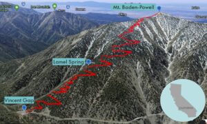
The path from Vincent Gap is the most direct route to the top of Mt. Baden-Powell. It steadily climbs 40 switchbacks up the northern face. Look for Wally Waldron, a 1,500 ancient limber pine on the ridgeline just before the final summit push.
Directions to Trailhead
| From the 210 East in La Cañada, drive 50.3 miles on Angeles Crest Highway (CA-2). Park at the Vincent Gap parking lot. There is access to several trails and a toilet. The trailhead is at the western corner of the lot. |
Directions to Summit
| Trailhead: From Vincent Gap, the hike begins on the Pacific Crest Trail (PCT). 0.9 miles: You can take a break at the bench. 1.8 miles: At the junction with the Lamel Spring trail, keep to the right to stay on the PCT. 3.7 miles: The switchbacks end at the ridgeline. 3.8 miles: At the junction with the PCT, turn left to follow the use trail to the top. 4 miles: You have reached Mt. Baden-Powell. Turn around and head back. |
Trek Highlights
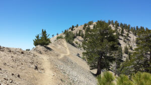
The approach to the summit is rather straightforward via a series of 40 switchbacks along the Pacific Crest Trail. After about a mile, there is a bench at a switchback on the left-hand side. At the midpoint, there is a 200-yard spur trail to Lamel Spring, the only source of water on the route.
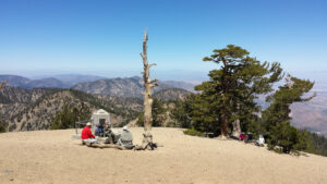
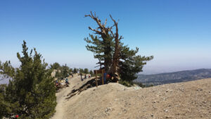
The switchbacks culminate at the ridgeline. The ridge is level until it reaches the use trail to the peak. At the start of the use trail is the Wally Waldron Tree, a wizened 1,500-year-old limber pine.
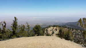
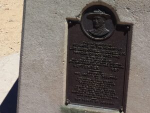
The switchbacks on this trail are no joke. After that, it is a short and steep final push to the top. At the zenith, there is a pole, a monument to Baden-Powell, and views of Baldy.
Red Tape
Display your adventure pass. This stretch of the Angeles Crest Highway is usually closed in the winter.
Factoids
Lord Baden-Powell was the founder of the international scouting movement.
Photos

