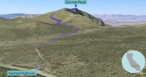
| Objective: Summit Garnet Peak, Laguna Mountains, California Distance: 2.4 miles (out and back) Peak Elevation: 5,880’ Elevation Gain: 571’ Difficulty: Easy |
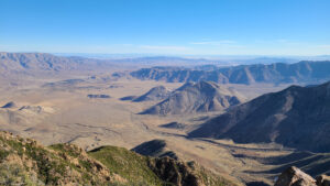
Garnet Peak glimmers from its spectacular perch in the Laguna Mountains with vistas normally reserved for mountains twice as high. The Laguna peaks are encrusted atop a steep escarpment beside Anza-Borrego’s vast badlands to the east.
Directions to Trailhead
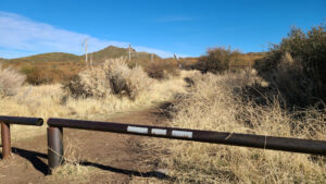
| Head south on the 5. At Torrey Hills, merge onto the 805 S and drive 10.7 miles. Take exit 17B to merge onto the 8 E and continue for 40.5 miles. Take exit 47 and turn left onto Sunrise Highway. Drive 14.2 miles. Park on the right next to a gate by the trailhead. |
Directions to Summit
| Trailhead: Begin hiking on the Garnet Peak Trail. 0.61 miles: At the junction with the Pacific Crest Trail, keep left to stay on the trail. 1.2 miles: You have reached the peak. Turn around and head back. |
Trek Highlights
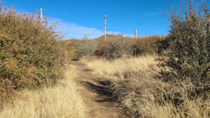
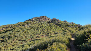
The path is rocky from the start. Golden stalks border the trail, which is level and surrounded by short vegetation.
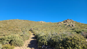
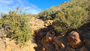
After crossing the Pacific Crest Trail, there is a little climb. For a five thousand-footer, Garnet Peak provides great value for your effort. The summit block is rocky, which requires a little bouldering. The views are phenomenal for miles in every direction. This mountain is clearly punching above its weight class.
Red Tape
Display your adventure pass.
Photos