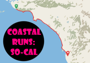
Objective: Run the So-Cal coast to the Mexican border
Distance: 383 miles (round-trip)
Segments: 41
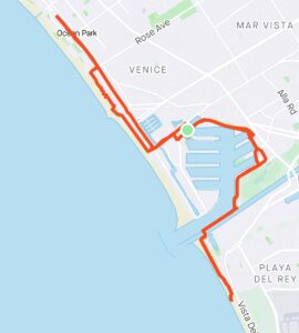
Southern California is more than an urban sprawl, it pushes right against the limits of the mountains, desert, and ocean. Running the coast is a primal eye opener, with wispy clouds and misty sea air blowing in from the shore. Run 383 miles in 41 separate round-trip segments along the county coastlines of LA, Orange, and San Diego to Mexico.
Ventura County to Malibu | Malibu to Zuma Beach | Zuma Beach to Point Dume | Point Dume to Pepperdine | Pepperdine to Eastern Malibu | Eastern Malibu to Will Rogers State Beach | Pacific Palisades to Crescent Bay Park | Santa Monica to Marina Del Rey | Playa Del Rey to Dockweiler Beach | Dockweiler Beach to Manhattan Beach | Manhattan Beach to Redondo Beach | Redondo Beach to Torrance | Torrance to Palos Verdes Estates | Palos Verdes Estates to Rancho Palos Verdes | Palos Verdes to San Pedro | San Pedro to Wilmington | Long Beach to Rainbow Lagoon Park |
Long Beach to Belmont Shore Beach | Seal Beach to Bolsa Chica State Beach | Huntington Beach to Newport Beach | Newport Beach to Corona Del Mar | Corona Del Mar to Crystal Cove | Crystal Cove to Emerald Bay | Laguna Beach to Victoria Beach | Victoria Beach to Monarch Beach | Dana Point to Capistrano Beach | Capistrano Beach to North Beach | North Beach to San Clemente Pier | Calafia State Beach to San Onofre | San Onofre Campground to Agra | Camp Pendleton Bike Access Route | Oceanside Harbor to South Oceanside | South Oceanside to Carlsbad | Encinitas to Solana Beach | Del Mar to La Jolla | La Jolla to Pacific Beach | Pacific Beach Pier to Mission Bay | Mission Bay to San Diego | Coronado to Imperial Beach | Imperial Beach to San Ysidro
Tips
Parking: Park in the middle of the segment. This affords greater flexibility to cut the run short if you need to.
Food: Enjoy a meal at a local spot after each run as a reward for your hard work.
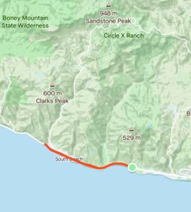
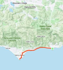
Run the So-Cal Coast – Ventura County to Malibu
Distance: 3.8 miles (round-trip)
Neptune’s Net is a meeting spot for bikers and surfers, which is technically in Ventura County. But parking is easy and you can grab a bite of seafood after the run. There is a fire department building on the hillside. On the beach slope, there are mailboxes and trees by the road. For the most part, the hills are open on both sides with the occasional home.
Large sections of Pacific Coast Highway (PCH) require that you run in the bike lane right next to the road. So be careful when running around parked cars and be aware of your surroundings. The manzanita here is symbolic of the domesticated wilderness of this segment where metropolitan LA begins asserting itself. People have cultivated this wild red shrub to grow tall. This is similar to how the rugged hills of Ventura County yield to LA’s population. Leo Carrillo State Beach is sandy and rocky with miles of secluded shoreline. Along the way, there are rabbits, mice, and lizards.
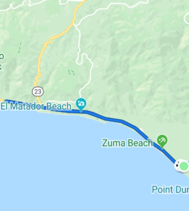
Run the So-Cal Coast – Malibu to Zuma Beach
Distance: 13.1 miles (round-trip)
There is a road leading down to Nicholas Canyon Beach. The hills above in Western Malibu are rather undeveloped, while the hills below have homes behind the tall trees. Encinal Canyon Road climbs the foothills to Charmlee Wilderness Park. El Matador Beach has a weathered rock arch formation on the water’s edge. The bike path on PCH begins its gradual descent with clear views of the ocean.
Before the fancy shops of Trancas Canyon, a sign welcomes you to Malibu and its 21 miles of scenic beauty. Zuma Beach is a couple miles long with a parking lot buffer between it and PCH. Remarkably, there are no homes between the sand and the roadside. At Zuma, there are many volleyball courts in the sand and concession stands by the parking areas. At PCH where the road curves, stay on PCH or turn off to explore Point Dume.
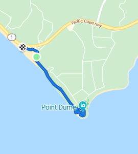
Run the So-Cal Coast – Zuma Beach to Point Dume
Distance: 3.7 miles (round-trip)
At Zuma Canyon, head southeast on Westward Beach Road. Westward Beach spans all the way to Point Dume with the cliffs above. At the end of the long parking lot, you will see the vertical northern rock wall of Point Dume. Perhaps someone is climbing it. Go east on the sandy trail up its northern flank. There are some spur trails that provide nice views of secluded Pirates Cove Beach. This was the filming location for “Planet of the Apes” where they discover the ruins of the Statue of Liberty. Follow the spiraling trail past the sandy bluffs to the top of Point Dume’s promontory. At the top, you can see the coastlines on each side. You can head down the clifftop trails to the east overlooking the curving Big Dume Beach.
Run the So-Cal Coast – Point Dume to Pepperdine
Distance: 14 miles (round-trip)
From Point Dume’s promontory, you run past the mansions of Cliffside Drive, Fernhill Drive, and Wildlife Road. In this fairytale intersection of homes, countryside, and ocean, there are driveways larger than typical home plots. Paradise Cove Beach, a magnet for Hollywood films, has a café and lounge chairs for the well-heeled. In the heart of Malibu, you run past walled off mega mansions to the south. Later, the trails rise up to Escondido Falls, Latigo Canyon, and Solstice Canyon to the north. Dan Blocker Beach has a mile of uninterrupted shoreline. The best RV park ever is perched on top of a bluff. After the legendary seafood shack, climb another hill, and turn onto Malibu Road, a quiet street with beautiful homes. There are a few public access points to secluded Puerco Beach and Amarillo Beach.
Run the So-Cal Coast – Pepperdine to Eastern Malibu
Distance: 8.5 miles (round-trip)
You could have remained on PCH instead of Malibu Road’s more charming coastal path. This alternative route descends a hill from Pepperdine, which is possibly the college with the best ocean views anywhere. You cross a bridge over Malibu Lagoon, and then gaze at ritzy Malibu Village. Surfer dudes pull their boards off their car rooftops. Shortly after, you can see Malibu Pier with its twin restaurants at its terminus. PCH is narrow and Malibu’s houses form a barrier to the ocean, while there are occasional storefronts on the hillside. A quarter mile before Carbon Canyon Road, the sidewalk disappears. In Eastern Malibu, Duke’s is on the water’s edge and Las Flores Canyon Road climbs the Santa Monica Mountains.
Run the So-Cal Coast – Eastern Malibu to Will Rogers State Beach
Distance: 11 miles (round-trip)
From Duke’s, there is a cliff on the left and a wall of homes on the right. The fancy cars sometimes protrude into the bike path, so the way is narrow. The break in the wall is the parking lot to Moonshadows. Dolphin View Coastal Overlook has a miniature gated garden on the cliff with a park bench. Las Tunas Beach is the best segment for running, with hills and a continuous stream of automobiles on the left. Gentle waves lap against the shore just below. After Topanga Canyon Boulevard and Mastro’s, the coast opens up again. Getty Villa is high in the hills above. Cool surfers lug their boards to coastal access points. Pretty girls lounge on the sand. At certain times, the ocean also twinkles. At Gladstones, city life has converged at Sunset Boulevard. And then it is a calm stretch before Will Rogers State Beach.
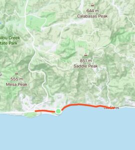
Run the So-Cal Coast – Pacific Palisades to Crescent Bay Park
Distance: 7.5 miles (round-trip)
Will Rogers State Beach is where the Santa Monica Bay coastline begins turning southeast away from the Santa Monica Mountains. Temescal Canyon Park has a well forested trail leading to a gorgeous waterfall. To the east, are high sandstone bluffs sheltering Pacific Palisades. The walkway and bike path within sandy Santa Monica State Beach are wide and vast with nice beach homes. The landmark Santa Monica Pier has two piers. The long municipal pier extends past the breakers. Pleasure Pier provides a carnival atmosphere with a trapeze school, street performers, an amusement park, and a solar-powered Ferris wheel. After running under the pier, pump some iron at Muscle Beach, or play with the rings, ropes, and slacklines. Just a little further, there are posh eateries and manicured greenbelts.
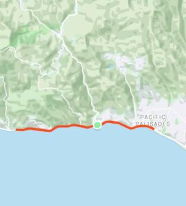
Run the So-Cal Coast – Santa Monica to Marina Del Rey
Distance: 13.6 miles (round-trip)
Crescent Bay Park has rows of columns crowned with a pergola, perfect for sunny summer days. The palm tree lined path is next to large parking lots and sand as far as the eye can see. The boardwalk gets curvy as it enters Venice. At Venice, you can follow the twisty tent-covered path, or wriggle past art vendors, trinket shops, and crowds. Skaters carve it up in the skate park. Players chase tennis balls with paddles.
The Venice Fishing Pier has a circular platform at the end. From the pier, head northeast on Washington. You can follow Admiralty Way to Fiji Way as the road bends around the boat ramps of Marina Del Rey. Fisherman’s Village is a colorful seaport with lively restaurants and fun bay cruises. The South Jetty path splits the main channel and Ballona Creek. Ballona Creek Bridge connects to the wonderful path that weaves through Playa Del Rey Beach with sand on both sides.
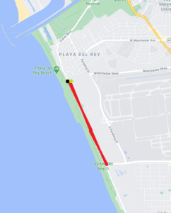
Run the So-Cal Coast – Playa Del Rey to Dockweiler Beach
Distance: 3.1 miles (round-trip)
Playa del Rey is on the other side of Ballona Creek, with Toes Beach after the South Jetty. Toes Beach popularized the hang ten maneuver where a surfer places all ten toes over the nose of the board. Playa Del Rey Beach extends from the jetty to the jet landing strips. Did you know that there is a ghost town in LA? Developers moved the homes in Palisades del Rey to make room for LAX. On the other side of the fence, there are only empty streets and land. The nature preserve is a haven for endangered species such as the El Segundo blue butterfly. As you run by the parking lots, you may see some fancy beach cafés and showers by the sand. Dockweiler State Beach is near LAX, next to Imperial Highway and a jetty.
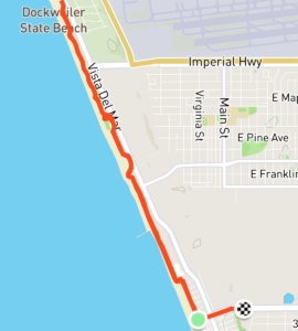
Run the So-Cal Coast – Dockweiler Beach to Manhattan Beach
Distance: 6.2 miles (round-trip)
Dockweiler State Beach has a wide swath of sand scattered with fire pits. (Bring your own firewood.) Jetliners regularly leave from nearby LAX. Dockweiler RV Park is in a prime location for a home on wheels, right on the beach’s edge. Once in a while, there is a roller skater or scooter thrown into the mix of cyclists, runners, and walkers. At the end of Dockweiler Beach, hang gliders launch off 30-foot sand dunes and land on soft beach sand. The Hyperion Water Reclamation Plant treats sewage before it reaches the bay. El Segundo Beach has fences and walls to block views of an oil refinery. El Porto Beach borders the small neighborhood of El Porto in Manhattan Beach. The Strand connects the three Beach Cities of the South Bay: Manhattan Beach, Hermosa Beach, and Redondo Beach.
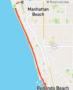
Run the So-Cal Coast – Manhattan Beach to Redondo Beach
Distance: 8.5 miles (round-trip)
If you have parked on Rosecrans, at the northern edge of Manhattan Beach, there are two paths. The bike path by the sand is off limits to those on foot. Stay on top of the grand staircases and run along the beach houses on the Strand. After every block, you can see the street access between the homes. The numbered streets get smaller the further south you go. Manhattan Beach Pier has Volleyball Walk of Fame plaques and at its end, a roundhouse aquarium. At Hermosa Beach, the Strand merges with the bike path. There are many courts in the deep sand here. At the surfer statue, Hermosa Beach Pier is a long and narrow fishing pier. Pier Plaza is a packed beachfront entertainment hub with bars, restaurants, and people. It gets wilder as the night progresses. Harbor Drive is a straightaway with a well-protected bike lane.
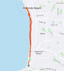
Run the So-Cal Coast – Redondo Beach to Torrance
Distance: 6.2 miles (round-trip)
Redondo Beach Pier is a maze of jetties, a Fisherman’s Wharf, boardwalk, marina, shops, and great seafood spots. Before Topaz Jetty, there are lots of volleyball courts. At the jetty, apartment buildings and resorts seem to sprout on all sides. The beach at this point is so narrow, you could veer off and dip your toes. People like to practice yoga and tai chi here. You can see the white frothy crests of knee-high waves. In South Redondo, take the high road or take the low road on a path by the sand. RAT (Right After Torrance) Beach is just below a curving hillside of residential homes in Torrance’s short stretch of coast. At the bottom of the hill, there are seaside homes to the right and Torrance County Beach to the left.
Run the So-Cal Coast – Torrance to Palos Verdes Estates
Distance: 10 miles (round-trip)
On Palos Verdes Boulevard, there is an arched sign welcoming you to Palos Verdes Estates. You take a big turn heading west into Palos Verdes Drive next to a creek. After City Hall, the road narrows and the sidewalk fades away. When you turn south on the peninsula, the water at Bluff Cove becomes visible with hilly slopes on each side. The wide roadside has plenty of trees and shade along the sidewalks as well as trees in the center. The center median is wide and grassy with a nice dirt path. By Lunada Bay, there is a water fountain and some shops. After a mile, in Rancho Palos Verdes, the sidewalk returns and there is a large shopping center to the left.
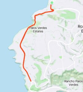
Run the So-Cal Coast – Palos Verdes Estates to Rancho Palos Verdes
Distance: 10 miles (round-trip)
Point Vicente lighthouse is on the southwesternmost point of the Palos Verdes peninsula, where it protects ships from dangerous waters. After Pelican Cove, Terranea is a seaside resort on a bluff overlooking beach trails and sea caves. The hills are rugged and open around Abalone Cove Shoreline Park. At Palos Verdes Hills, Wayfarers Chapel is a glass marvel where you feel like you are sitting in between redwoods. Abalone Cove Beach and Sacred Beach have great tide pools. After passing the heights of Portuguese Point, you have clear views of the ocean. Portuguese Bend Reserve has trails in every direction.
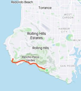
Run the So-Cal Coast – Palos Verdes to San Pedro
Distance: 13.5 miles (round-trip)
You can head off-road on some sandy trails down a hillside. The ocean appears at the end of a valley like a treasure. The path narrows until you are on a steep dramatic cliffside with the water immediately below. White Point Nature Preserve has coastal sage scrub and a former Nike missile site. Until Point Fermin, West Paseo Del Mar alternates past homes and parks.
The Korean Bell of Friendship is in a stone pavilion atop a hill in Angel’s Gate Park. At the southeastern corner of the peninsula, Point Fermin Lighthouse provides a navigational aid. San Pedro is a nice place to raise a family with lots of space and little traffic. Cabrillo Beach is a big space with a pier, a jetty, an aquarium, and a large park. A quiet road connects the marina to the massive 22nd Street Park and finally the Port of Los Angeles. The Battleship USS Iowa rests beneath the Vincent Thomas Bridge and the container ships.
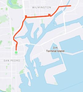
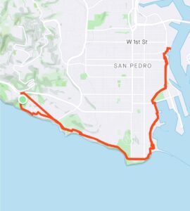
Run the So-Cal Coast – San Pedro to Wilmington
Distance: 11 miles (round-trip)
In Central San Pedro, once you are parallel with the 110, you can see the containers and a semi-truck dealership. To the right, two sets of railroad tracks carry trains with containers stacked double and even quadruple. There are lifts on the side of the tracks for double stacking the well cars. Head east onto C Street with its densely packed little homes, soccer fields, and container cranes in the background. The area is a mix of trucking companies, roosters crowing, and stray dogs barking. Diagonal Alameda Street has a dirt path next to 30 rail lines. At some point, you may enter a tunnel formed by trains moving on both sides. Turn right on Anaheim, climb over the bridge above the industrial oil refinery, and pass auto wrecking yards. This area looks like the place where the Terminator was killed.
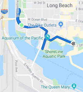
Run the So-Cal Coast – Long Beach to Rainbow Lagoon Park
Distance: 3.1 miles (round-trip)
The concrete LA River completes its journey from the San Gabriel Mountains. It crosses downtown LA and the LA Basin, to its mouth between Port of Long Beach and Long Beach’s Waterfront. The Queen Mary casts a large shadow at Queensway Bay, as does the giant dome of Carnival Cruise Lines. Cross the Queensway Bridge over to Shoreline Aquatic Park. Visit the Aquarium of the Pacific and the Lions Lighthouse on a hill. Head east on Shoreline Drive and run past the restaurants and shops of downtown Long Beach. Run under the rollercoaster pedestrian bridge to the Pike, another set of restaurants and shops. Rainbow Lagoon Park is to the left, Shoreline Village is to the right. Beyond the long lawn of Marina Green Park is the marina area of Shoreline Yacht Club.

Run the So-Cal Coast – Long Beach to Belmont Shore Beach
Distance: 8.6 miles (round-trip)
Shoreline Way has a separate pedestrian walkway and a bike path through the sands of Belmont Shore. Junipero Beach runs parallel below Bluff Park. Along this stretch, look for the Astronaut Islands. They are artificial islands with landscaping and tall structures designed to conceal the oil rigs. Belmont Pier is a concrete pier with a snack shop at the end, two extending arms, and a landing dock. The Long Beach Breakwater is a literal line in the Long Beach harbor that keeps things calm. The lack of waves is ideal for the Belmont Kite Beach kiteboarding hotspot. Alamitos Peninsula provides shelter to the three islands of Naples in Alamitos Bay. This is ideal for the many swimmers swimming around Naples. You can choose to run by the bayfront or the oceanfront until Alamitos Park at the end.
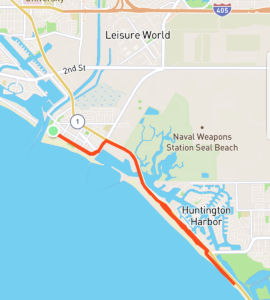
Run the So-Cal Coast – Seal Beach to Bolsa Chica State Beach
Distance: 11.0 miles (round-trip)
Somehow, the San Gabriel River makes it all the way down from the San Gabriel Mountains to Seal Beach Jetty. There are many new houses and apartments on each side. At Seal Beach Pier, there is an old-fashioned clock tower. You can run on the sidewalk, in an alley, or along the sand. Turn northeast on Seal Beach Blvd, head southeast on PCH, and then follow a dirt path above Anaheim Bay. After the Naval Weapons Station, the bridge passes Seal Beach Wildlife Refuge and crosses over to Surfside. There are many restaurants, bars, and boat slips between Surfside and Sunset Beach. Someone converted a water tower into a 360-degree sky-high rental home. A long narrow strip of land between the ocean and Bolsa Bay finally reaches the Bolsa Chica wetlands.
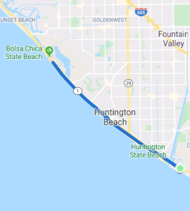
Run the Co-Cal Coast – Huntington Beach to Newport Beach
Distance: 15.0 miles (round-trip)
The wide path makes its way between the parking areas and the sand of Bolsa Chica State Beach. Bolsa Chica Basin is next to the salt marsh, the intertidal zone that is flooded by the ocean. When the parking lot ends, there is a vegetation buffer between PCH and the bike path. This long, non-bending path is free of homes, but not of oil rigs. You pass picnic tables and the occasional lifeguard tower. The Huntington Beach Pier is a continuation of the city’s Main Street core. During the summer, there are numerous surf competitions. At Huntington Street, Nude Dude is a statue of a surfer catching a killer wave. After the volleyball courts, you pass the power station smokestacks and desalination plant site. After the Santa Ana River mouth, you are in Newport Beach.
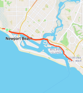
Run the So-Cal Coast – Newport Beach to Corona Del Mar
Distance: 10.0 miles (round-trip)
PCH has a high wall separating the Newport homes and the coast. At the big junction, there are two routes you can explore. The southern route follows Newport Boulevard south and past Lido Isle. Between Newport Beach Pier and Balboa Pier are wide, long, sandy beaches and the Balboa Fun Zone. The Wedge is a legendary surf spot at the Newport Jetty and the end of Balboa Peninsula. The northern route keeps heading east on PCH toward Lower Newport Bay. Newport Harbor’s inner shorelines are completely covered with docks and slips for boats and yachts. Continue beyond the giant seafood dining spots, boat charters, shipyards, and exotic car dealerships. Take the bridge to the frozen bananas of Balboa Island or turn south on Bayside Drive to Corona Del Mar.
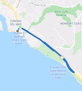
Run the So-Cal Coast – Corona Del Mar to Crystal Cove
Distance: 5.5 miles (round-trip)
At the eastern entrance of Newport Harbor, you can hop across the boulders of the Corona Del Mar Jetty. Below the cliffs of Lookout Point, you can climb the sandy rocks and explore the tide pools. Follow the parking lot exit up the hill to Ocean Boulevard. The beach homes have unobstructed views of the ocean past the cliffside lawn. Head north on Marigold Avenue and turn right onto PCH. Run through the heart of Corona Del Mar past the sidewalk commotion and car traffic. Soon, you are next to trees that obscure the homes behind. Where the sidewalk ends, you can follow the dirt path by PCH or the trails in Crystal Cove State Park. At the point where PCH climbs and curves, grab a shake at Shake Shack and enjoy it from the clifftop.
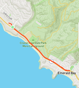
Run the So-Cal Coast – Crystal Cove to Emerald Bay
Distance: 3.5 miles (round-trip)
Starting from the corner of a ritzy shopping center, you pass the tail end of Crystal Cove State Park. The sidewalk ends and becomes a bike lane right next to the whizzing cars. And native chaparral phase out the palm trees on the blank hillside. The rolling curves cut across open foothills to the left and cliffs and water to the right. You reach Moro Canyon, with trails in Crystal Cove State Park reaching up to Moro Ridge. Or you can walk through the Crystal Cove Tunnel. This is a cool pedestrian tunnel under PCH with artwork that leads to Moro Beach. Once you enter Laguna Beach, there are homes on each side with high hedges for privacy.
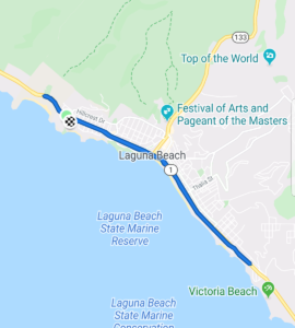
Run the So-Cal Coast – Laguna Beach to Victoria Beach
Distance: 7.0 miles (round-trip)
You cannot really see over the hedges. But Abalone Point and Emerald Point sort of break up the coastline and form a gateway to Laguna Beach. By Crescent Bay, there are apartment buildings on both sides and the sidewalk returns. Shaw Cove is great for diving. Turn right at Cliff Drive and run above Heisler Park and the tidepools. At Las Brisas, reconnect with PCH and descend the slope to the boardwalk by the basketball courts and Main Beach. PCH cuts through the heart of Laguna Beach, past a couple miles of shops and restaurants. Soon, the sidewalk gradually climbs from the city center, past apartments, and then below houses on top of the hill.
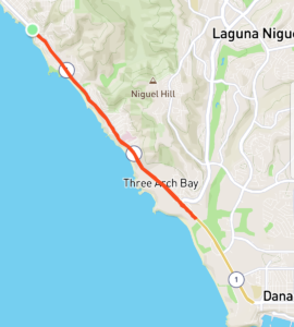
Run the So-Cal Coast – Victoria Beach to Monarch Beach
Distance: 7.3 miles (round-trip)
La Tour is a castle tower on a cliff’s edge that connects a mansion to Victoria Beach. Treasure Island Beach provides a typical Laguna Beach experience with perfectly manicured hedges, railed walkways, red flowers, and tidepools. Aliso Creek empties into Aliso Beach, a skimboarding capital. After a bit of a hill climb, you reach the shops and restaurants of South Laguna. Table Rock Beach has wind swept rock formations. Keep running uphill on PCH until 9th Avenue and take the 230 steps down to tucked away Thousand Steps Beach. From there, you can see the private staircases from the mansions on the cliffs. With some scrambling you can get to Secret Cove in the north. Monarch Beach is at the northern edge of Dana Point. The sidewalk is back and it descends a bit.
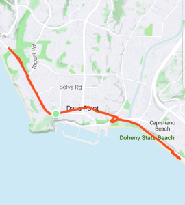
Run the So-Cal Coast – Dana Point to Capistrano Beach
Distance: 9.5 miles (round-trip)
The Ritz-Carlton has winding paths from the high cliff to Salt Creek Beach. The sidewalk weaves back forth around the bushes and trees. The top of the Dana Point Headlands forms a right angle on the coastline. Here you can turn left to continue on PCH or you can descend to the marina. Baby Beach is a safe spot for kids to swim and for launching kayaks and SUPs. On Dana Point Harbor Drive, you can see the yachts and restaurants along the marina. On PCH, you can run under the Lantern District arch and see the shops of downtown. When you see the giant Dana Point pedestrian walkway, turn right at Dana Point Harbor Drive. Run within Doheny State Beach. After linking with Coast Highway, run next to the railroad and the ocean until the pedestrian railroad bridge.
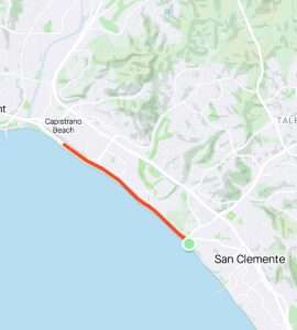
Run the So-Cal Coast – Capistrano Beach to North Beach
Distance: 6.0 miles (round-trip)
At the turnoff for the Capistrano Beach parking, the two-lane bike path (with protective barricade) starts. If you could envision a cross-section of this stretch, you would see homes with commanding views atop the cliff. At the base of the hill, there is a sidewalk next to Coast Highway. The concrete traffic barriers really fortifies the protected path from vehicular dangers. A guardrail and a fence enclose the coastal railroad. Trees and a road provide privacy for the homes right on the beach.
The flat and well-maintained path would make a fast 5K or 10K race course. Occasionally, there are times when you have to run around walkers, runners, and bikers, but there is room for all. At the point where Coast Highway becomes El Camino Real, the sidewalk beneath the sandstone bluffs offers nice shade. The Sea Summit Trail is a mix of dirt path and stairs with jaw dropping panoramic ocean vistas.
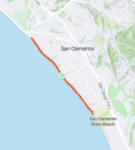
Run the So-Cal Coast – North Beach to San Clemente Pier
Distance: 4.5 miles (round-trip)
From North Beach station, start running along the San Clemente Pedestrian Beach Trail. There is a cliff on one side and on the other, a fence, railroad tracks, rocks, sand, and waves. There is one long somewhat steep boardwalk. Along the sandy path, there are many other runners, walkers, and doggies. Casa Romantica is a Spanish villa with a commanding hilltop position.
After the clock tower, walk on San Clemente Pier with surfers on both sides and fisherfolk at the end. Admire the Mediterranean charm of the Pier Bowl as it rises up the hills from your perspective at sea level. A covered pedestrian staircase overpass goes over the railroad down to T Street Beach. The beach path continues below sandstone bluffs and across some bridges. There are a couple more beach access stairs before you reach Calafia State Beach. Here you will find trails and a concession stand with root beer floats.
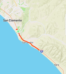
Run the So-Cal Coast – Calafia State Beach to San Onofre
Distance: 10.0 miles (round-trip)
From Calafia State Beach, continue following the shoreline path to Trestles. Lower Trestles is a classic surf spot with consistent endless waves. As an alternative, head east on Avenida Calafia, then turn south onto Avenida Del Presidente. Turn left at Cristianitos Road. Then just before the southbound entrance to the 5, head south on the fenced off walkway. At Basilone Road, connect with Old Pacific Highway. To the northeast, Camp Pendleton’s undeveloped land spreads across from the ocean up to the mountains in Cleveland National Forest. San Onofre State Beach and San Onofre Bluffs Beach sandwiches the closed San Onofre Nuclear Generating Station. San Onofre State Beach is a popular camping location. There is a gate to San Onofre Bluffs Campground.
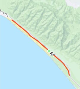
Run the So-Cal Coast – San Onofre Campground to Agra
Distance: 13.6 miles (round-trip)
If you park at the San Onofre Bluffs Campground, you will need to get a $15 day pass. The campground is a little over 3 miles to the end. Old Highway has restrooms, fire pits, and 7 quarter-mile trails to the beach from the blufftop. At the end of the campground, there is a gate with a narrow entrance. This spot, Agra, marks the beginning of Camp Pendleton. Agra once was a Santa Fe railroad point, a now abandoned railroad cattle loading station on the Santa Margarita Rancho. You can run down this stretch until the Las Pulgas gate. But it is forbidden to leave the path to the west or the east. The coastal railroad is to the east. The paved road slowly climbs to the Las Flores Viewpoint. At this vista, you can observe the base and the ocean below, after which it tucks under Interstate 5.
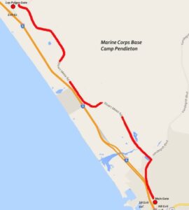
Run the So-Cal Coast – Camp Pendleton Bike Access Route
Distance: 16.0 miles (round-trip)
The only way to visit the 8 miles of coastline within Camp Pendleton is with a DBIDS recreational bicycle pass. You must do this in person from the Main gate Visitor Center in Oceanside. Only cyclists who are US citizens or permanent residents with driver’s licenses or IDs can apply for the DBIDS pass. Cyclists (with a pass) ride from Las Pulgas gate (Stuart Mesa Road) to Main gate (Vandergrift Boulevard) and vice versa. The base does not permit any activities other than recreational cycling.
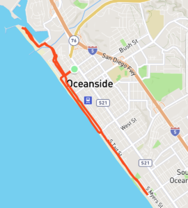
Run the So-Cal Coast – Oceanside Harbor to South Oceanside
Distance: 6.5 miles (round-trip)
Starting at North Jetty, run between the yacht marina on the left and Oceanside Harbor on the right. Harbor Village is a laid-back waterfront area in the last harbor before San Diego. After crossing the breakwater, the Strand provides ample space for non-motorized traffic between low slung beach cottages and the water. With palm trees on each side, apartment buildings begin sprouting. The Oceanside Municipal Fishing Pier is a long wooden pier with a diner at the end. When the Strand hits the sand at Wisconsin Avenue, turn left, then turn right onto Pacific Street. Run through the quiet neighborhood until Buccaneer Beach Park. The northern side of the street has a high rampart, which is nice to run along.
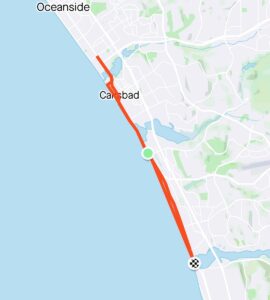
Run the So-Cal Coast – South Oceanside to Carlsbad
Distance: 14 miles (round-trip)
Starting from South Oceanside, there are plenty of shops and cafes. By the time the homes return, you pass by the tall cattails and grass of Buena Vista Lagoon. From the traffic circle to the namesake street arch, Carlsbad Village has got it goin’ on. From Carlsbad State Beach, you can run on the blufftop or by the concrete Sea Wall along the shoreline below. The beach homes here have clear views of the water. After Tamarack State Beach, there is water on both sides with Agua Hedionda Lagoon to the left. The cliff’s edge has wind swept trees and purple flowers, making this the best stretch of coastline. There are many surfers before the break and many paddleboarders beyond it. After a climb, vegetation provides privacy for a long campground. Eventually, you head downhill and pass the twin jetties at the mouth of massive Batiquitos Lagoon.
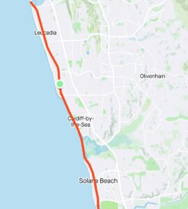
Run the So-Cal Coast – Encinitas to Solana Beach
Distance: 16 miles (round-trip)
There is a slight climb from the lagoon to Leucadia’s hilltop, which is lined with white eucalyptus trees. Coast Highway 101 is laid-back and full of cafes, breakfast spots, brewhouses, tacos, and murals, not necessarily in that order. Encinitas’s Highway 101 has cool spots on both sides and a little waving girl statue. Swami’s is a well-known point break, where waves break over a rock and become totally tubular. Swami’s Park has wooden Easter Island statues, and is named after the nearby self-realization ashram. After the shops, Cardiff-by-the-Sea’s coastline becomes visible and at the surfer statue, tall hedges block the campgrounds. To the east is the railroad with pedestrian bridges over the tracks to the hillside homes. After San Elijo Lagoon and Solana Beach, the Del Mar Fairgrounds are on the edge of San Dieguito Lagoon.
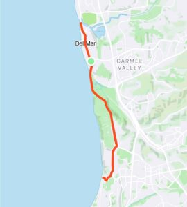
Run the So-Cal Coast – Del Mar to La Jolla
Distance: 16 miles (round-trip)
San Dieguito Lagoon flows into the ocean under the bridge, forming a great little dog beach under a bluff. Camino Del Mar provides a sidewalk, parking lane, bike lane, and tree-lined median to buffer the swanky homes from traffic. The road climbs slightly to the high ground of Del Mar Village, which is brimming with Old World charm. Camino Del Mar dips and becomes Torrey Pines Road, turning to the vast Torrey Pines State Beach.
After Los Penasquitos Lagoon, Torrey Pines Road begins its epic unyielding climb past the Torrey pines and seaside trails. At reaching the glorious top, you pass by Torrey Pines Golf Course and the road to the Torrey Pines Gliderport. UCSD is a world-class university that is close to the sun and sea. Turn to the coast at La Jolla Shores Drive where it twirls and descends to the Scripps Institution of Oceanography.
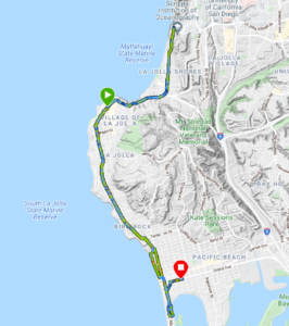
Run the So-Cal Coast – La Jolla to Pacific Beach
Distance: 16 miles (round-trip)
Before Birch Aquarium, there is a pedestrian bridge that connects to an elevator leading to the shore. Scripps performs research on Ellen Browning Scripps Memorial Pier. La Jolla Shores Drive is a steady downhill cruise in a charming residential neighborhood. At the bottom of the hill, turn right onto Torrey Pines Road for a hilly and curvy session. Turn right onto Prospect Place to explore the round peninsula of La Jolla Village. The restaurants are fancy, swanky, and aromatic. After the run, you can kayak to La Jolla Cove and see the sea lions. Turn left at La Jolla Boulevard and run by hedge-lined neighborhood. Bird Rock is ritzy with great brunch spots and numerous traffic circles. After a little right at Mission Bay Boulevard, run past the jewel-named streets of Pacific Beach. Along Bayside Walk, you are between the beach homes, houseboats, and curving shore of Mission Bay.
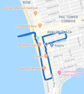
Run the So-Cal Coast – Pacific Beach Pier to Mission Bay
Distance: 1.0 mile (one-way)
At the end of Garnet Avenue, Crystal Pier is at the heart of hip and vivacious Pacific Beach. The pier has hotel cottages where guests can drive to, at the end of which is a fishing platform. Ocean Boulevard is a pedestrian oceanfront walkway with vendors, a pelican statue, and tons of young people. There is plenty of energy with eateries, bars, shops, and homes to the left and packed beaches to the right. The boardwalk becomes a chokepoint in many spots. PB has banned scooters from La Jolla to Mission Beach, making it a former electric scooter capitol.
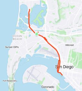
Run the So-Cal Coast – Mission Bay to San Diego
Distance: 16.5 miles (round-trip)
Mission Bay is a marine playground with bridges and islands where paddle boarders, water skiers, and rowing crews navigate. SeaWorld is at the southern end of the bay. Once Mission Bay Drive becomes Sports Arena Boulevard, you will see one of the best spots for ‘cue, Phil’s BBQ. The swap meet in the parking lot of Pechanga Arena gets pretty busy.
After Pacific Highway passes the loud jet airliners at San Diego International Airport, downtown San Diego’s skyline comes into focus. At Little Italy, it might be hard to resist stopping at one of the restaurants. Along Harbor Drive by Waterfront Park, you can explore the tall ships that once toured the Seven Seas. Check out the cruise ships at B Street and Broadway Piers, and the USS Midway aircraft carrier at Navy Pier. Seaport Village is an exciting waterfront shopping, dining, and entertainment complex at the bend in the Embarcadero.
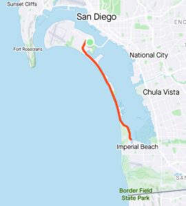
Run the So-Cal Coast – Coronado to Imperial Beach
Distance: 17 miles (round-trip)
Since you cannot run across the iconic Coronado Bridge, take the ferry between the Convention Center and Coronado Ferry Landing. The ferry costs $5 each way for a 15-minute ride that leaves every 30 minutes. (Every May, you can join the Navy Bay Bridge 4-mile race across the Coronado Bridge.) Or just drive across the bridge. Hotel del Coronado’s red conical rooftop cupolas are a landmark draw. After passing the Naval Amphibious Base, the Silver Strand bike path (protected by a concrete fence) stretches along the peninsula. Soon, you can see the naval ships and container cranes in San Diego Bay. On the other side of this narrow land, you can see the ocean. Coronado Cays is a collection of mansions and yachts in San Diego Bay. The bottom of the bay contains the San Diego Bay National Wildlife Refuge, which border Imperial Beach.
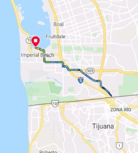
Run the So-Cal Coast – Imperial Beach to San Ysidro
Distance: 7.3 miles (one-way)
Along the Bayshore Bikeway, run next to the Otay River as it empties into the San Diego Bay. Imperial Beach is the southernmost city in the Best Coast. From the end of the bay, you can check out the pier or head directly east to Otay Mesa West. At the San Diego Trolley station, follow Beyer Boulevard as it heads southeast next to the trolley line.
On top of a hill on East Beyer Boulevard, you can see San Ysidro below and Tijuana’s hillside homes beyond. At long last, you have made it to the Mexican border. San Ysidro is bustling with people entering and leaving Mexico. The PedEast pedestrian walkway becomes narrower as you go until you reach the turnstiles. If you have time, cross over to visit Tijuana. You can take the trolley back to San Diego from the San Ysidro Transit Center. Congratulations on running the entire length of the So-Cal coastline!
Are you ready to run tall the way back to Ventura County?