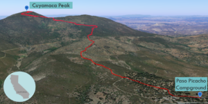
| Objective: Summit Cuyamaca Peak, Cuyamaca Mountains, California Distance: 5.8 miles (out and back) Peak Elevation: 6,512’ Elevation Gain: 1,600′ Difficulty: Moderate |
After stuffing your face with apple pie in Julian, hike to one of the peaks in Cuyamaca Rancho State Park. Cuyamaca Peak is the second tallest mountain in San Diego County.
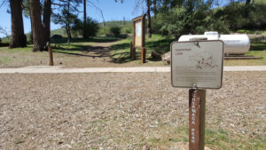
Directions to Trailhead
| From the 5 South in Carlsbad, take CA-78 East for 58.3 miles. The road passes through Escondido, Ramona, and Santa Ysabel to the junction with CA-79 just past the town of Julian. Turn right (south) on CA-79 and continue for 10.6 miles past Lake Cuyamaca. Look for the entrance to Paso Picacho Park on the right. Continue 5.6 miles further (mile marker 4) to a gated dirt road on the left side. Park on the left just before this road. |
Directions to Summit
| Trailhead: From the parking area, walk southwest across the Paso Picacho campground road. The trail starts at a point between campsites 68 and 69. 0.36 miles: Follow this trail a short distance to Lookout Road. The road goes all the way to the peak. 1.67 miles: The road turns to the south. 2.9 miles: You have reached Cuyamaca Peak. Turn around and head back. |
Trek Highlights
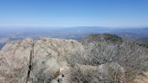
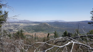
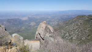
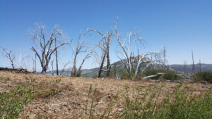
The asphalt road is steep and steady the whole way up. It climbs past a burned out, chopped down slope, until a forested patch near the peak. Gray elephant tusk-like branches have been charred and bleached by the sun. Along the way, I spot little birds with yellow and orange bellies and a rabbit with a white cotton-ball tail. At the top, it smells like the sweet honeysuckles that grew by my grandmother’s home in San Diego. Although there is a communications tower, you have unobstructed views for miles. The terrain is rather flat in all directions except for a handful of knobby peaks that are rising from the ground like elbows or knees. The valley floor is varying verdant shades of pea soup and spruce, with stretches of mustard yellow and burgundy wildflowers.
There is an annual 50-mile ultra, starting from Anza Borrego, passing through Cuyamaca Peak, and ending by Cuyamaca Lake. The last aid station below the summit offers caffeinated sodas, like the appropriately named Mountain Dew.
Red Tape
As there is no parking permitted along the road, there is a $10 day use fee by the trailhead.
Factoids
Cuyamaca Rancho State Park was created in 1933 when Mr. and Mrs. Ralph M. Dyar donated 50% of the property to the State. Gold worth $2 million was extracted, before the mine (on the northeast slope of Stonewall Peak) closed in 1892.
Photos